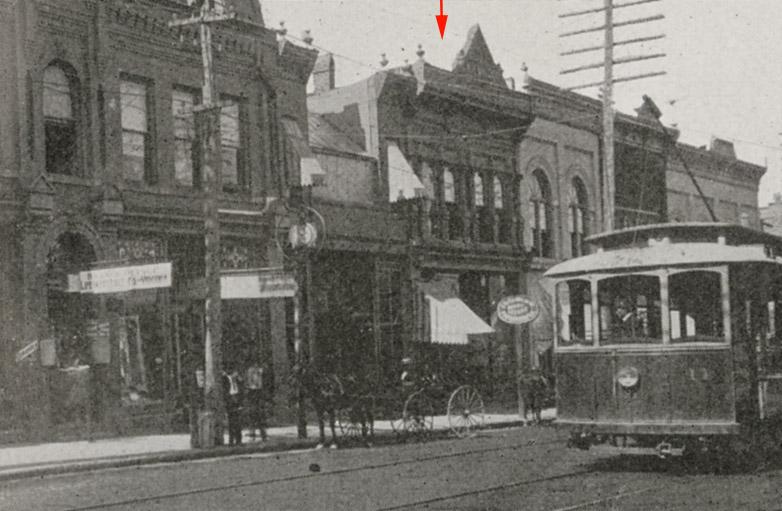
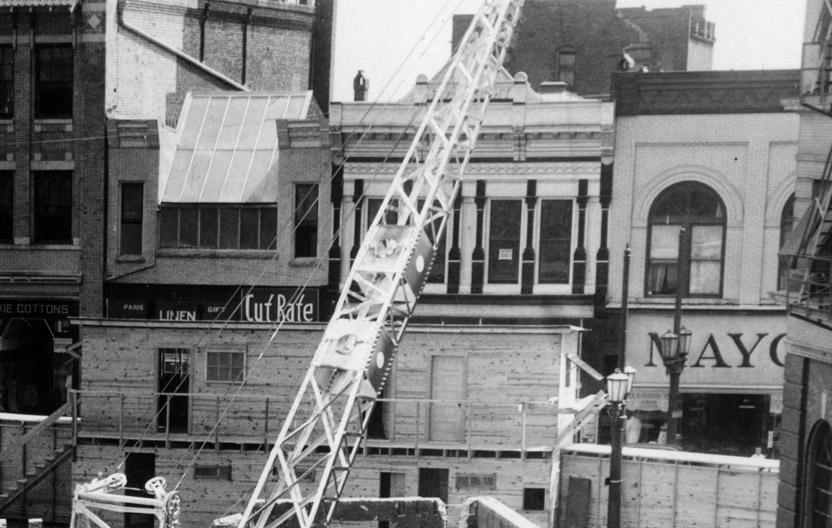
4 storefronts once existed where 201 West Main Street does now
Left to Right, 201-203, 205, 207, and 209 West Main St., 1905
(Courtesy Duke Rare Book and Manuscript Collection. Scanned by Digital Durham)
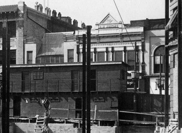
Evidently built by Richard H. Wright in 1895, 207 West Main was the first home to the Citizens Bank, which evolved from the Morehead Bank. The bank was located here until 1908, when it moved to its own new building at 105 West Main St.
(Courtesy Duke Rare Book and Manuscript Collection)
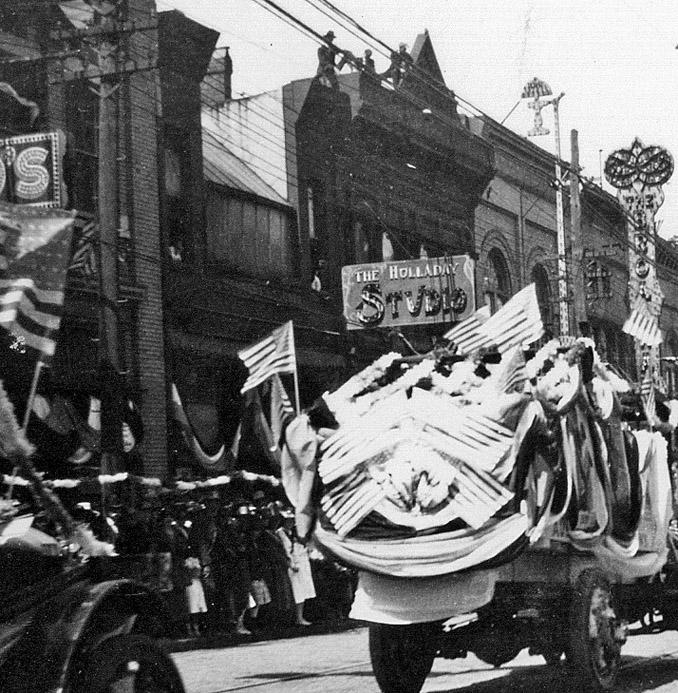
In 1919, the building was occupied by WJ Womble, a jeweler and Nathan Rosenstein an optician (presumably upstairs.) By 1923, the first floor housed "The Electric Shoe Hospital."
205-207 West Main, ~1925
By 1928, the building 'incubated' another bank - the Hood System Industrial Bank, which would move to the former Merchant's Bank building at 116 West Main St. by 1934.
(Courtesy The Herald-Sun Newspaper)
(Courtesy The Herald-Sun Newspaper)
Circa 1940s, the upper floors were utilized as the "Commercial Hotel."
.JPG)
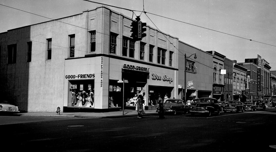
"The Wee Shop would then occupy the building; it would share space with "Babs Slipper Shop" by 1940, renamed "Marilyn Slipper Shop" by 1944. By 1952, Turner-Hargis clothing occupied the building, along with "Sallie McDonald Cosmetics"
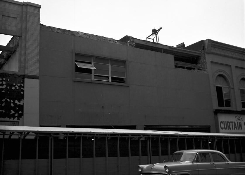
In the mid-1950s, the facades of 205 and 207 West Main were removed and replaced with a single 'modern' front.
mid-1950s
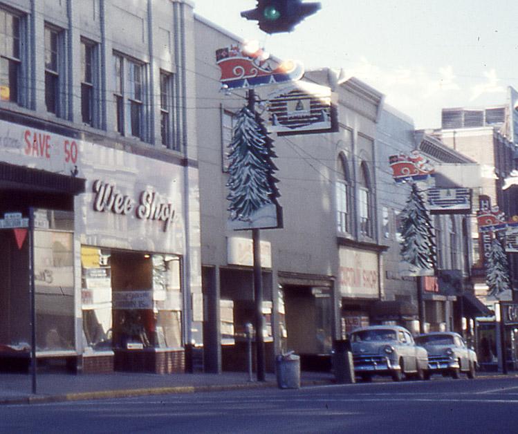
"Craig-Hargis Clothing" occupied the first floor of the building in 1957, replaced by the Durham Toy and Gift Shop in 1960. By 1960-61, the building had been emptied out - whether by new ownership or suburban flight.
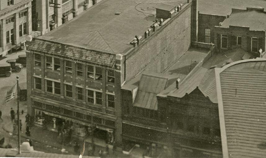
205-209 West Main, ~1960
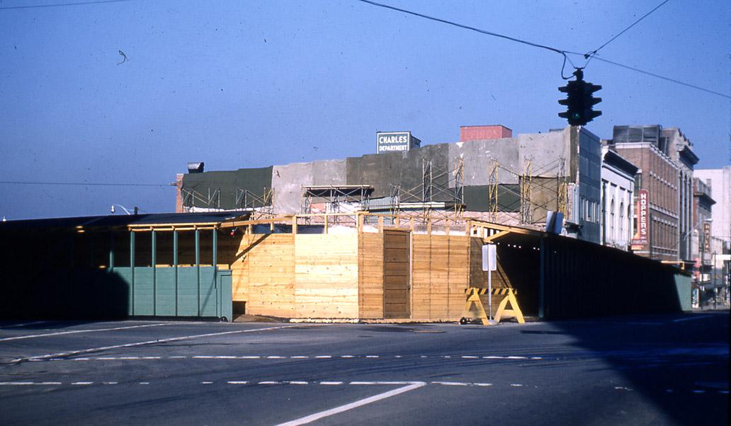
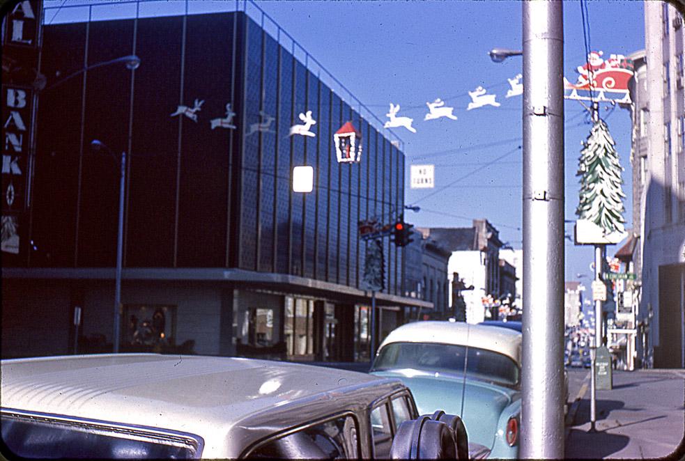
Thalheimer's, which had acquired Ellis-Stone (located across the street in the Hill building through the 1950s) purchased 201-209 West Main (4 buildings) and demolished them all to build a modern department store building.
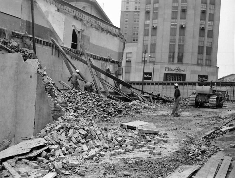
Beginning demolition, 02.07.61
(Courtesy The Herald-Sun Newspaper)
02.07.61
(Courtesy The Herald-Sun Newspaper)
02.07.61
(Courtesy The Herald-Sun Newspaper)
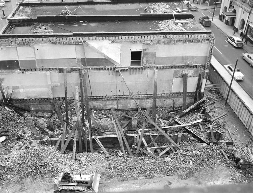
The buildings being demolished, 1961
(Courtesy Durham County Library / North Carolina Collection)
(Courtesy Durham County Library / North Carolina Collection)
(Courtesy Durham County Library / North Carolina Collection)
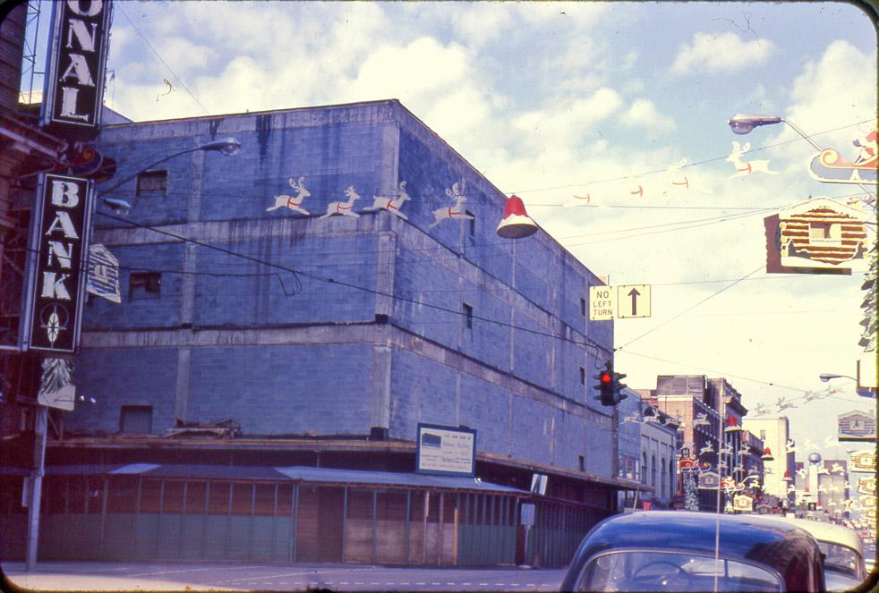
Thalheimers didn't last long here - about 10 years - before giving up on downtown.
Might have been related to pictures of their building attached to Morning Herald stories entitled "Night of Destruction." - 04.06.68. (You can figure out the cause from the date.)
(Courtesy Herald-Sun)
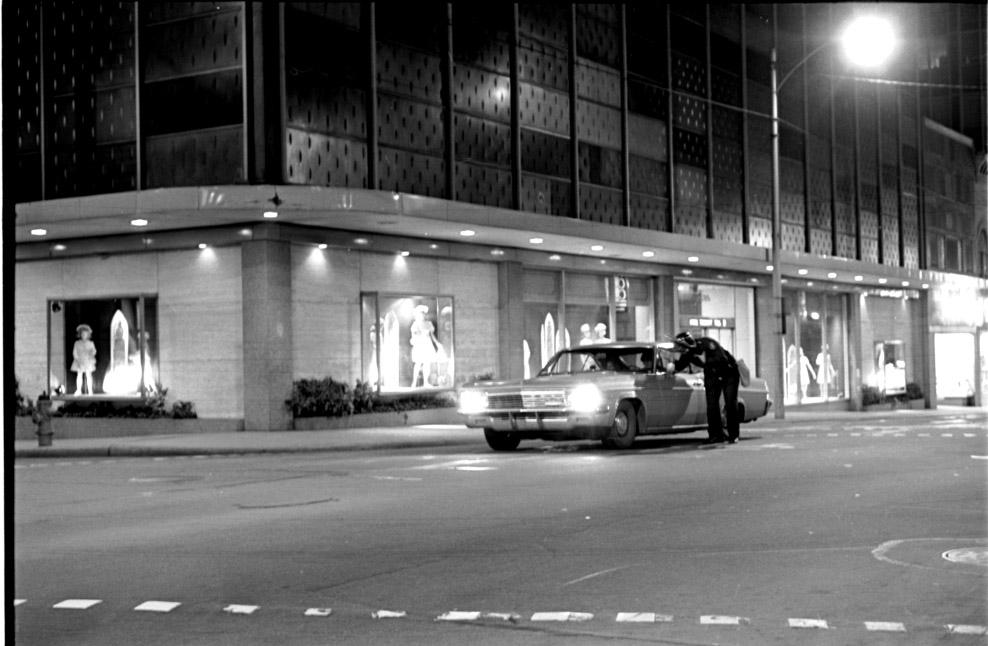
Wachovia decided to abandon the Geer building and remodel this building - evidently for extreme photosensitives -in 1972.
(Courtesy Durham County Library / North Carolina Collection)
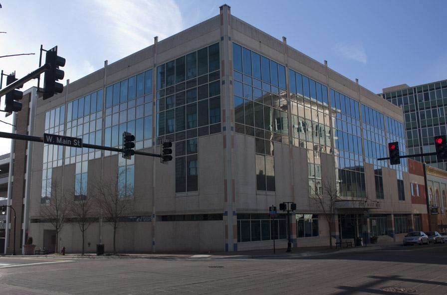
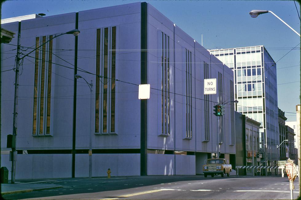
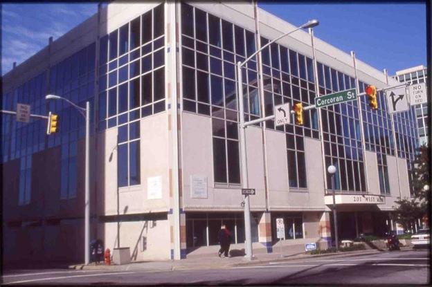
The Self-Help Credit union bought this building in (I believe) the late 90s, and remodeled the exterior in 2002. It still isn't one of my favorite buildings, but it's better than it was.
(Courtesy Durham County Library / North Carolina Collection)
01.22.11
So - end of the story of 207 West Main Street, right?
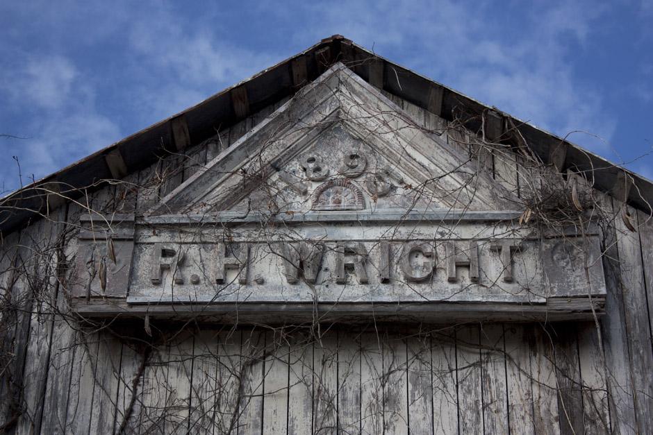
Interestingly, no. I received an email from a reader asking me a question or two about RH Wright. Turns out that he had stumbled upon an abandoned barn in the woods near his house in northern Durham County, and Wright's name appeared on the barn. He speculated that the barn might have been part of Wright's property in north Durham; he sent a picture. In looking at it, I thought I recognized the sign. After digging through and finding the above pictures, I confirmed:
Cornice sign from 207 West Main St., 01.22.11
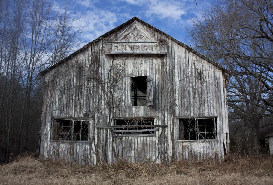
Cornice sign from 207 West Main St., affixed to barn, 01.22.11
Sometime after the facade of 207 West Main St. was dismantled in the early 1950s, this piece of it ended up in rural Durham county, attached to the side of a barn. Long abandoned, I have no idea how it got here.
Note: I'd like to try to track down the owner of this land and understand how safe this sign is here before identifying its exact location.
Find this spot on a Google Map.
35.995635,-78.902121
Add new comment
Log in or register to post comments.