35.996569, -78.906532
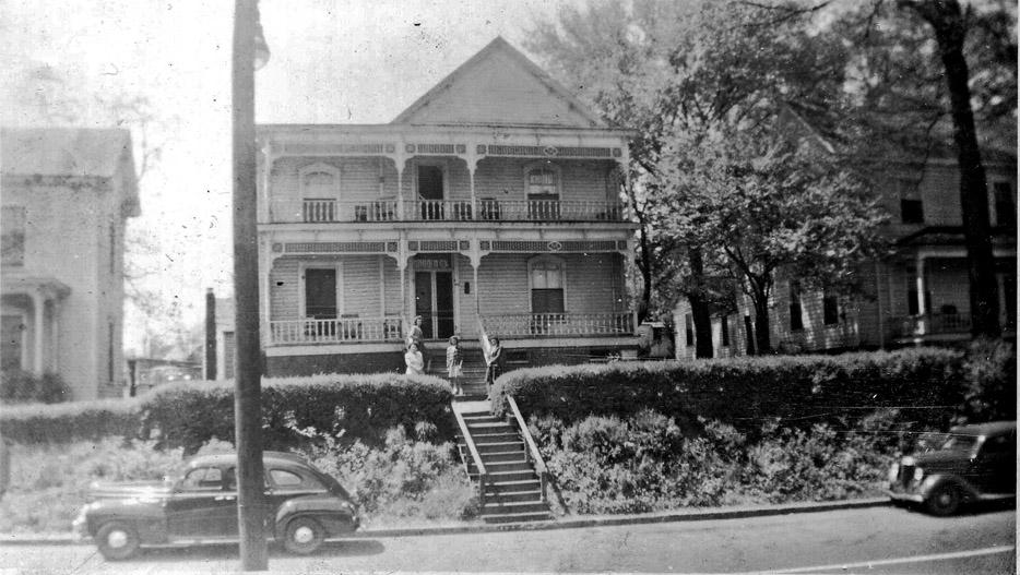
403 West Pettigrew Street, 1940s
----
The change in relation of the houses in the 400 block of West Pettigrew to the street level gives a significnant sense of how far the grade was dropped at West Chapel Hill St. and West Pettigrew when the Chapel Hill St. underpass was created in the 1920s.

Looking west on West Chapel Hill St. from the east side of the railroad tracks, early 1920s. The crossing guard tower seems to sit in its own landscaped island with more roadway and the houses in the 400 block of West Pettigrew St. beyond it.
Looking south-southeast at the same houses, 1940. You can see the second set of stairs to get down to ground level on the house with the Victorian details.
(Courtesy John Temple)
These houses were demolished by the early 1960s for parking lots - I'm not sure what businesses they served.
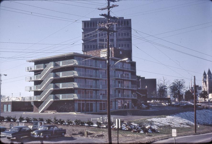
403 West Pettigrew, 1965.
(Courtesy Durham County Library)
401 West Pettigrew, 1965.
(Courtesy Durham County Library)
These eventually became part of the asphalt parking goodness of The Downtowner/Heart of Durham
Looking west from the corner of Ashton Place and West Pettigrew, 1967.
(Courtesy Durham County Library)
Looking west, 1967 - Ashton Place is now closed, but the 400 block extended from the cars at the left side of the frame to Chapel Hill St.
(Courtesy Durham County Library)
This too-high for the street spot, created for the safety of the West Chapel Hill St. RR crossing, remains the challenge to an effective use of this spot. Any good utilitzation of the spot should bridge the differential between the sidewalk level and the peak of the dirt with an active streetscape. It's not clear to me that the Bus Station will accomplish that.
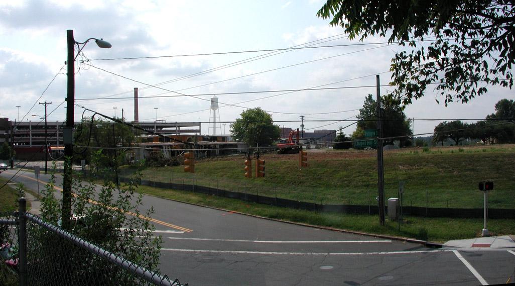
Looking southeast, 09.30.07
Comments
Submitted by Joseph H. (not verified) on Thu, 2/21/2008 - 4:34am
I wonder what that small tower is in the center right of your first picture?
Submitted by Gary (not verified) on Thu, 2/21/2008 - 9:51am
Joe
That's the tower for the crossing guard. Up to a point, the gates for the trains were manually operated, so the guard would sit in the tower to see when trains were approaching. When they did, he would go out and lower the gates. I'm not sure what other stages of mechanization this might have gone through, but they appear to have all disappeared after the 1920s - so I assume that some point after that, the tech was available to send an electrical signal to the gates from a switch up-track.
GK
Submitted by Anonymous (not verified) on Thu, 2/21/2008 - 9:09pm
Interesting to note that the 1967 view of the intersection and the 2007 view of the intersection are virtually identical...
Add new comment
Log in or register to post comments.