Support OpenDurham.org
Preserve Durham's History with a Donation to Open Durham Today!
OpenDurham.org is dedicated to preserving and sharing the rich history of our community. Run by our parent nonprofit, Preservation Durham, the site requires routine maintenance and upgrades. We do not ask for support often (and you can check the box to "hide this message" in the future), but today, we're asking you to chip in with a donation toward annual maintenance of the site. Your support allows us to maintain this valuable resource, expand our archives, and keep the history of Durham accessible to everyone.
Every contribution, big or small, makes a difference and makes you a member of Preservation Durham. Help us keep Durham's history alive for future generations.
Comments
Submitted by Anonymous (not verified) on Mon, 4/28/2008 - 10:00pm
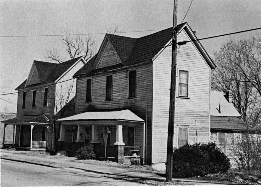
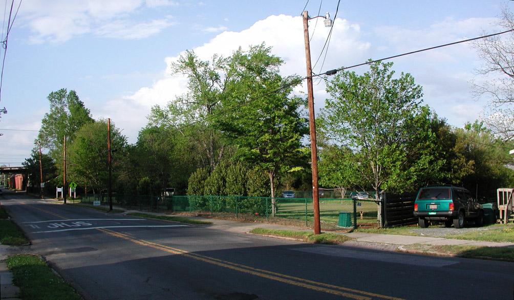
What is the obsession Durham has about parking lots? Either weed-strewn empty lots or unkempt parking lots! Let's see no houses, no businesses, no retail = no people, no cars, and no need for parking lots!
AAAAGGGGHHHH
Add new comment
Log in or register to post comments.