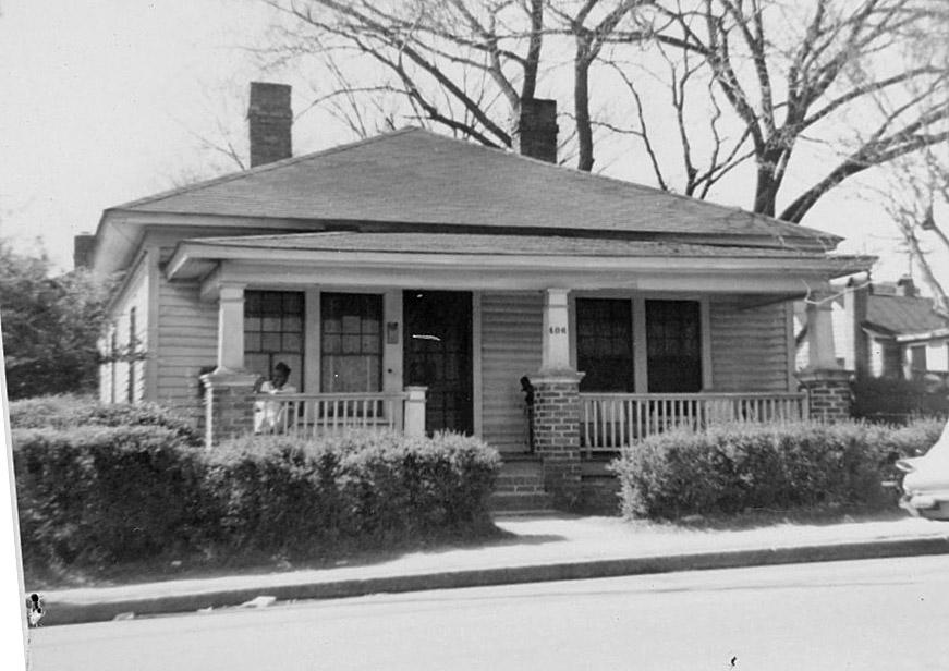
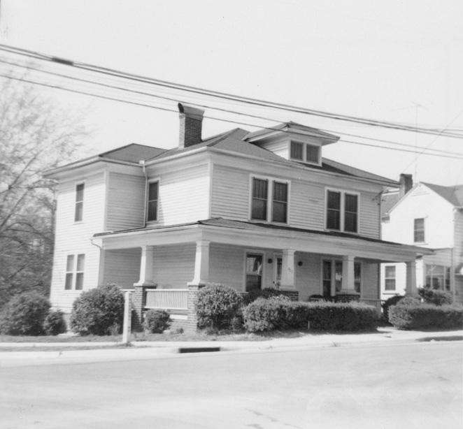
406 South Roxboro St., 1965
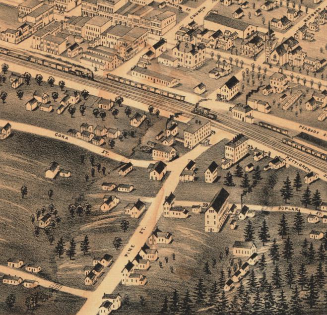
What is now South Roxboro Street was initially Pine Street - one of a number of north-south streets south of the North Carolina Railroad line that did not connect to streets north of the tracks.
The non-connecting and non-aligned Roxboro and Pine Streets, 1891.
(Courtesy Duke Rare Book and Manuscript Collection / Digital Durham)
The residential area was, early on, an area of Jewish settlement - experienced eastern European hand-rollers of cigarettes had come to Durham from New York in the 1880s, and settled on Pine Street and the present-day Cleveland-Holloway neighborhood. Many of them returned to New York in relatively short order, and hand-rolling was quickly outmoded by automation. However, the location of the first Durham synagogue on Liberty St. - between the neighborhoods, attests to this early demographic trend.
By the early 20th century, though, the Pine Street area had become more definitively part of the Hayti community, although this portion would remain an approximate northwest edge of the community. By the 1920s, Pine and Roxboro had been connected across the railroad tracks, although they retained separate names until the 1960s.
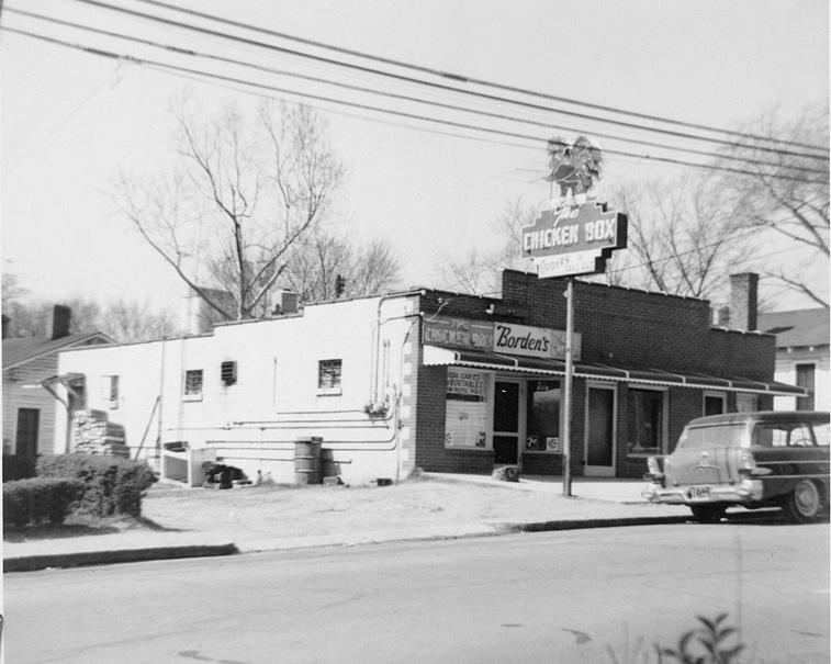
This side of the 400 block remained primarily residential, although by the 1950s, one restaurant had been established - the Chicken Box, established in 1957.
Moving north to south from Poplar Street, all looking generally west:
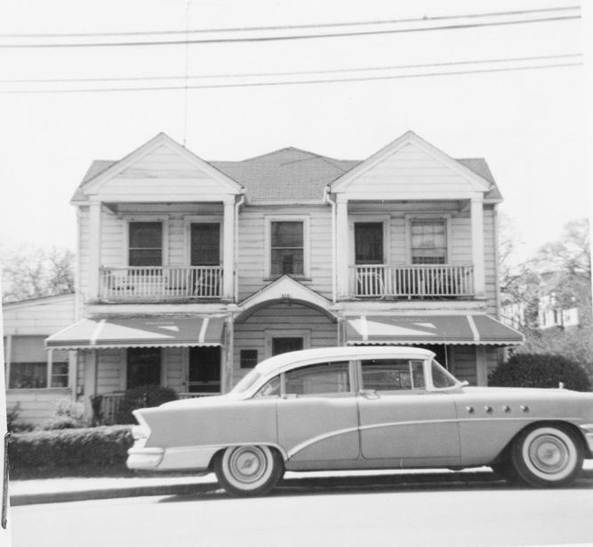
410 South Roxboro - the Chicken Box.
(Courtesy Durham County Library / North Carolina Collection)
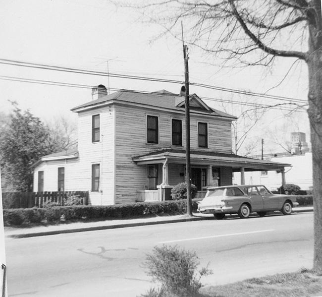
412 South Roxboro
(Courtesy Durham County Library / North Carolina Collection)
418 South Roxboro
(Courtesy Durham County Library / North Carolina Collection)
420 South Roxboro
(Courtesy Durham County Library / North Carolina Collection)
These structures were demolished by the city of Durham using urban renewal funds in the late 1960s. Chicken Box moved to Fayetteville St. and became the Chicken Hut (which Greg Cox of the News and Observer notes to be the second oldest continually operating restaurant in Durham after Bullock's, established in 1952.)
This area was combined into a great big parcel (the stream to the west culverted underground) and put up for sale by the Redevelopment Commission.
Looking south from the courthouse, 07.15.68. The area to the west of Roxboro (right side) had been completely cleared, and the freeway is under construction in the background. Demolition of the east (left) side of the street had not begun.
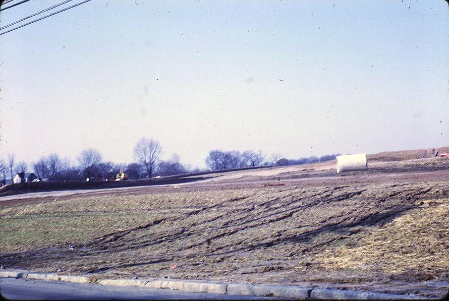
Hard to get perspective on this, but I believe it is looking southwest from near Dillard Street, 1968
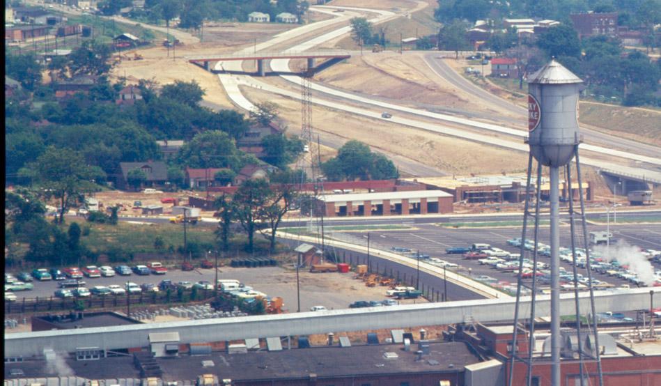
Looking north from present-day Jackie Robinson, ~1969-70.
(Courtesy Durham County Library / North Carolina Collection)
Elkins Chrysler-Plymouth moved south from their former location at North Roxboro and Parrish Streets in a land swap for their former location, which was also demolished by urban renewal.
Elkins Chrysler under construction, looking east, 1968.
(Courtesy The Herald-Sun)
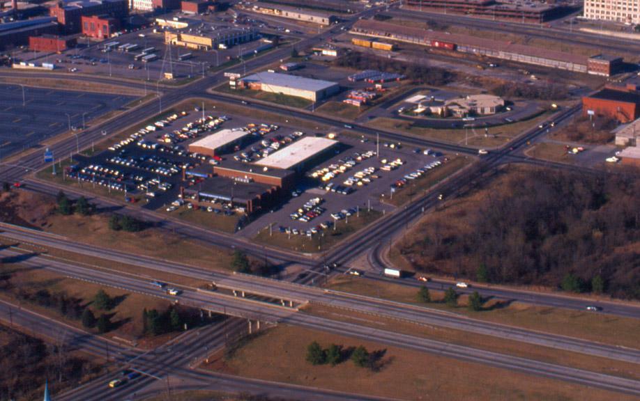
Looking northwest, 02.01.89.
Elkins Chrysler operated successfully here for the next several decades before being bought out by the Johnson dealerships, which will move the dealership to Southpointland.
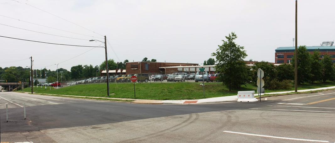
Looking southwest from near S. Roxboro St. and Dillard St., 07.10.08.
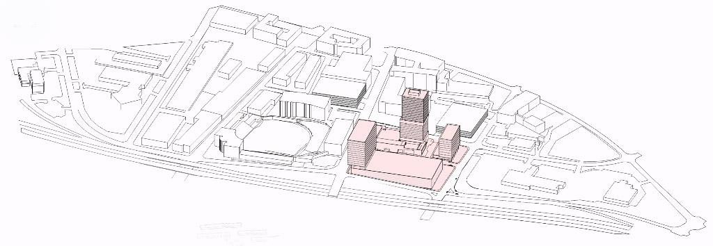
Scientific Properties placed the site under contract in May 2007, and plans to redevelop the entire site into a mixed-use development with some substantial vertical elements - one of the reasons for naming the project "Van Alen", after the Chrysler Building (NYC) architect.
I hope the project will address the important Dillard/Roxboro and Dillard/Mangum corners with a strong pedestrian-scale presence - another reason why the county's choice to put an immense parking deck with neither first floor retail or a liner building across the street is unfortunate.
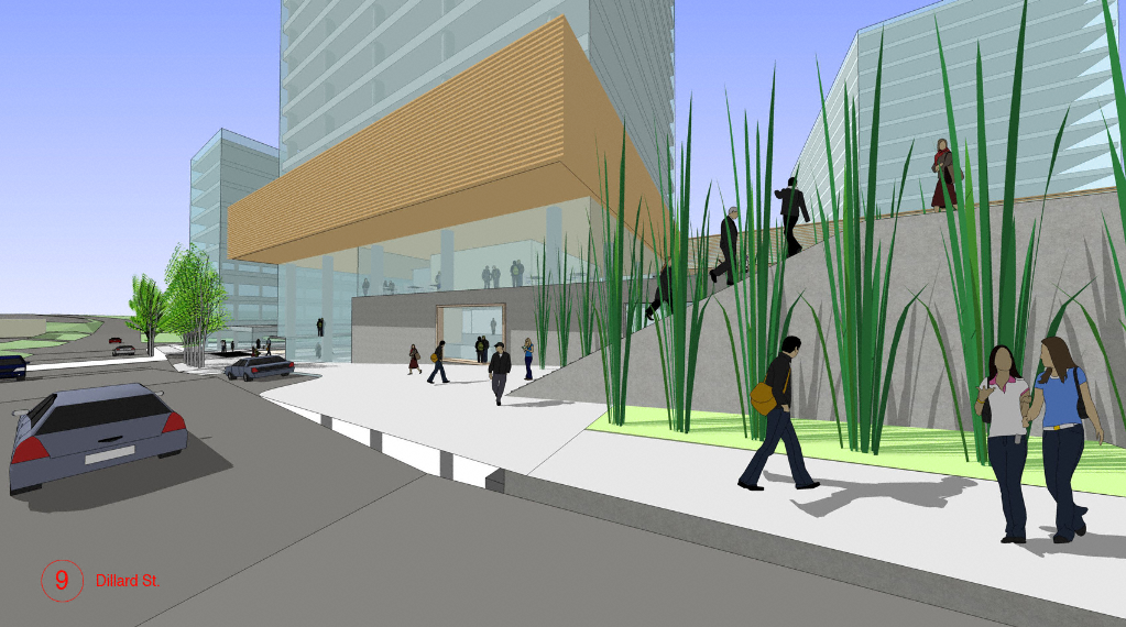
The only publicly-available renderings of the Van Alen project are from LoopNet (the commercial leasing website.)
Rendering of the Van Alen development, Bird's Eye view looking northwest.
(Via LoopNet)
(Via LoopNet)
Rendering of the Van Alen development, street level view from Dillard St., looking southeast. This is a fairly cartoon-ish rendering, which makes it difficult to assess how successfully the architecture addresses the street, despite a heavy population of SketchUp avatars. I hope the final project will provide a pedestrian scale and level of architectural detail at the first floor level that makes the area around Dillard/Mangum feel walkable.
Regardless, redevelopment of one of our three downtown car dealerships will be a definitive improvement - a change that will decrease the desolate feeling that this space has had since 1968.
35.990588 -78.900898
Add new comment
Log in or register to post comments.