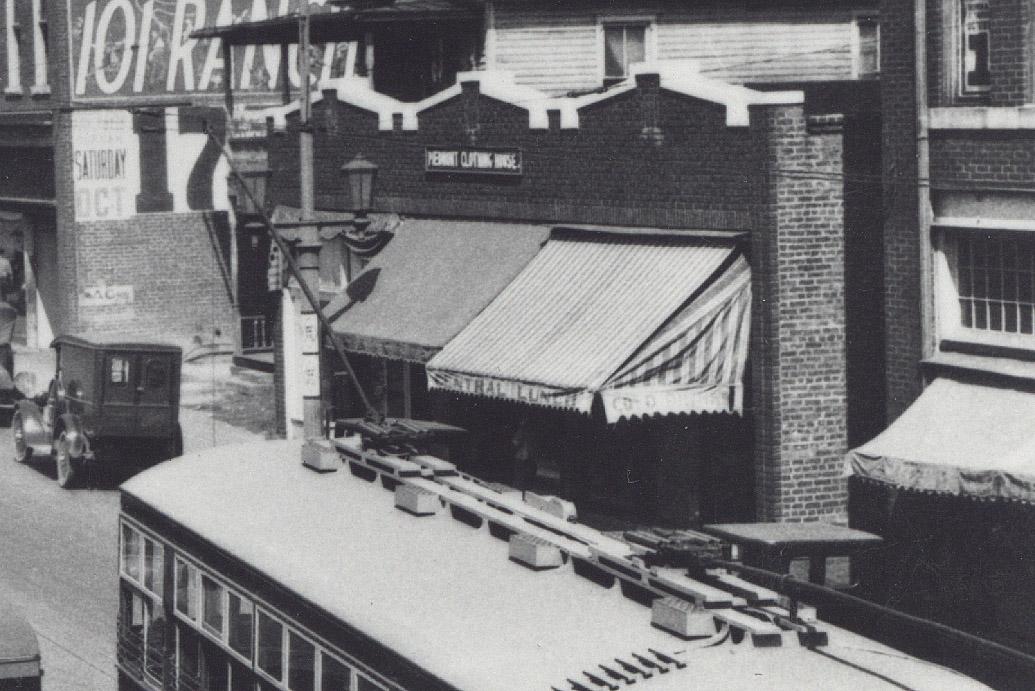
The northwest corner of Five Points contained a series of commerical structures, similar to Main St., that fronted on Five Points and turned the corner at Morris Street.
A view from the 1920s, looking northwest.
(Courtesy Durham County Library)
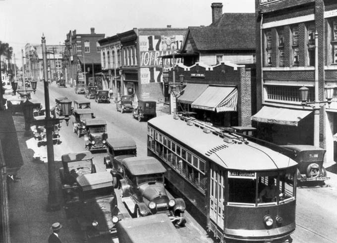
A 1920s view from a bit further west (starts on right with building near the left edge in the above picture),
looking west up Main St.
(Courtesy Durham County Library)
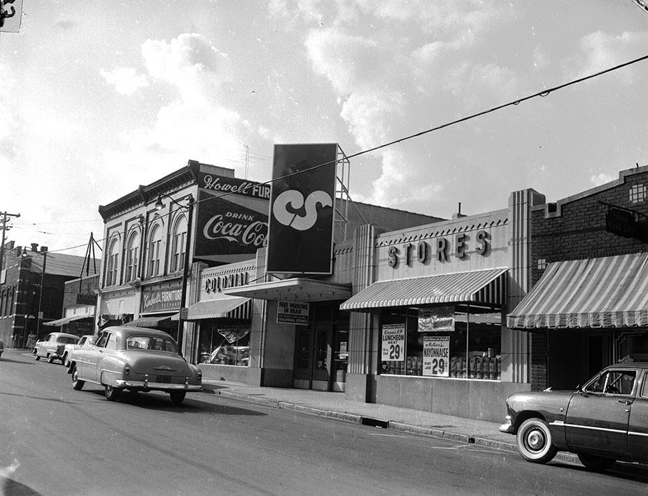
Another view of these buildings looking northwest, from the 1950s. 420-424 is barely visible at the right edge.
(Courtesy Herald-Sun)
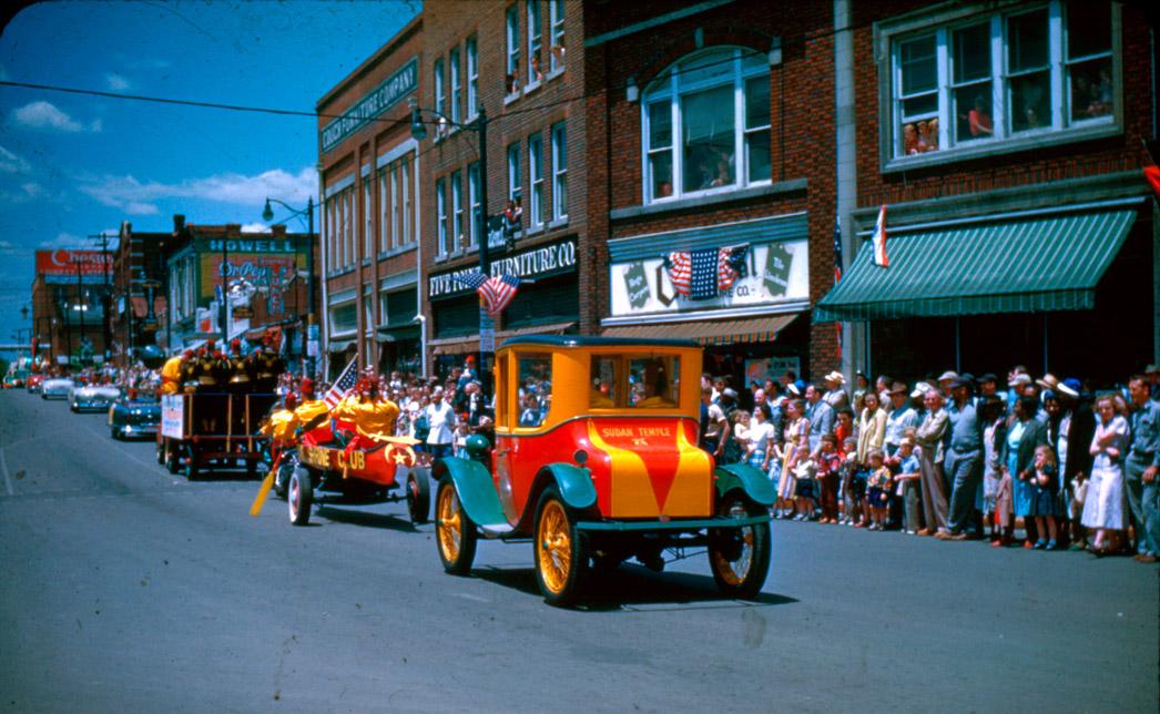
An early color picture of this block, taken during the Durham centennial parade in 1953. 420-424 is in the background, and the large "Central Lunch" sign is visible on its facade.
(Courtesy Barry Norman)
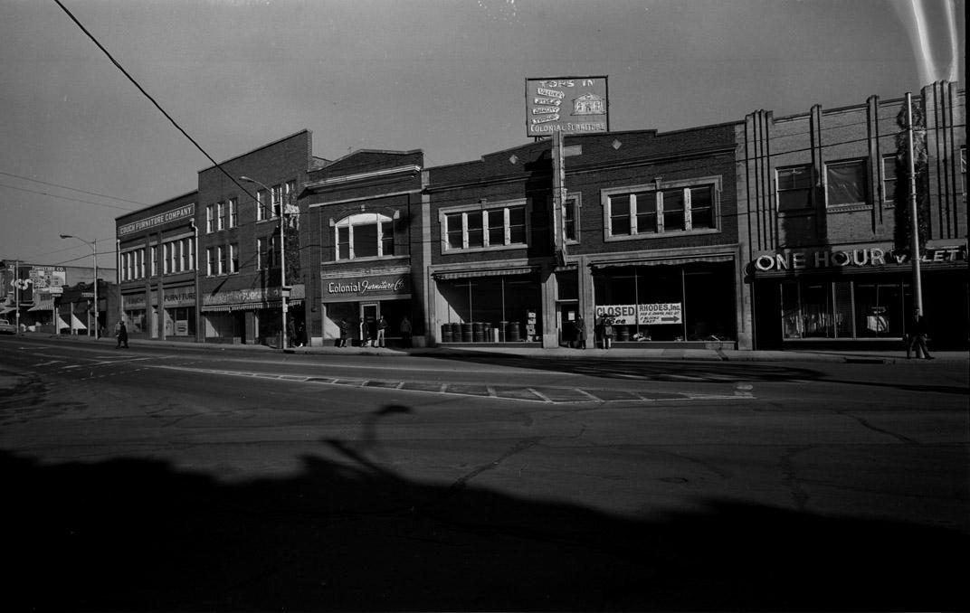
A view of the block from 1971, looking north from the middle of Five Points - a corner structure was added, likely in the 1930s.(Notice the Salvation Army building to the right on Morris St.)
Here is a view facing north, looking east down Main St., from Great Jones Street (a bit west of the current loop), 1971 (you can relate this the above 1971 picture by looking for the blue, vertical "Colonial" sign in both pictures.)
Courtesy Durham County Library
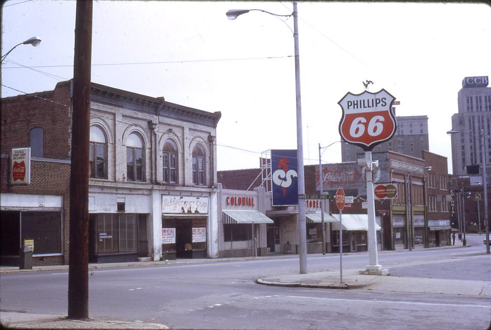
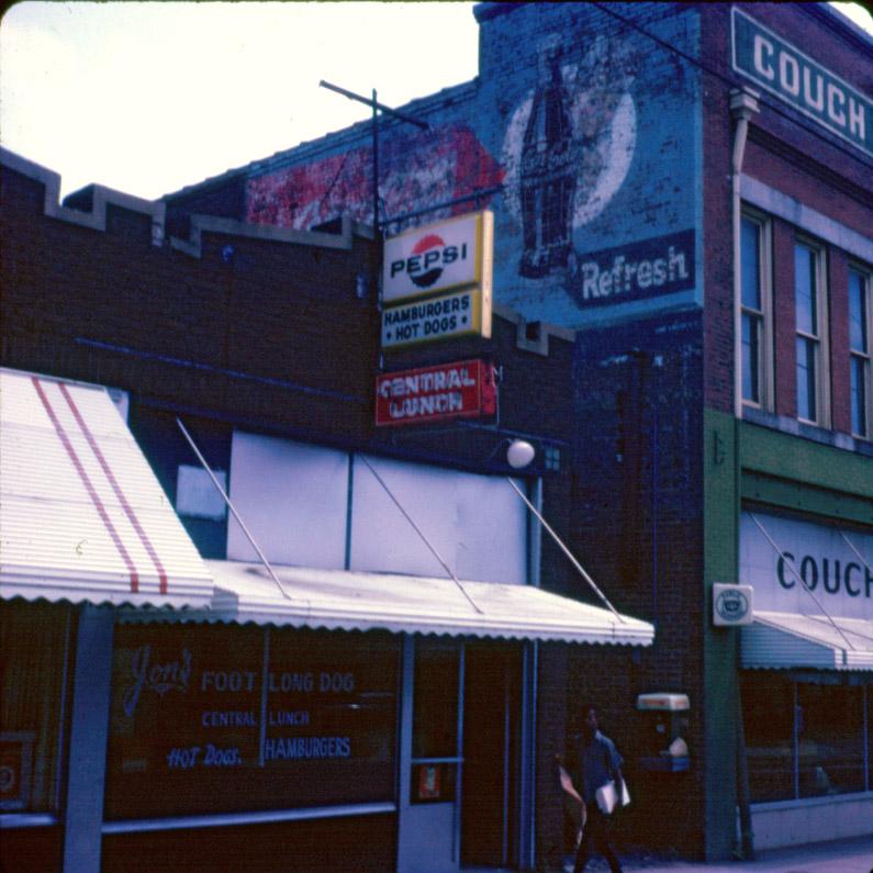
The 420 bay of 420-424 visible above, with Central Lunch still in place, c. 1971. (DCL)
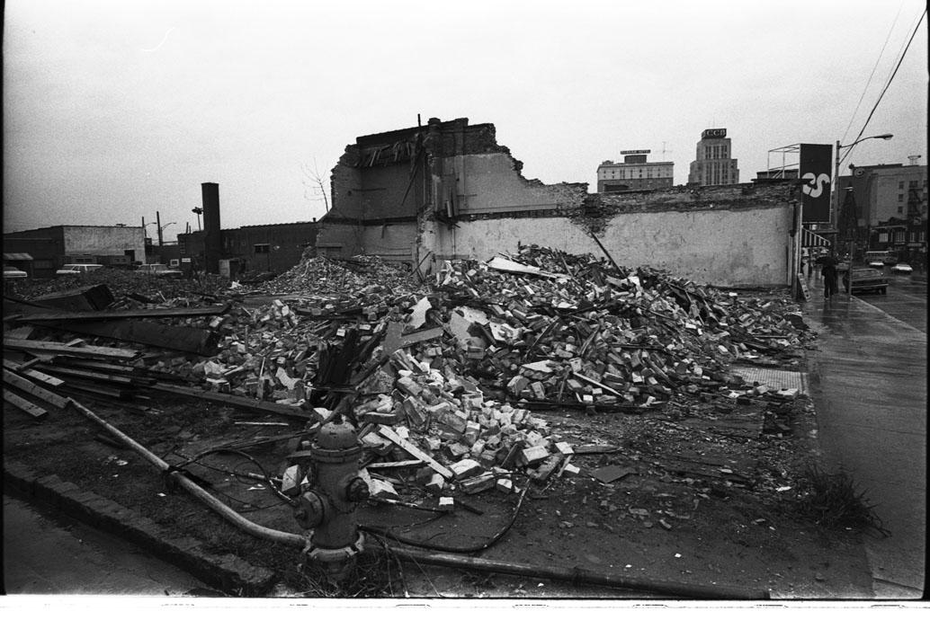
In 1972, this entire block (between West Main, Morris, Great Jones, and Morgan) was demolished by the city using urban renewal funds.
These buildings being demolished, around 1972:
Looking east.
(Courtesy Herald-Sun)
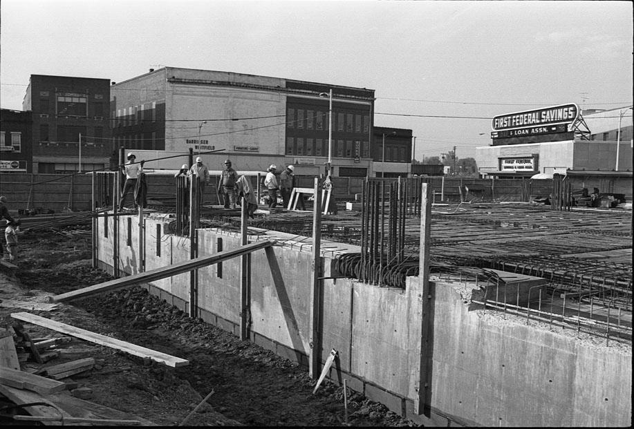
By 1974, First Federal Bank had decided to move from its building across the street (see "Five Points 1") into a large new structure on this site.
Under construction, looking southwest from Morris, 1970s.
(Courtesy Herald-Sun)
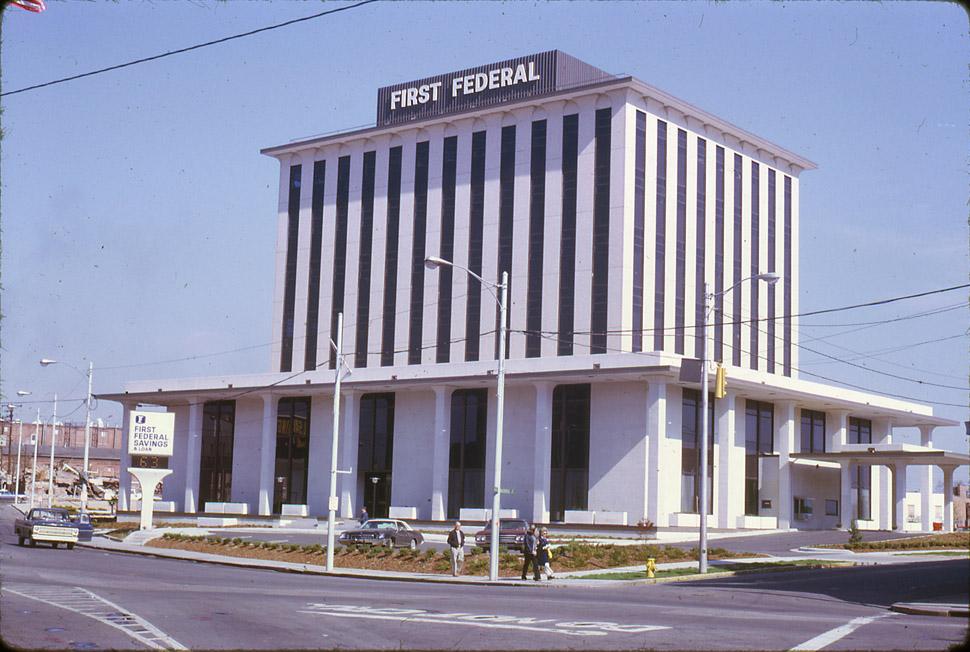
Here is how the corner looked in 1974.
Courtesy Durham County Library
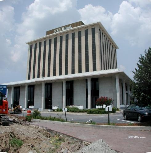
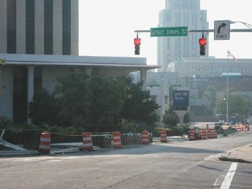
And here is the building in 2006, now known as the Southbank building
Looking east from Great Jones, 2006.
It is hard to overstate how this building dominates the landscape at Five Points. While its height is certainly out of scale with any older structures at Five Points, the setback, lack of street orientation, unclear entrance, sea of parking, dominating lower floors... everything about this building sneers at the pedestrian.
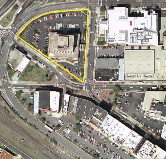
|
Southbank building/property at Five Points 2006, outlined in yellow |
Approx same area, 1930, in blue (I didn't draw the curve where the Loop was put through) |
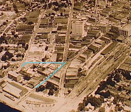
I don't have a better early aerial right now, unfortunately, but you can get a sense of the diversity of buildings/architecture in this area and how they related to the street in the 1920s. While I'm not a fan of this building architecturally, regardless of location, I actively loathe this building at this particular location. It would help to fill in some of that parking lot with some buildings that had normal street frontage on Main Street. It might soften this hulking fortress a bit.
I'm sure that when this building was constructed, city leaders were thrilled that a bank was going to keep its main building in downtown Durham, and would have allowed anything to be demolished or built in order to get that to happen. Unfortunately, on this front, things haven't changed all that much. What wouldn't Durham allow to be demolished if Bank of America or a similar company wanted to put their world headquarters in downtown Durham? Would anything be sacred?
Add new comment
Log in or register to post comments.