The original path of Elizabeth St. still persists south of East Main, roughly equidistant between Dillard and Fayetteville St., which is now where N. Elizabeth deposits its southbound traffic. The old route was a smaller, winding street that traveled north of E. Main through the current Liberty St. Apartments housing project, connecting with the original Elizabeth St. somewhere between Liberty and Holloway.
This smaller caliber roadway supported neighborhood traffic in the residential neighborhood to the east of downtown - a variety of smaller and larger houses typical as one moved away from more prominent, often ridgeline streets.
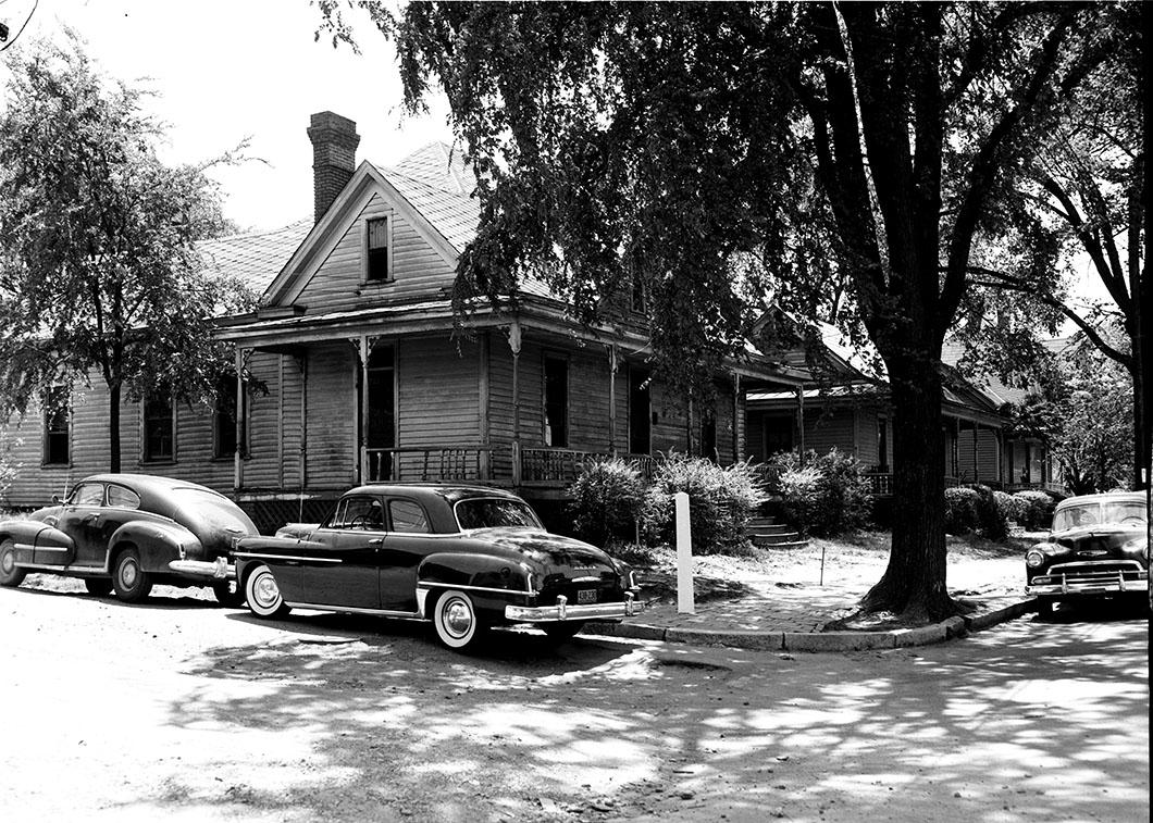
Looking east northeast at the corner of S. Elizabeth and Ramseur Sts. Although not readable, one of the once-ubiquitous white obelisk-like street markers is visible by the brick sidewalk. June, 1954.
(Courtesy Herald-Sun)
The caption on this picture read "Houses being torn down." So it goes. The neighborhood began to transform as early as the 1920s, when houses on East Main were torn down (Julian Carr's Somerset Villa in 1924.)
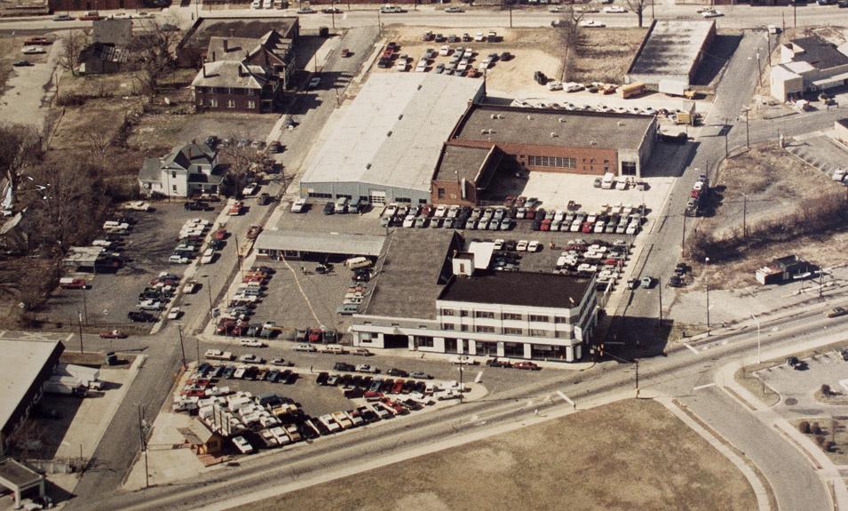
What replaced this was a decent commercial structure. Ongoing expansion of Carpenter Chevrolet further transformed the neighborhood into a commercial area by 1959..
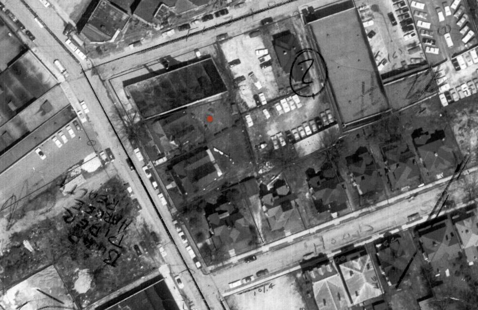
The red dot is on
603 Ramseur - 601 is just to its left/west, 1959.
The remainder of the houses in this block were torn down during the 1960s
Looking south, early 1970s.
The landscape, overall, is just - I may have used this word three days in a row - bleak.
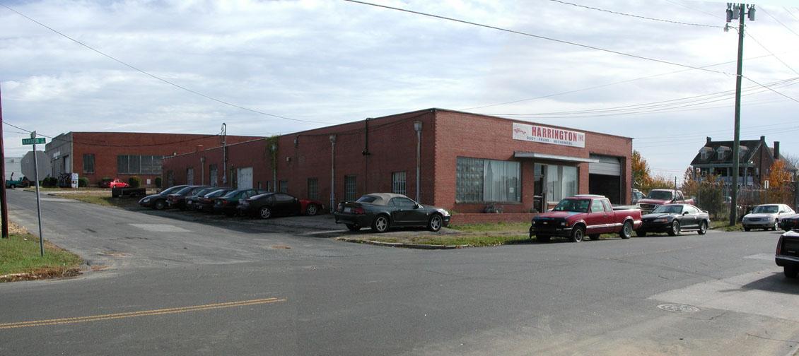
Looking northeast, 2007. (G. Kueber)
Two blocks worth of surface parking just to the west (starting at the corner on the left side of the picture) courtesy of the county certainly isn't going to help matters much.
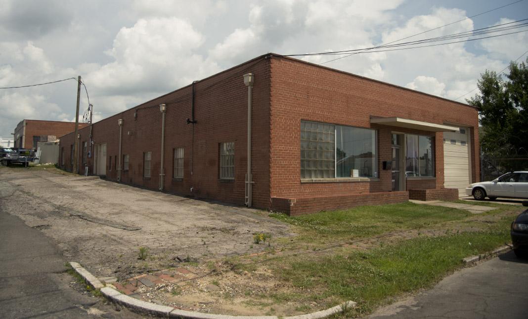
As of 2013, this building became home to an arts-related use - a group called Supergraphic. That represents one possible path for the buildings in this block; the other is total demolition for a new police department for the City of Durham.
06.25.13 - note the old patterned Durham brick sidewalk. (G. Kueber)
Guess which path the city chose!
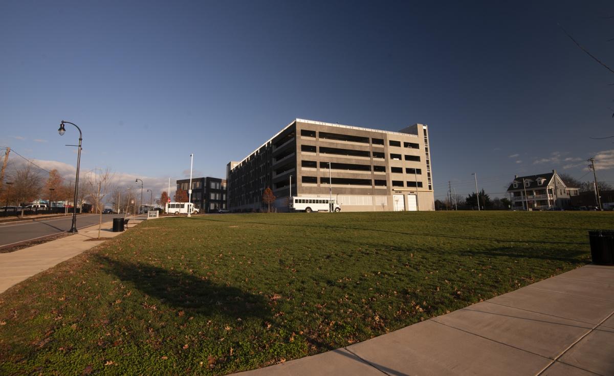
12.14.2019 (G. Kueber)
Comments
Submitted by Steve Graff (not verified) on Wed, 1/30/2013 - 4:28am
Wow, I didn't know that this area was once residential! I too am disappointed that he county built a surface parking lot for the new complex. Short term thinking, that is. They'll just need to tear it all up in the not-too-distant future to put in a multi-level parking garage. If they had just done that now, it would have sparked investment in this area, increasing property values and thus property tax income. This area seems to me to be on the cusp of receiving much needed investment, as lower hanging fruit in more desirable areas of downtown becomes more scarce.
Add new comment
Log in or register to post comments.