This is a first in a 4-part series of posts examining the corner of E. Main and Dillard Streets, starting with the southeast corner.
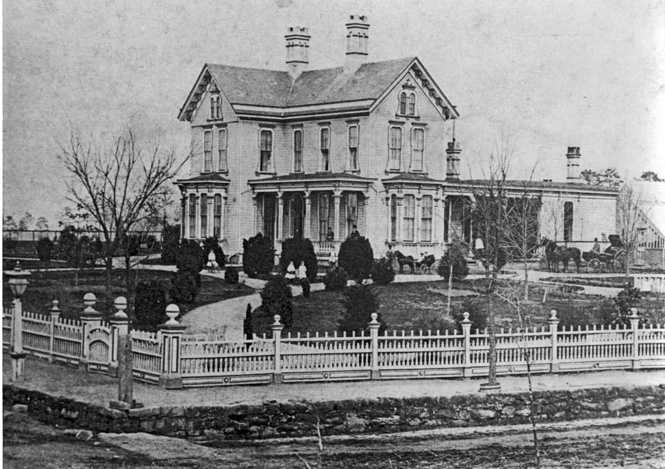
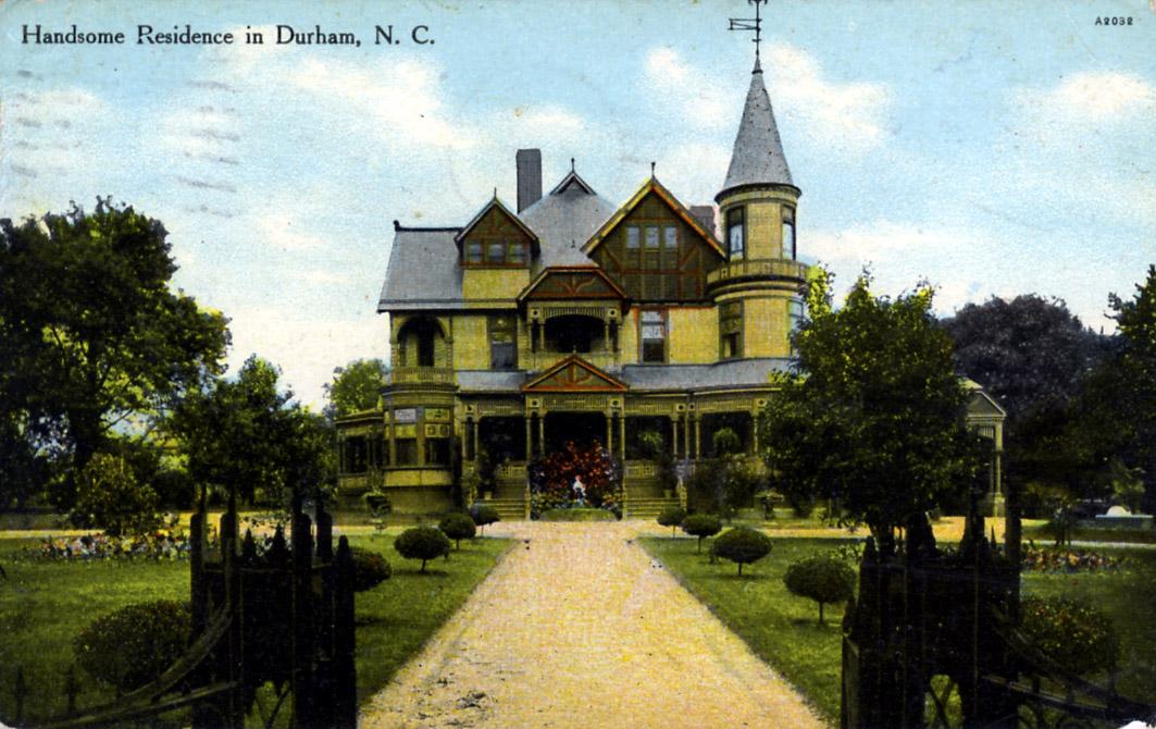
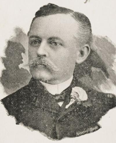
One of Durham's most influential citizens, Julian Shakespeare Carr, a member of a successful Chapel Hill mercantile family built his estate on this site in 1870. It was called 'Waverly Manor'.
(Courtesy Durham County Library)
J.S. Carr would become involved in almost every venture that made Durham successful in its early years - from the WT Blackwell (Bull Durham) tobacco company, to the Durham Hosiery Mills, to Golden Belt, to the Durham Lighting Company, to donating the racetrack that is now East Campus for Trinity College to move to Durham. That is only a smattering of his endeavors.
If you look on the land use GIS for the block of late 1920s commercial structures at the southeast corner of Main and Dillard streets, though, you see the words "Somerset Villa" as the area designation.
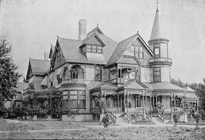
That's because, in 1888, Carr moved Waverly Honor to the south side of Peabody (now Ramseur) so that he could build Somerset Villa. The house was located at 404 East Peabody Street in 1898, but appears to have been moved to 202 South Dillard by 1907. James Southgate took out a lease on the house in (one of) its new locations for his son, James H. Southgate, and his daughter-in-law Kate Fuller Southgate soon after they were married in 1882.. (Kate was the daughter of Bartholomew Fuller.) The house appears to have been demolished by 1913
Looking east.
(Courtesy Duke Archives)
Looking south.
(Courtesy Durham County Library)
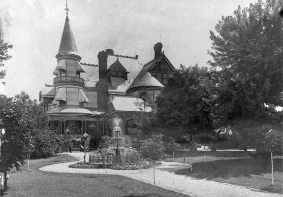
Another view (looking north):
(Courtesy Durham County Library)
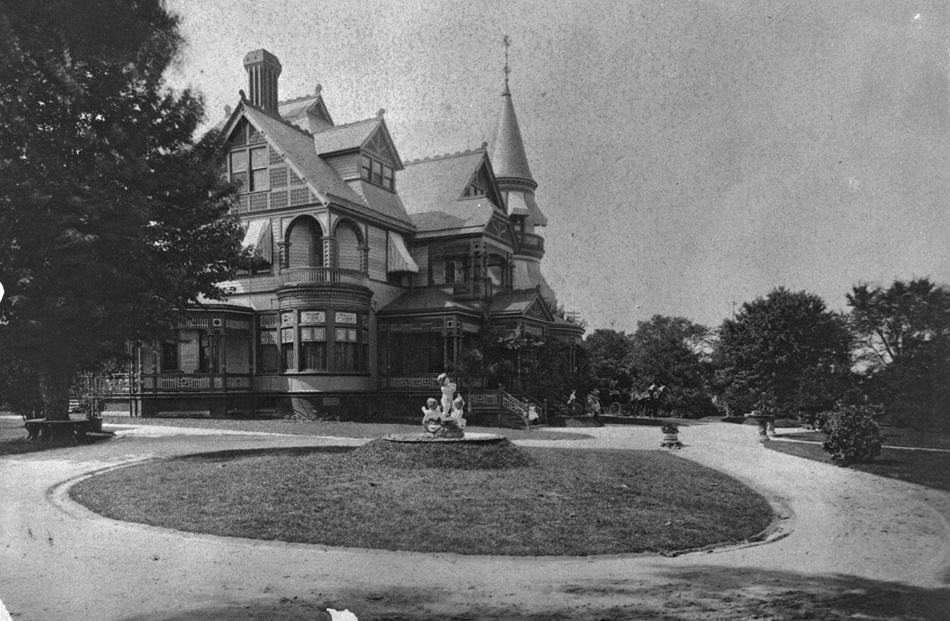
Somerset Villa was, and likely still is, one of the most impressive structures ever built in Durham. A sampling of the decription from the historic inventory:
"... front veranda measured 220 ft, a large turret on the northeast side of the house was capped by an ornate copper weathervane. The interior....:intricately carved mantels, stairway platform inlaid with medallions of white holly, mahogany, rosewood, and ebony, floors made of French mosaic tile...."
Somerset Villa from S. Dillard St., 1910
(Courtesy Robby Delius)
The structure was designed by John B. Halcott of Albany, New York, and reportedly cost over $100,000 to build.
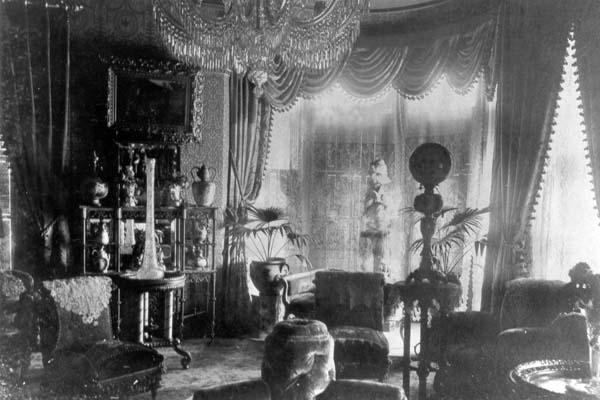
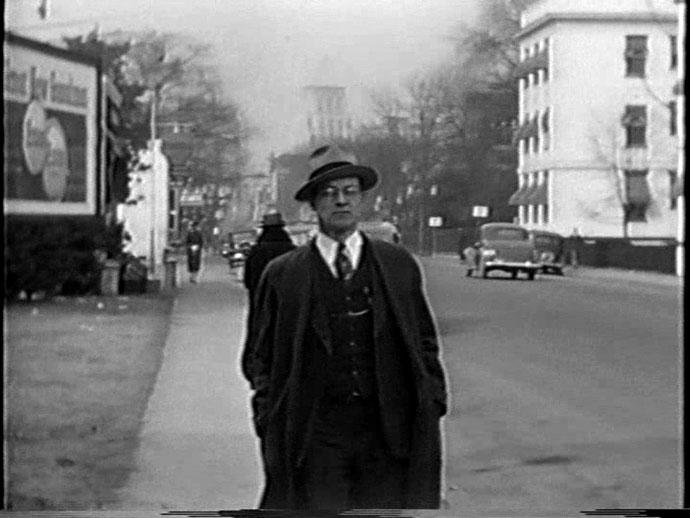
One photo of the interior of Somerset Villa.
(Courtesy Durham County Library)
The estate took up the entire block now bounded by Dillard, Main, Ramseur, and S. Elizabeth with the grounds containing elaborate gardens.
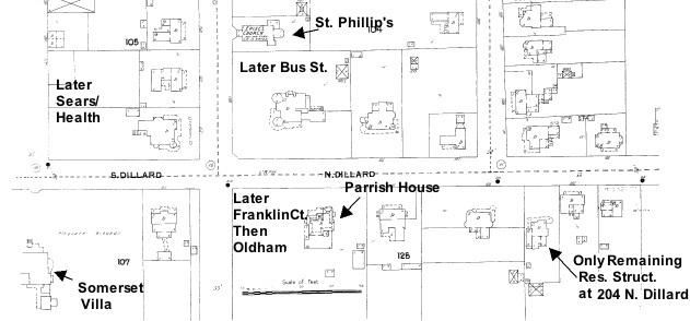
Here is the corner on the 1902 Sanborn Fire Insurance Map, with Somerset Villa the large property on the southeast corner (there is a smaller structure on the corner proper in this picture, although not on the previous Sanborn map from 1898). It is entirely residential, with the exception of St. Phillip's Episcopal Church.
Copyright Sanborn Fire Insurance Company
In 1915, Carr's wife died, and in 1926, the structure was destroyed. The current Peabody St. was extended through the middle of the former property. While it seems inexplicable that a structure this beautiful would be torn down, it is in keeping with Durham's near-total disregard for its architectural heritage as a resource with value outside of an economic development paradigm. So it was in the late 1920s, so it is now.
The E. Main St. frontage was replaced with 1920's era small commercial structures, many of which are still standing today.
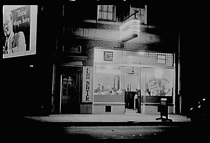
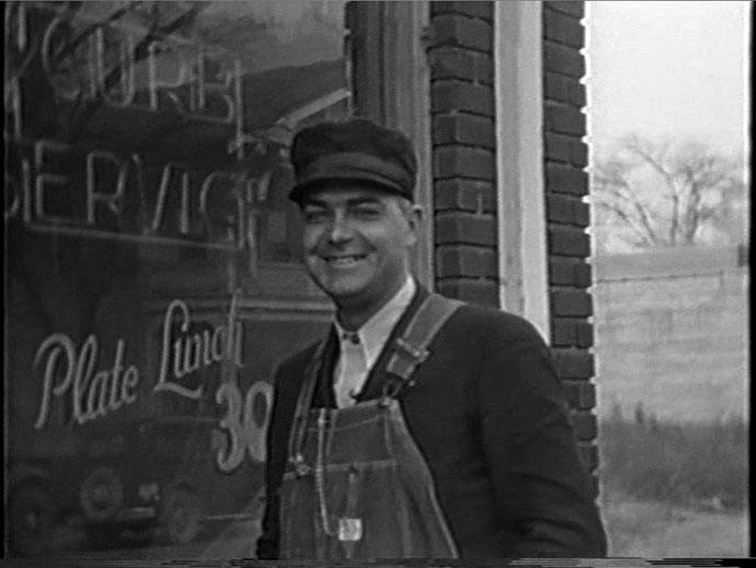
George's Grill at 526 East Main St. - documented by Farm Service Administration photographer Jack Delano in 1940 during a study of life in Durham (with an emphasis on the Tobacco trade.) An early piece of "curb service" hamburger joint Americana.
(Courtesy Library of Congress)
The front window of George's Grill, 1939. I like that you can see the shadow of 523 E. Main across the street.
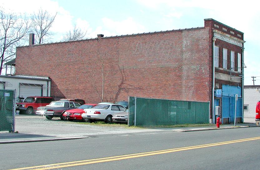
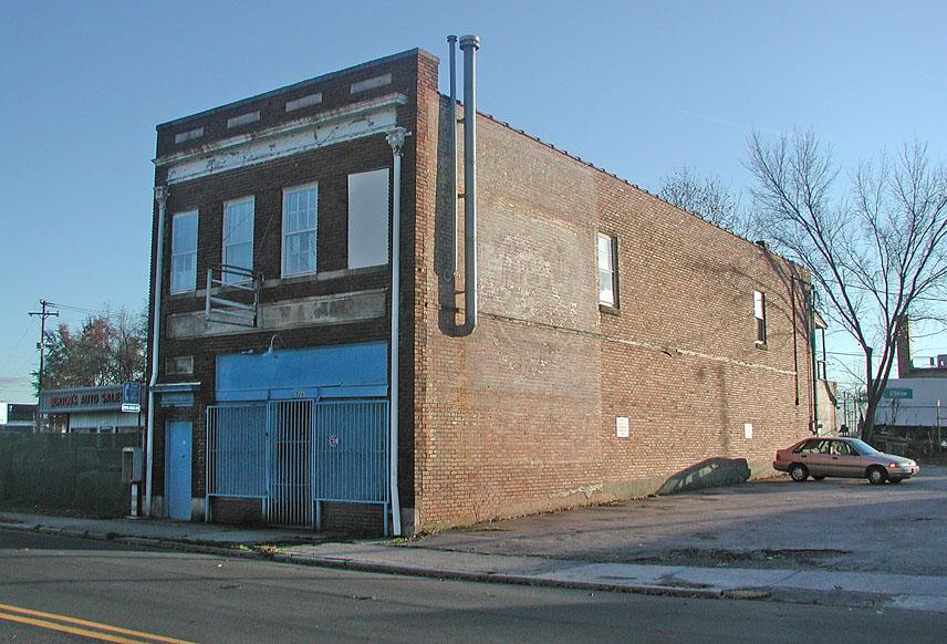
526 East Main - George's Grill - at this point clearly the best structure on the block - looking east, 2007.
and looking west, 2007.
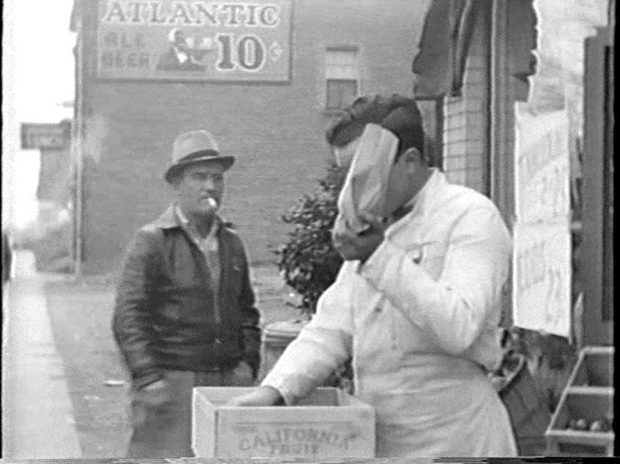
The produce market at 520 East Main, below, in 1939 - with George's Grill in the background (looking east.)
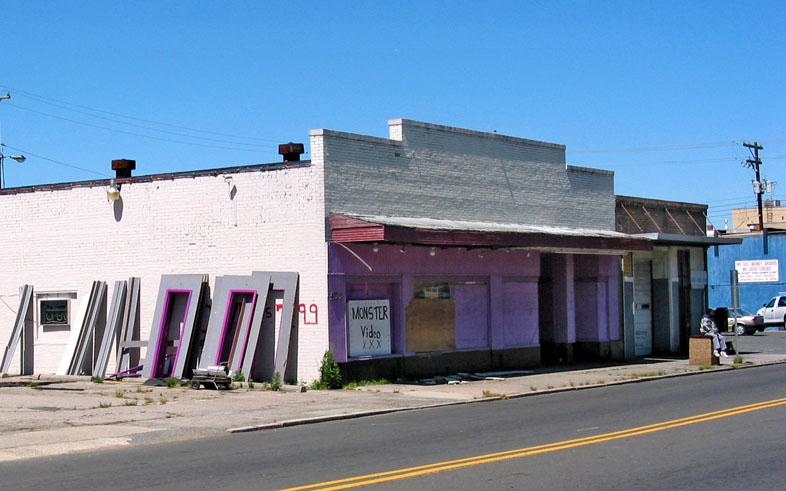
518-520 E. Main, purveying xxx Monster Video, 2007.
Below, looking west from mid-block 500 East Main, 1939.
The 'blue store' - TNT, source of much Wild Irish Rose.
Looking southeast, 2006
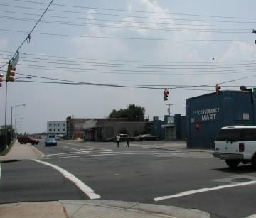
Interestingly, this same block of structures is now in the crosshairs for Durham County, as they plan their new social services complex. They plan to tear down the current health department (old Sears building) across Dillard Street from this block, and they plan to tear down this entire block of 1920s commercial structures for... wait for it... Surface Parking! Never enough of that - particularly not with the vast county surface parking lot across the street at Queen and Main (and Liberty). While clearly, the uses of the structures in the 500 block would be no great loss, the structures should be retained with parking behind them. The uses would likely change over time with the influx of new employees.
Moral of the story: if Durham can't get a piece of downtown land to its lowest possible use the first time around (1920s), it'll get there eventually.
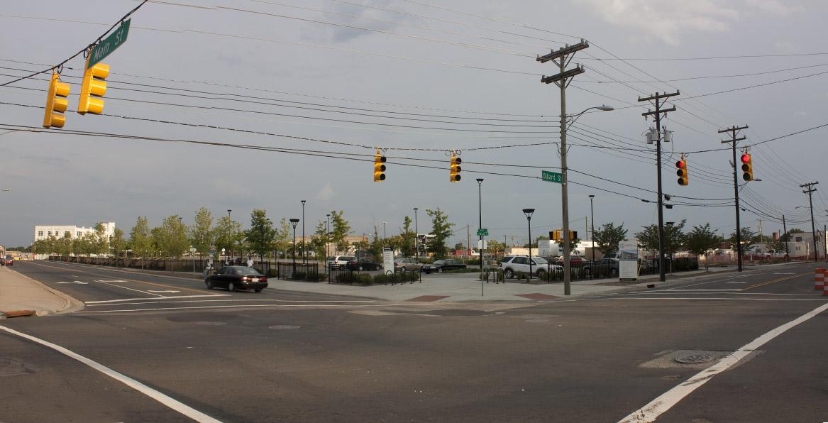
This entire block was torn down in 2008, and was transformed into a sea of surface parking. A terrible urban design decision that will stymie the revitalization of the eastern part of downtown for the next several decades. Thanks, Durham County.
06.24.11
Add new comment
Log in or register to post comments.