Support OpenDurham.org
Preserve Durham's History with a Donation to Open Durham Today!
OpenDurham.org is dedicated to preserving and sharing the rich history of our community. Run by our parent nonprofit, Preservation Durham, the site requires routine maintenance and upgrades. We do not ask for support often (and you can check the box to "hide this message" in the future), but today, we're asking you to chip in with a donation toward annual maintenance of the site. Your support allows us to maintain this valuable resource, expand our archives, and keep the history of Durham accessible to everyone.
Every contribution, big or small, makes a difference and makes you a member of Preservation Durham. Help us keep Durham's history alive for future generations.
Comments
Submitted by Laura F (not verified) on Wed, 2/17/2010 - 4:49pm
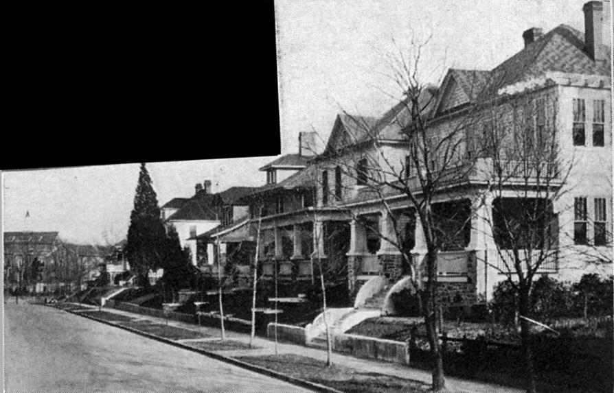
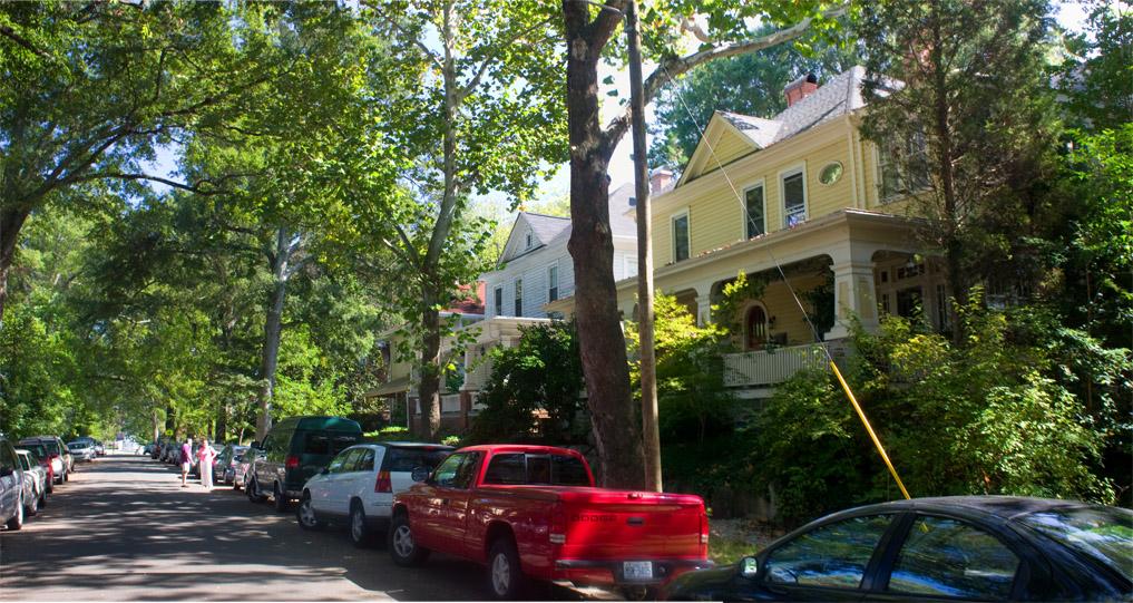
I love how the trees fill in this streetscape compared to the 1920's, however the addition of the car clutter is unfortunate.
Submitted by Marsosudiro (not verified) on Wed, 2/17/2010 - 6:20pm
Nice to see Durham High in the rear of the older photo. I can only imagine what it would be like to walk to school.
The big block looks like some kind of monster Christmas ornament on that one tree :-)
Submitted by Andrew Edmonds (not verified) on Wed, 2/17/2010 - 7:43pm
That looks like Schelp in the street; can anyone verify that he has a purple shirt?
Just documenting this for future generations, you know. Some future historian is bound to say, "I wonder who that person in the purple shirt was?"
Add new comment
Log in or register to post comments.