----
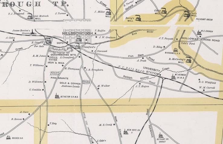
Map of Orange County as it was late 19th Century - University Station and the rail line are visible to the southeast of Hillsborough.
I've done an Orange County post or two before - given that most of Durham County was once Orange County, and the European settlement of Orange around the county seat of Hillsborough predated that of parts east, the early history of the two counties - and the cities of Hillsborough, Chapel Hill, and Durham are tightly interwoven, as much as we may act like rival siblings.
As most know, the establishment of the University of North Carolina at Chapel Hill predates significant agglomerations of people in now-Durham County, and the establishment of the city of Durham. The university was chartered in 1789 and began regular classes for undergraduates in 1795. It would be ~60 more years before the North Carolina Railroad would be constructed, leading to the establishment of the city of Durham.
Chapel Hill and UNC history is not my area, so the details of why Chapel Hill was chosen, aside from a central location in the state, are beyond my knowledge base.
It seems an interesting choice, though - one which would affect the transportation connectivity of the university much later (the main subject of this article.) The main roads of the state - from pre-European history to the 18th century, ran along relatively flat ridgelines. Those who have heard me speak have seen me start out talking about the NC railroad and Durham by pointing out the 'ridge' that separates the Cape Fear from the Neuse river basins - which became the Hillsborough - Raleigh Road in this area of the state. By separating the university from this existing 'highway' - atop a hill miles to the south, the founders made it rather more difficult to get to.
[Mark Chilton points out in the comments below that the site was on the road from Raleigh to Guilford Courthouse and the road from Pittsboro to Oxford - I believe this is the New Hope Road and only a mile off of the road from Fayetteville to Hillsborough.]
One major consequence of this arise when the North Carolina Railroad was established in 1848, the choice was made to run the route from Goldsboro to Greensboro, along the aforementioned ridgeline - which put the track, at its closest point, about 8.2 miles from the university.
With the establishment and growth of Durham, particularly after 1865, Durham quickly became a stopping off point for travelers (as Prattsburg had been previously) - from farmers bringing tobacco to auction, former rural residents looking for work, and students at the university, who found the depot at Durham Station the preferred point of transfer from road to railroad. Durham grew rapidly, and the proliferation of saloons was in no small part due to the demand of these constituencies. (College students, despite the romantic notions of college faculty and administration, have not changed much over the past 200+ years.)
The ingrained view of Durham as a dirty, uncouth place - in contrast with the slice of heaven atop a hill to the southwest, began to take shape during these mid-to-late-19th century years. There was some truth to this - Chapel HIll was bereft of the kind of industry and commerce that brought great wealth to Durham, but also all of the externalities of commerce and industry.
This tension would leave Chapel Hill and the university torn between the benefits of bringing a railroad to Chapel Hill and the concern over what that railroad might bring to Chapel Hill. Several failed attempts - including building a line to Durham - preceded the establishment of the Chapel Hill Iron Mountain Railroad company, which would not connect with Durham, but to a closer point to the NCRR mid-way between Hillsborough and Durham. It would also pass by Iron Mountain, with some promise of industrial utility for the line. The university stipulated that the railroad be located 2 miles away from the university - to again provide a buffer between the university and the feared influence of the train. The depot was established at the West End, later known as Venable, and still later, as Carrboro.
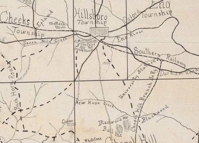
Map showing the relationship between Hillsborough, Chapel Hill and the rail line - now attributed to the Southern Railway
The connection with the NCRR was known as University Station, and later, just University. A station and a handful of houses and establishments grew around the depot. The name of the railroad company was soon changed to the State University Railroad Company, and the line was later operated by the Southern Railway.
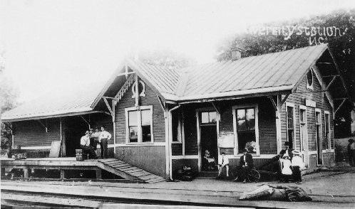
The University Station Depot, undated, source unknown.
Although the sources I have give little attention to University Station, it doesn't seem that the depot grew at any significant rate. Houses and potentially lodging and food were available from a small number of venues. Several people with Durham connections established farms in the University Station area. The Fitzgerald family - Robert and Richard - established their first farm and brickmaking operation at University Station prior to moving to Durham's West End.
I've written previously about the various 'gentleman farmer' farmhouses/operations of Durham's wealthy industrialists, including Lochmoor, Bonnie Brae, Quail Roost Farm, and Julian Carr's Occoneechee Farm. Jean Anderson notes two other farms of the Durham nobility that were located in the University Station area:
Benjamin Duke bought many small tracts and put together a farm of over two thousand acres, the Meadows, near University Station on the old road to Hillsborough. John T. Hogan, his farm manager, regularly sent him rather discouraging reports on the farming operations. In 1895, Duke added a large frame house (still standing) with wide porches facing the road to Hillsborough near University Station. In the next decade, James Southgate built on top of a nearby hill a two-story log house in which he entertained friends with his magnificent view of the countryside by day and the stars by night. The young members of the Fun-Lovers Club were entertained by Southgate once in their giddy youth and remembered it thirty years later as 'the grandest place with cozy corners galore. There were thirty of us at University Station... We sat around a big log fire and Mr. Southgate was grand to us. We all kissed him good-bye.'
(Ben Duke and James Southgate were neighbors back in Durham as well, both living on the southern corners of Willard and West Chapel Hill St.)
Carr, seemingly a man of boundless energy, provided funding for the initial University line, and later, as a state representative, sponsored a legislative bill to finally settle the unpaid monetary bill for the construction. Carr bought the established Alberta mill, built by Tom Lloyd in 1898, in 1909 and made it part of of his Durham Hosiery Mills empire as the Durham Hosiery Mill No. 4. He also purchased another Lloyd mill on the south side of Main St. and made it Durham Hosiery Mill No. 7 at the southern end of the line. The West End/Venable would come to be named for him in 1914 - Carrboro.
In the early 20th century, at the northern origin of the line, along US 70, north of the tracks, a sort of secondary nucleus grew of bungalows and a service station/store.
The Durham Hosiery Mills contracted severely in the 1930s - both 4 and 7 went out of business. The rise of automobile travel, which afforded a much more direct route to Chapel HIll, made the University line less and less viable. Per "Orange County, 1752-1952," the last passenger trains on the University line ran around 1940.
When the last train ran [in ~1940], Bruce Strowd issued an invitation to the children of Chapel Hill to make the trip over to the junction and back. Many of them found it an exciting adventure because they had never been on a railway train before.....Captain Fred Smith was conductor on the train from 1889 for about fifty years......
What happened to University and University Station over the subsequent decades isn't detailed anywhere that I've found, but photos from the Durham Morning Herald in 1972 show an underused looking place.
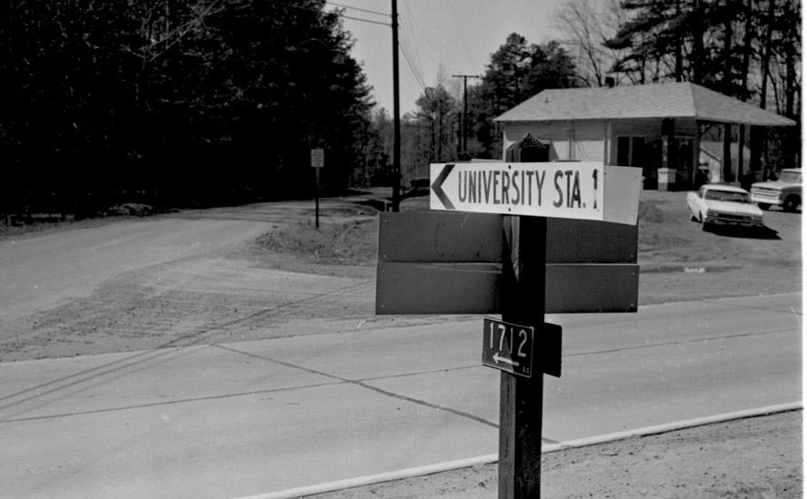
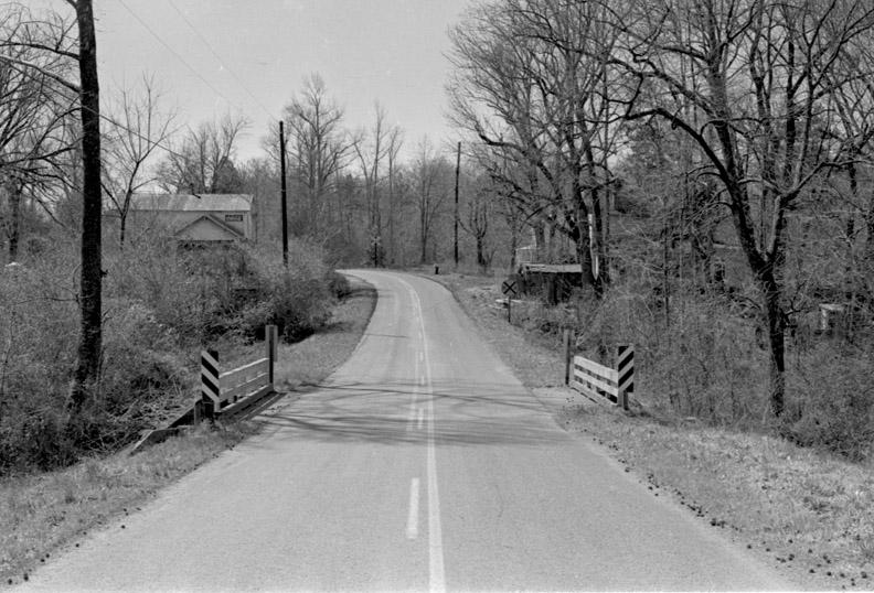
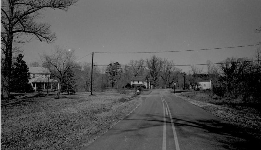
From US 70, looking south on University Road towards University Station - Griffin's Store is to the right, 03.10.72
(Courtesy The Herald-Sun Newspaper)
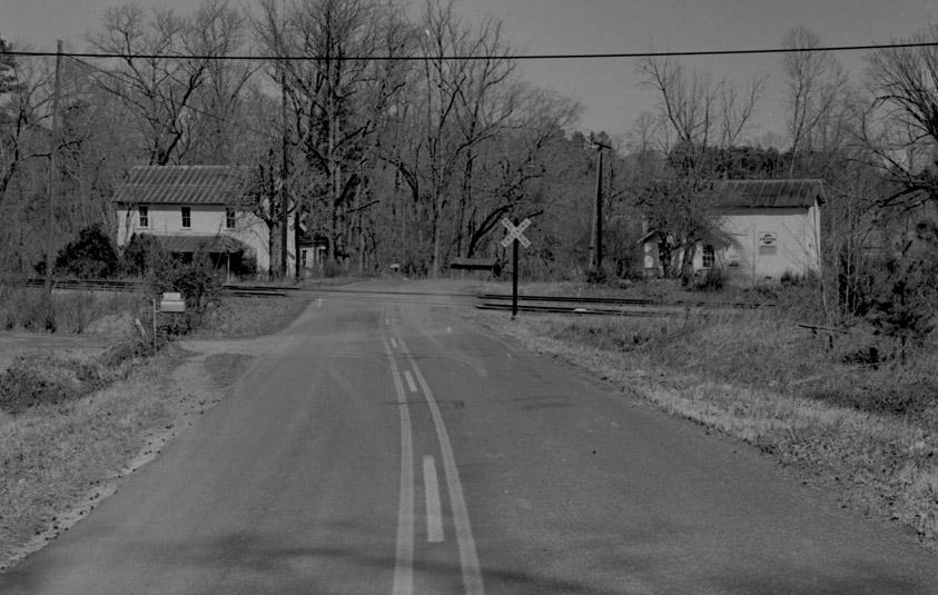
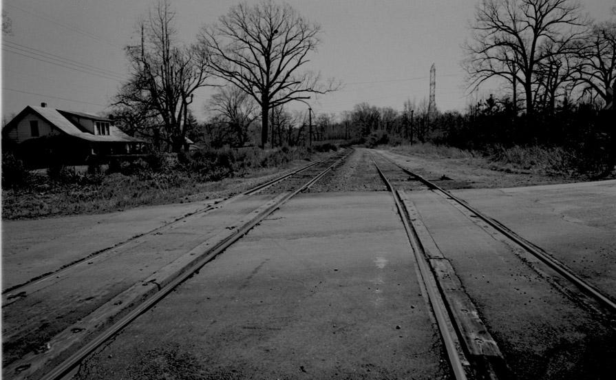
Looking south towards the junction, 03.10.72
(Courtesy The Herald-Sun Newspaper)
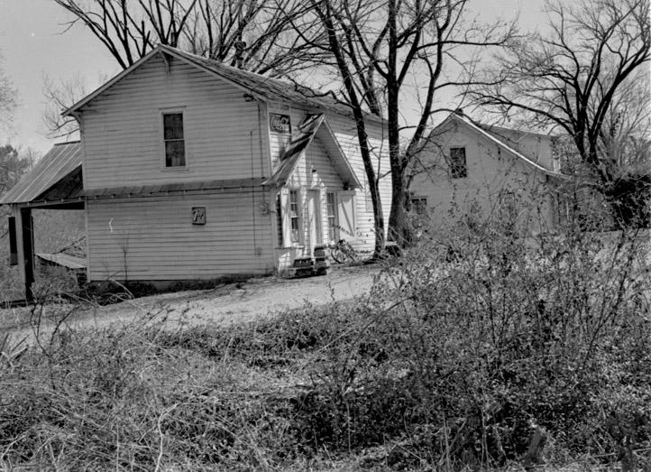
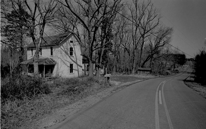
University Station, 03.10.72
(Courtesy The Herald-Sun Newspaper)
University Station, 03.10.72
(Courtesy The Herald-Sun Newspaper)
University Station, 03.10.72
(Courtesy The Herald-Sun Newspaper)
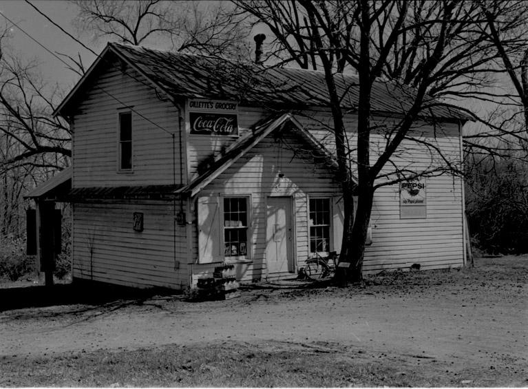
University Station, 03.10.72. This grocery was evidently burned by an arsonist in the late 1970s or early 1980s.
(Courtesy The Herald-Sun Newspaper)
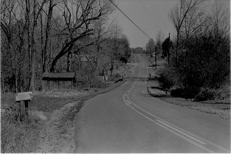
University Station, 03.10.72
(Courtesy The Herald-Sun Newspaper)
University Station, 03.10.72
(Courtesy The Herald-Sun Newspaper)
University Station, 03.10.72
(Courtesy The Herald-Sun Newspaper)
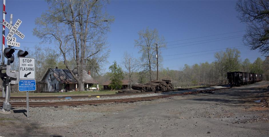
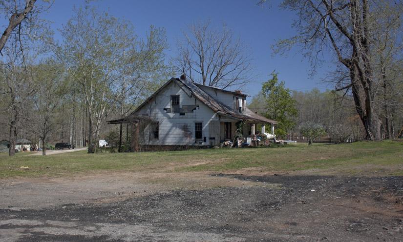
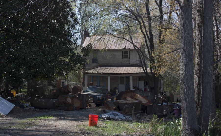
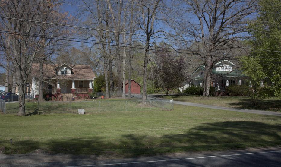
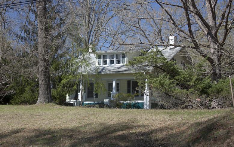
I'm not sure where the station/platform actually were at University Station - there isn't clear evidence of them now. The station area still appears somewhat abandoned, although there is the house of a clear enthusiast behind the trees.
04.04.11
04.04.11
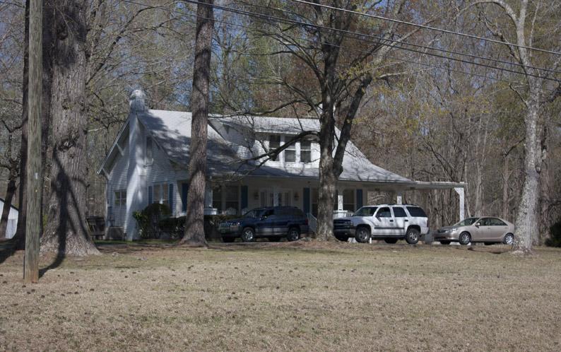
04.04.11
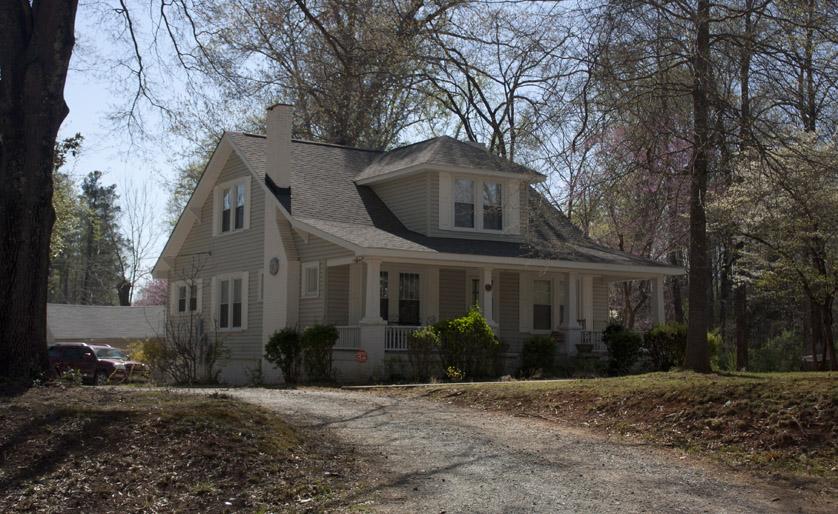
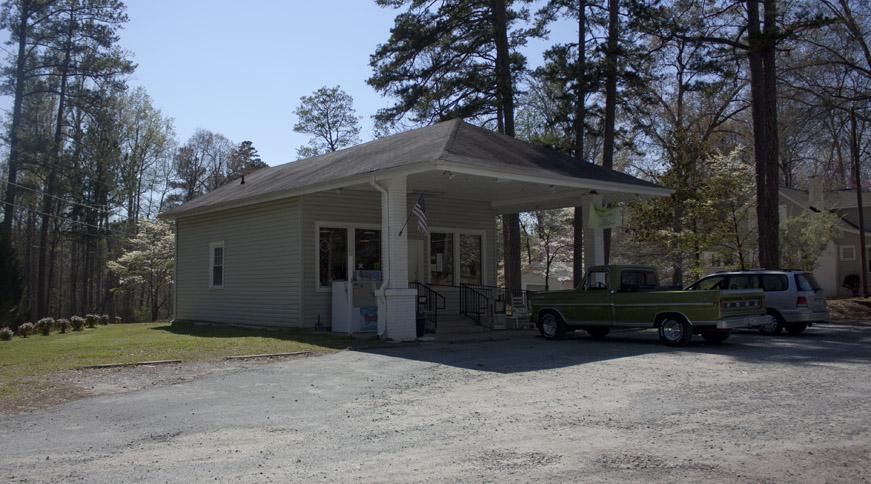
The area along US 70 has fared better, with several nice bungalows, and the store, which is now called University Station Market.
04.04.11
04.04.11
04.04.11
04.04.11
04.04.11
Carrboro faded, as did Durham, from the loss of its industrial backbone in mid-20th century.
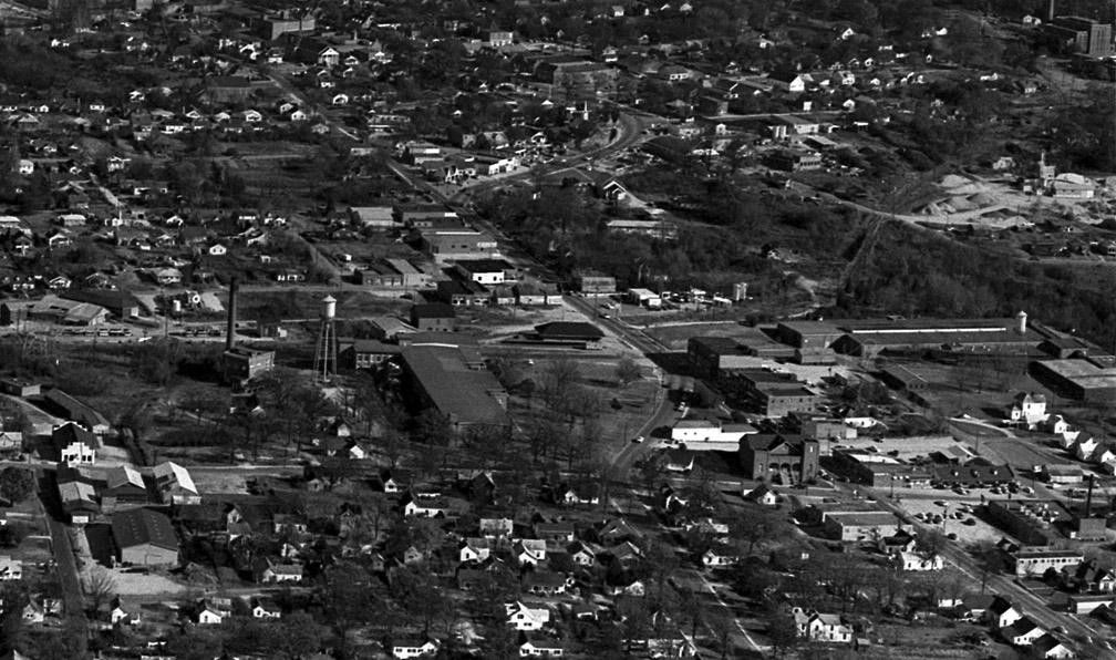
Carrboro, 1960s-1970s, showing the industrial development around the southern end of the University Station line. The former Durham Hosiery Mills No. 4 and No. 7 are visible (later the Carrboro Woolen Mills No. 1 and 2, branches of Pacific Mills)
(Courtesy The Herald-Sun Newspaper)
The mills closed in the 1960s. Fortunately, the close proximity of UNC meant that the bottoming-out was short-lived, with repurposing of old structures occurring throughout the 1980s and 1990s, although the former Durham Hosiery Mill No. 7 was demolished.
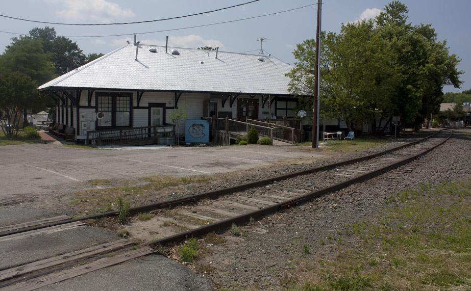
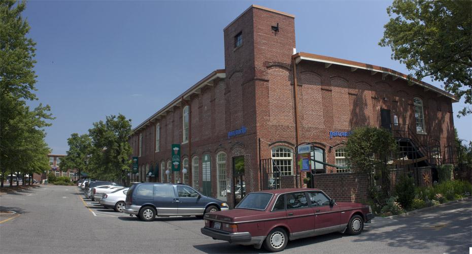
I believe the train still heads down this spur to supply coal to the UNC power plant, although I don't know that it serves anyone else. The Southern Railway station at Carrboro has been preserved (kudos to them for not being as deeply stupid as Durham in demolishing its own train station.) The former Durham Hosiery Mill No. 4 survives as the Carr Mill Mall - the 1977 year of its repurposing evident in its name.
Southern Railway Station, Carrboro, 05.22.11
The former Durham Hosiery Mill No. 4 / Carr Mill, 05.22.11
Find University Station
Find University
36.03762,-79.035484
Comments
Submitted by Michael Bacon (not verified) on Sat, 5/28/2011 - 10:00pm
The coal train does still serve the steam and power plant that sits behind Cameron Ave. I've seen trains rolling slowly down that track and crossing Merritt Mill Rd. There's another spur of the track that splits off south of Main St. that goes to what appears to be a concrete and construction materials plant/warehouse. I've never seen a train go to it, but the siding to it is well maintained and free from overgrowth.
I still don't understand why the regional rail plans steadfastly ignore the University Station spur as a means of providing service to Chapel Hill. Past the steam plant, there's a wide right-of-way serving the steam conduits to the main campus of UNC. It's always seemed like the path of least resistance to do a commuter rail line that used that right-of-way to position a stop just behind the Carolina Inn. From there you could have a commuter line with stops at Carrboro, at the new Carolina North campus (provided it ever gets built), at the massive town Park and Ride lots on Eubanks, at NC-86 at Allen and Son, and at University Station.
As for University Station, as much as an urbanite as I've become, I also fully understand that there are people who want to live in small developments away from the hustle and bustle of the city. U.S. has always seemed to me the ideal place to site a small, high-density development tightly wrapped around a transit stop that quickly went into protected public lands. I know tons of people who would love to live in that kind of development.
Ah, well. I need to go buy a lottery ticket...
Submitted by Gary (not verified) on Sat, 5/28/2011 - 10:01pm
Michael
Thanks for bringing the modern regional rail dilemma into the disccussion, as I'd hoped to tie the historic decision and dilemma back to our present one, but just ran out of time to research whether the US line had been considered, what the latest iterations of, say, the STAC plan conclude about Chapel Hill (if anything,) etc.
My assumption is simply that the 'spur' nature of the line is unappealing, and the fact that the spur branches from a rural area rather than an existing population center is as well. But given the proximity to 70/85, it seems like the kind of development you're talking about is feasible.
GK
Submitted by rollins (not verified) on Sat, 5/28/2011 - 10:01pm
Very cool.
Submitted by Michael Bacon (not verified) on Sat, 5/28/2011 - 10:01pm
Every time I talked to someone who was on or close to the STAC, the response was something along the lines of the following:
a) Whoever controls it right now is being uncooperative. This blows my mind a bit. That spur handles at most five trains a week, and more traffic would mean more rent.
b) It's a long way around to get to Chapel Hill. Durham-to-Chapel Hill times would be pretty bad just because of the circuitous route.
c) It's a single track most of the way. This I can understand -- it would be expensive to double-track it the whole way, although there's certainly room in the right-of-way.
d) It doesn't get you close to UNC Hospitals, which is where about half of the commuter rail demand is in central Chapel Hill.
Still, even with that, there was so much hand-wringing and gnashing of teeth over the traffic and transit connections to Carolina North when that was a more pressing concern, it was always pretty surprising that the spur NEVER seemed to come up in any public conversation about it.
Submitted by Gary (not verified) on Sat, 5/28/2011 - 10:01pm
Thanks Michael. I understand some of those - and I can certainly understand the freight lines being uncooperative. It seems like what they do. The barely utilized spur from ~Fayetteville St. up to Roxboro - used only for the cement plant at Geer St. and abandoned from there north - seems a prime example. Why not figure out a better use for it? I can't imagine the cement plant covers the cost of running and maintaining the line.
The hospital question is a bit interesting - looking at google maps, it appears that the line extended all the way past the cogen plant to S. Columbia behind the Newman Center at some point. Stuff appears to have been built in the ROW, though, and I don't know if that's university owned or now. If it is though, getting a train all the way to S. Columbia certainly seems close enough to be viable.
GK
Submitted by Michael Bacon (not verified) on Sun, 5/29/2011 - 10:01pm
That ROW is currently just used for massive steam transfer pipes taking the steam to the campus. I don't know if it was ever planned to be a rail line, but I'm pretty sure it's never had tracks laid on it. The stuff you can see "built" in it from Google Maps is steam piping that comes up out of the ground that's been installed recently during a lot of work they're doing in that line. Whether that's the permanent solution or whether it's going to be put back in the ground eventually, I don't know.
Submitted by Gary (not verified) on Sun, 5/29/2011 - 10:02pm
I could see that there was stuff in it, but I didn't know what that was. From a quick look at the old Sanborn maps of Chapel Hill, it appears that, in 1925, the rail line extended past the steam plant as a "spur" - actually extending all the way through the current campus, through the big quad (sorry, don't know the names) out what is labelled "Lenoir Drive" and ending up somewhere on the tennis courts just south of what is labelled "Cobb Drive".
Submitted by Michael Bacon (not verified) on Sun, 5/29/2011 - 10:02pm
Whoa! Now that's something I didn't know. I thought the rail line had never been allowed to get closer than the coal plant. I wonder if it was ever used, or if there was ever a campus station for it?
Submitted by Mark Chilton (not verified) on Tue, 5/31/2011 - 10:02pm
I recently blogged about the circumstances of UNC's connection to the world by rail:
http://piedmontwanderings.blogspot.com/2011/05/have-you-ever-wondered-w…
UNC was built at a major intersection on several hundred acres of land donated by area farmers who thought the rest of their property would go up in value more thane enough to compensate them - a point on which they seem to have been suitably vindicated.
The site was chosen because Chapel Hill was aesthetically appealing and was free and had good road access. Chapel Hill was already on the road from Raleigh to Guilford Courthouse and the road from Pittsboro to Oxford and only a mile off of the road from Fayetteville to Hillsborough.
Submitted by Gary (not verified) on Tue, 5/31/2011 - 10:02pm
Thanks Mark - I enjoyed reading your post and the additional insight it provides. I appreciate the info re: Chapel Hill's pre-existing transportation connectivity.
GK
Submitted by Patrick McDonough (not verified) on Tue, 5/31/2011 - 10:02pm
First, Gary, this is a terrific piece of research and documentation. Well done.
As to Michael's question about why the University Railroad Spur is not considered a primary line for future regional transit usage, the most important consideration is that very few people travel through that corridor compared to the 15-501 corridor.
I did some looking around to find the best way to illustrate what I mean, and some graphics created for Triangle Transit by the Triangle J Council of Governments do a good job of showing the current and projected trip intensities in our region.
Download the PDF at this address:
http://www.wmpo.org/NCAMPO/2008_NCMPO_Presentation_TriangleTransit.pdf
and check out slides 26 and 27. Pink, red, and purple are the most promising places for higher-order rail transit in our region.
Submitted by Anonymous (not verified) on Wed, 6/1/2011 - 10:03pm
"We would go to Wardsville School. On beautiful days, we would go to school a half a day, then walk down University Station Road to where it linked to Linden Road in the vicinity of Highway 70."
Here's a link to a guy who grew up 80 years ago or so.
near University Station
http://enoriver.org/fishdam/johnscarlett.htm
Submitted by John Hartwell (not verified) on Thu, 9/15/2011 - 2:00am
I can add a couple of tidbits to this fine thread: 1. As to the location chosen for UNC, I believe the enabling legislation specified that it not be closer than 12 miles to an existing town. By the road then in use the Chapel Hill location was just over 13 miles from Hillsborough. 2. I'm certain that I have seen a map showing tracks into campus from the current power plant location. These might have been used to deliver building materials, however, and do not necessarily imply passengers. Duke's West Campus was quite covered in temporary rails during its construction ca 1930, the stone being hauled from the Duke quarry just west of Hillsborough. 3. Fitch Lumber was a railroad customer in Carrboro until perhaps 20 years ago. Fitch not only brought in materials to sell from its existing store on Greensboro St, but also shipped out manufactured wood products from its mill across the street (just north of Carr Mill Mall). John Hartwell, Hillsborough
Submitted by herb englishman (not verified) on Mon, 8/5/2013 - 10:24am
Is this the same Railway that serviced the Eno Steam Power Plant on Pleasant Green Road near Hghway 70. There is a spur line that services the site now abandoned but historically significant
Add new comment
Log in or register to post comments.