(Photo courtesy Durham County Library)
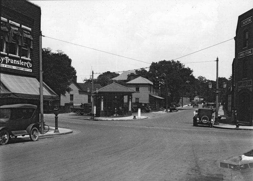
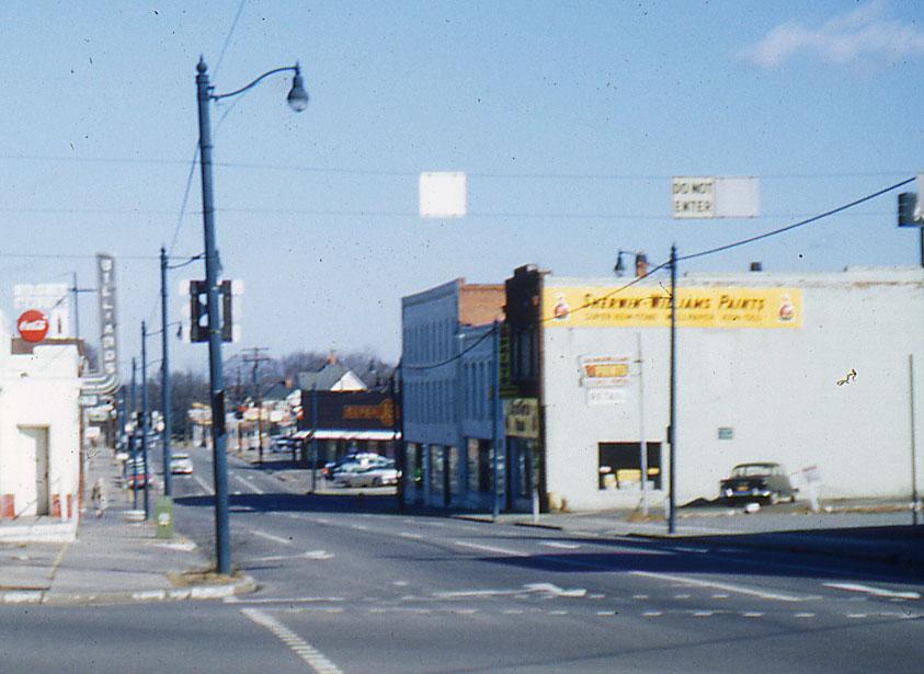
The southeast corner of N. Mangum and East Chapel Hill contained several two- and three-story commercial structures, all built in the late 1910s-early 1920s
The southeast corner is to the right in this photo, looking northeast from N. Manguma and East Chapel Hill, 1920s.
(Courtesy Duke Archives)
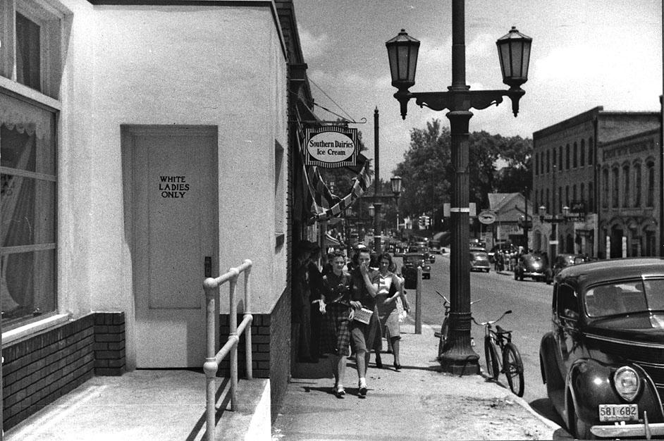
The view north on North Mangum, 1940 - the structures are visible on the right. The bus station is on the left - segregated, like most everything in Durham was.
(Library of Congress)
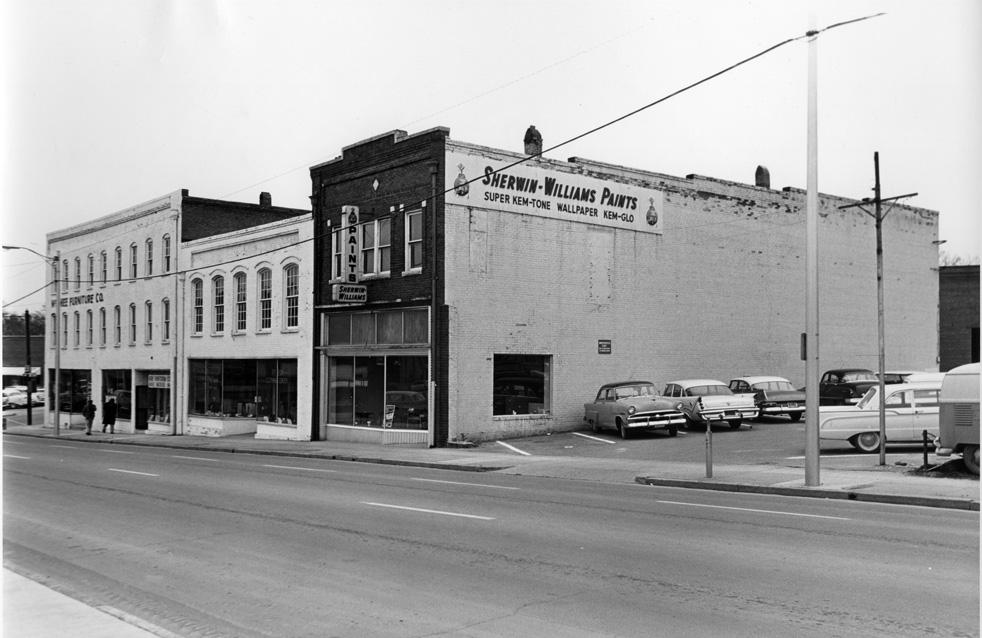
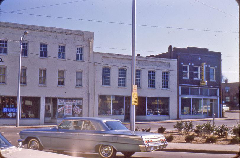
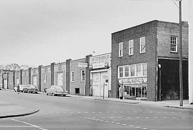
The view of the three buildings facing Mangum - a Sherwin-Williams, a clothing store,and McGhee Furniture
(Courtesy Duke Archives)
A slightly different view, looking north on Mangum, 1962.
(Courtesy Durham County Library)
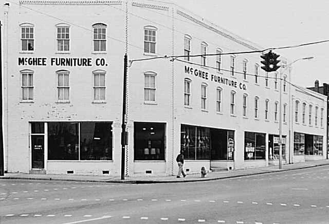
Yet another, looking east across Mangum.
(Courtesy Durham County Library)
The corner view, looking southeast.
(Courtesy Duke Archives)
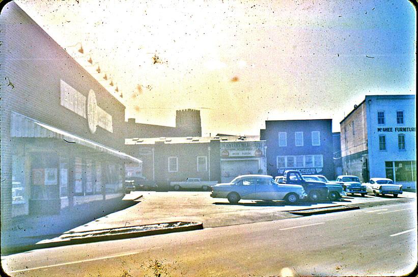
A view of an additonal structure on the corner 'site', the Rochelle Gun and Bicycle Shop - gotta love the combo deal = seen from the A&P parking lot. The Planter's Warehouse is to the left, and I'll profile that next time.
(Courtesy Durham County Library)
Rochelle's, and the Planter's Warehouse, looking east-southeast.
(Courtesy Duke Archives)
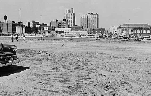
In the early 1960s these buildings were bulldozed by the city for surface parking
Looking west towards the remainder of downtown.
(Courtesy Duke Archives)
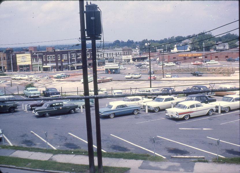
Looking north-northwest.
(Courtesy Durham County Library)
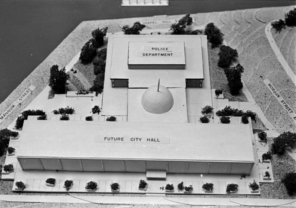
Within a few years, the city began the construction of the "government center" - including a new police station, fire station, and city hall.
The fire station and police station came first.
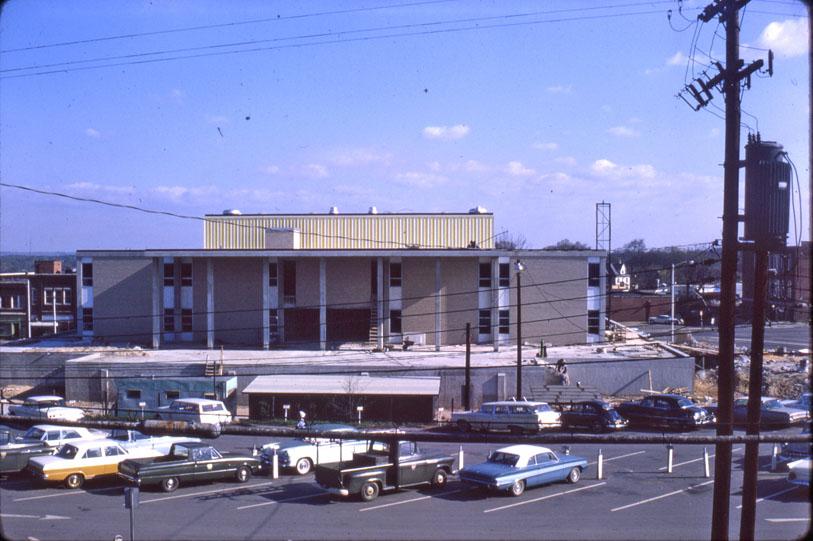
The police station under construction, looking north-northeast, 1964
(Courtesy Durham County Library)
Nearly complete, looking north-northeast, 1965.
(Courtesy Durham County Library)
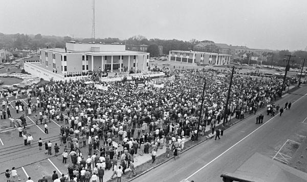
To give you a sense of the times and the divisions in Durham in the late 1960s, this was a George Wallace rally at the police station, 1968. In less political, architectural analysis, you can get a sense for how the police station and Fire Station #1 were supposed to interact with one another in a modern interpretation of a classical forum.
Looking southwest from East Chapel Hill, 1978.
(Courtesy Durham County Library)
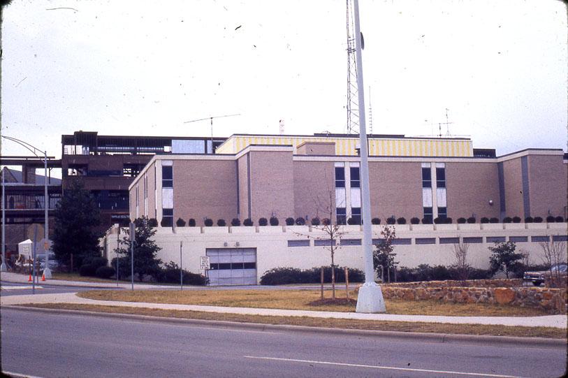
This structure served as the police station from ~1966 until sometime in the 1980s, when the police station moved to the former Home Security Life building on West Chapel Hill St.
This building then became the city hall annex, which it remains.
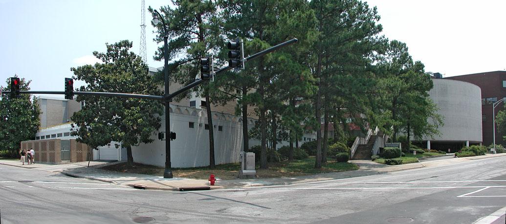
Looking southeast from North Mangum and East Chapel Hill, 2007.
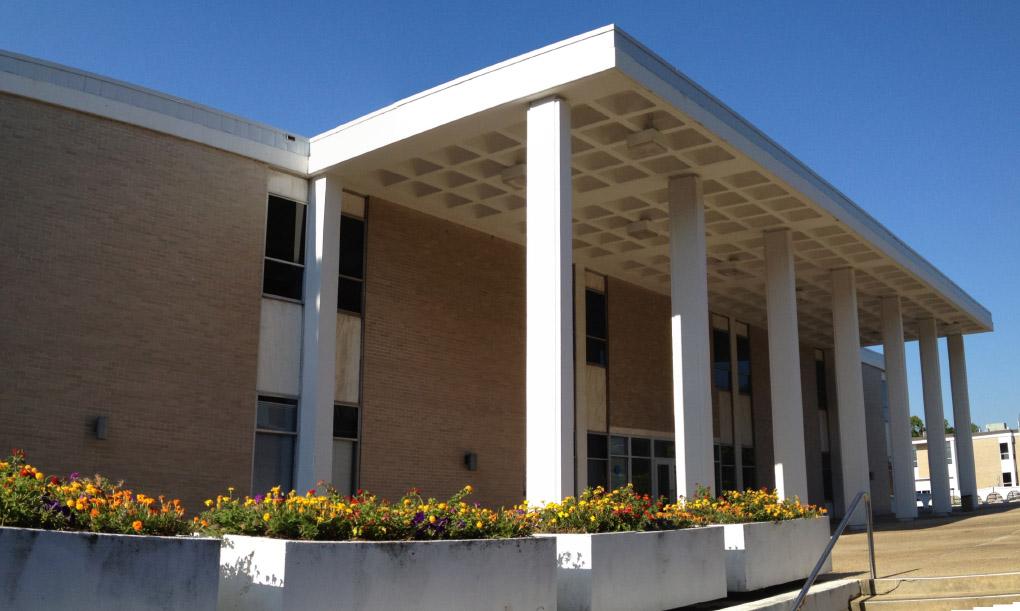
Worst building in downtown? - ooh, tough category. The SouthBank building may win on size and prominent location. I have to give We-Want-Oprah its due with a certain kitch value to the windowalls and first-floor retail. City Hall itself - pretty atrocious, but, well, at least they were trying to be interesting.
This building is just stridently mediocre in style, and downright awful in site plan. I'm not sure you can give a bigger affront to a major street than this building does to East Chapel Hill St. It is classic for the 1960s - service entrances all around your main street, and then the main entrances fronting on a bare, useless space in the center.
We've gotten better about not being so stark with our spaces, but we're still building these inwardly focused street-affrontage buildings.
Michael B. commented a few posts ago that he'll break out the champagne when this sorry excuse of a building goes down - I think it will be a hoppin' party, and I'll be there.
The rarely seen primary facade of the police department - 06.28.12 (Photo by Gary Kueber)
Comments
Submitted by grady (not verified) on Fri, 7/20/2007 - 11:58am
There are signs in the window of the Ray Uniform Co. (5th photo down from the top) that say "Sale" "Building Coming Down" "Drastic Reductions." It's about as close as Endangered Durham gets to an "action shot" ;-)
Submitted by Gary (not verified) on Fri, 7/20/2007 - 12:22pm
Nice catch Grady - I missed it. Yeah, I'd say that I don't get a lot of practice on how to embed YouTube. :)
GK
Submitted by Michael Bacon (not verified) on Fri, 7/20/2007 - 5:49pm
DIE DIE DIE DIE DIE!!!
(Okay, get a grip, let's do this right now...)
This building has everything, as far as I'm concerned. Sure, SouthBank is high on the list, but at least it has the decency to go vertical. The CHA has just two stories of bland suburbia, almost no windows, that awful white steel/yellow brick mix, and a portico on the "front" that's the building's only real attempt at architecture, but it's so lame and half-hearted that it just sort of dies.
I hadn't realized that it predated city hall, which at least explains somewhat why the portico is where it is. Opening onto a parking lot is a sin we're still committing, but I'd originally thought it had been built staring, fixatedly, at the backside of city hall.
What really takes the cake here is, as you said, its relation to the street, and, well, anyone. The only remotely visible entrance this building has is a service entrance that very clearly implies -- "Do not enter! What are you doing here? Go away!" That it's on one of downtown's cardinal streets, just where it crosses another cardinal street, is bad enough. What makes it so much worse is that neither of the other two street faces has anything remotely resembling an entrance either. For goodness sakes, it even has battlements around the sides. If the city ever fell under siege from barbarian raiders, this building is set to go.
The sole entrance to the place is completely inaccessible, as near as I can tell, except by either mounting the long, random stairs near the Cylinder of Power that's on the side of City Hall (and marks one of the only two interesting things about that building), or by going out the back door of city hall.
But what's the old addage... the Chinese symbol for "crisis" is the combination of the characters for "danger" and "opportunity." This building is a crisis of architecture, but given the fact that nobody's going to shed a single tear when it meets its trinitrotoluene, the space represents a great opportunity. The current city hall is a mess, but its major problem really isn't that intractable: it has no major entrance that gives it an architectural presence. It would be fine as the #2 building in a city service complex, but as the #1 just lacks the power that it should. And here's where the Annex comes in. Flatten that piece of nonsense, and you suddenly have the opportunity to build a real, honest-to-god front to city hall, which looked out over a suddenly relevant Rotary Park, and presided over the intersection of three major roads. At that point, the current main city hall building could become the less-seen "annex," the current front door would make a perfectly respectable back door, and city hall might even give off a vibe of a place where its citizens were welcome.
Submitted by Eric Heidt (not verified) on Tue, 11/15/2011 - 12:50pm
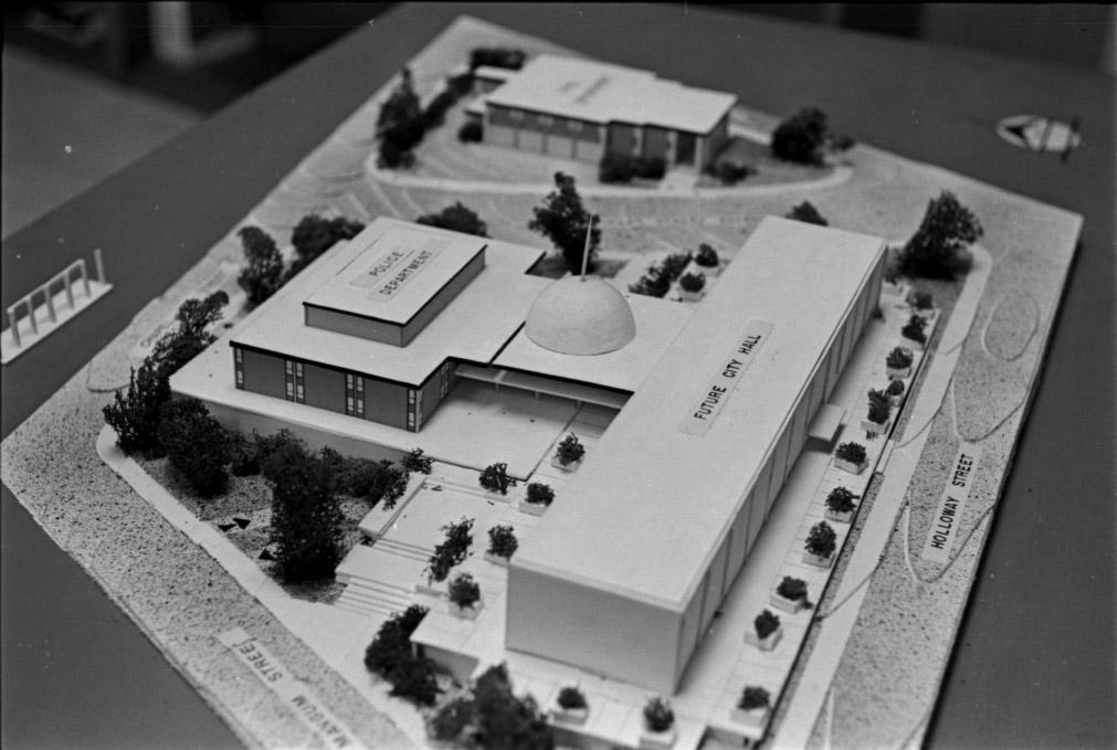
Interesting how the original model shows Holloway St in front of City Hall (altough it looks like it might be kinked in relation to Holloway across Roxboro), and does not indicate the crazy 'Liberty St. On-Ramp' behind the then-Police Station. I guess that piece of enlightened city planning came a little later.
Submitted by gary on Tue, 11/15/2011 - 9:07pm
Eric
Originally, before the crazy Liberty-Holloway on-ramp mess that came a bit later, Holloway St. did start at Mangum St. (the current "City Hall Place" and continued eastward, to its still-extant portion east of Roxboro. Liberty St. intersected with Cleveland St. and Church St. at a three-way intersection next to Trinity Methodist Church. Morgan Street didn't continue east past Mangum, and Chapel Hill St. terminated ('T'-ed) into Cleveland at First Baptist. So if you were heading westward on Holloway, you would have had to either gone west to Cleveland, north to CHS, and then continue west, or west on Holloway to Mangum, then north on Mangum to Morgan, then westward on Morgan.
So it was kind of a mess, forcing a lot of traffic onto Main Street, which, prior to the bypass being built in the early 1950s, was also the main east-west highway through central NC. So one can understand the 'driving' force behind creating the mess we now have. It was too heavy handed, and too intent of creating highways rather than connectivity.
Add new comment
Log in or register to post comments.