36.005502, -78.901344
Cross Street
Neighborhood
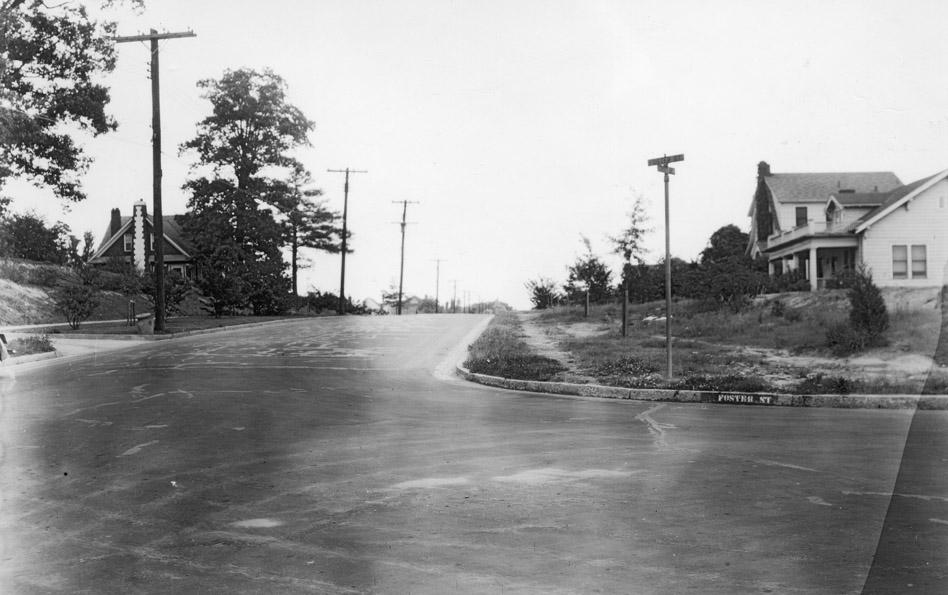
West Trinity Ave. from Foster St., May 1938.
(Courtesy Duke Forest Collection)
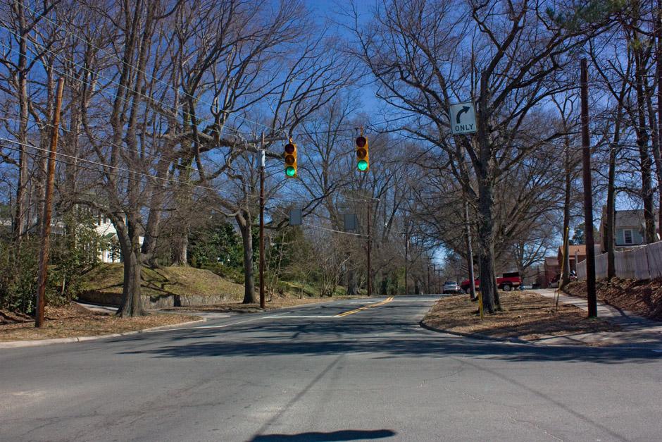
West Trinity Ave. from Foster St., 3.13.10
(Copyright Endangered Durham)
Find this spot on a Google Map.
36.005502,-78.901344
Comments
Submitted by Steve Graff (not verified) on Fri, 6/25/2010 - 9:23pm
It's interesting to note how much "lower" the granite curbs are today as compared to the old picture. The rising tide of asphalt is overtaking our old curbs.
It would be nice if the next time the city re-surfaces many of our old streets that they scrape them down so that we can once again have effective curbs that channel water towards storm drains, and also act as an impediment to parking up on the curb. There are also places where I can see beautiful old bricks peeking out from under old broken asphalt.
Submitted by David Jeffreys (not verified) on Sat, 6/26/2010 - 1:33am
Also interesting that in 1938 this particular corner hearalded the present street corner signs, though it does still have the name painted on the curb. Whatever happened to those beautiful vertical obelisks at the street corners with the names on them? That was a nice touch and I think they are all gone. Does anyone have an obelisk remaining on their street corner?
Submitted by D N (not verified) on Sat, 6/26/2010 - 3:30am
David: Gary has written about those signposts before, so he can correct me if he's wrong, but I believe the last known one is at Gordon/Yancey near 147/Chapel Hill St.
Add new comment
Log in or register to post comments.