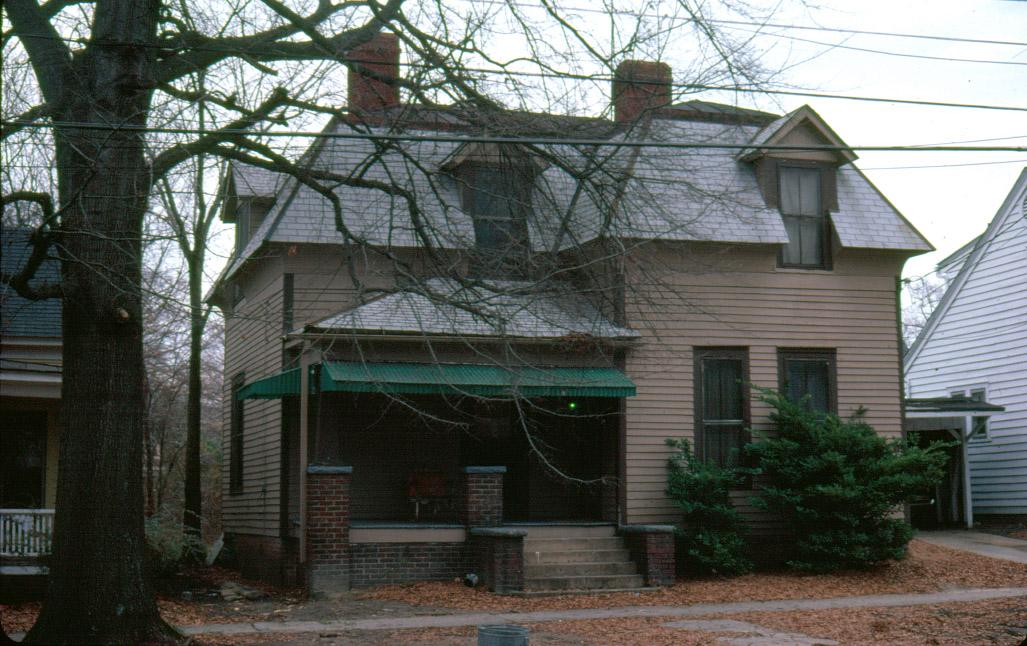
1981 (NHS - Durham County Library)
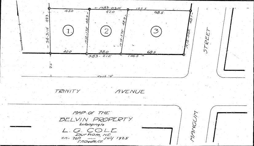
Plat showing subdivision of the "Belvin Property", owned by LG Cole, in 1925
(Below in italics is from the 1984 National Register listing; not verified for accuracy by this author.)
Although this house does not appear on the 19[13] Sanborn Insurance Maps, several of its features, most noticeably the mansard roof (which is the only one of its kind in North Durham), indicate a construction date closer to the turn of the century. Other details supporting an early date for the one and one half story weatherboard sided house are the tall first story windows and the front door with multiple small colored panes of glass surrounding the clear central window. In addition to the roofline, the incorporation of gable roofed wall dormers and concave cornices distinguish the modest size dwelling. The porch supports of a frame pylon on a brick pier are typical of the 1920s and 1930s and may be a replacement. It is possible that the house was moved to the site.
Although the historic inventory states "several details support a construction date close to the turn of the century," and I agree, it doesn't appear in the city directories until after 1925, and is not on the 1913 Sanborn map of this area. As the plat above shows, 1001 N. Mangum, 106 West Trinity, and 108 West Trinity were likely one parcel, likely with the main house on the corner facing N. Mangum - the house on that corner on the 1913 Sanborn looks like it could be a match.
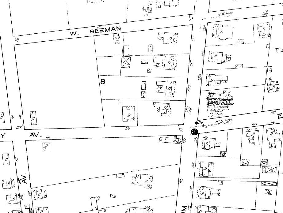
1913 Sanborn Map.
It seems possible that the original house may have been moved to this parcel when the Esso Station was constructed on the 1001 N. Mangum corner. However, the shapes on the Sanborn maps are not really a match (and usually mansard roofs are indicated.) The porch supports are 1920s-era, and although turned posts were often replaced with box pylons + piers in the 1920s, it would also support a move in the 1920s with a new porch.
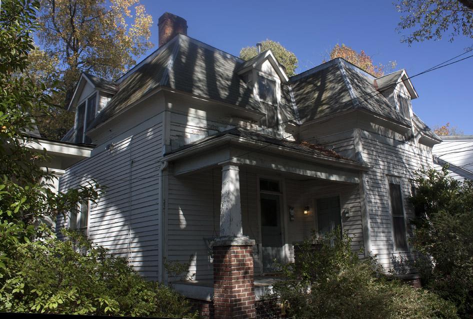
106 W. Trinity, 11.07.09 (G. Kueber)
Comments
Submitted by Michael Bacon (not verified) on Sat, 4/2/2011 - 8:49pm
Do you know anything about the history of this house? It strikes me as having a lot of unusual style elements, like the mansard roof.
Submitted by Fordtruxdad (not verified) on Sun, 10/16/2011 - 2:00am
I owned the house to the right (104) from 1991 until 2003, having bought it from the original owner since the 1920s, Mrs. E. Stewart Cole, daughter-in-law of L.G. Cole. I do know that 106 was moved there and is significantly older than most of the houses on that block. Mrs. Cole and others said that a lady ran a "kindergarten" there in the '20s and '30s. The house has a beautiful but narrow winding staircase.
Submitted by Jane Walden (not verified) on Sat, 5/31/2014 - 6:25pm
I own this house and have recently started renovating the exterior. I chose a dark Prussian blue as the color for the body of the house and added plum, vinca blue and green as accent colors. The trim is in restoration ivory. These colors were carefully chosen to project the saturated colors of the Victorian era, since this house is a Second Empire Victorian. As we took the house down to the wood, we discovered seams in the siding that clearly indicate that once there was a glorious front porch on this house that actually turned the left corner and projected out further at the front and stopped near the first front window. This house was moved, I think it used to be facing Mangum St. and evidently when they moved it, they put it on a tiny non-conforming lot and had to remove the porch so it would fit! What a shame! I hope that someday the city will approve an adjustment so that I can restore the front of the house to it's original glory.
Submitted by Jane Walden (not verified) on Thu, 6/5/2014 - 4:24pm
As I have studied the 1913 Sanborne map, I think the thumbnail sketch shown on the map at 1001 N. Mangum is my house. Here is why i think so.... I think the structure on the back right of the house was destroyed when the house was moved so that it would fit on the new, smaller lot, and I think the portion of the front of the house that juts out at an angle was also taken off. If you stare at what is left, it reflects the current footprint of the house. And as I mentioned in the comment above, we discovered seams in the wood that shows something else was on the house. The seam on the left side of my house, reflects the porch on the Sanborne map and the seam that is now above the first window on the front, is approximately where that angled portion on the thumbnail map would have tied in to the front. I am sure it had a gloriously deep front porch originally. So I think the mystery is solved about the thumbnail on the Sanborne map not matching up with the existing property!
Add new comment
Log in or register to post comments.