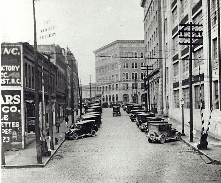
Looking north from West Peabody St., 1920s.
(Courtesy Durham County Library)
The shot above shows Corcoran St. looking north from the railroad tracks towards Main St. On the right side are the Hosiery Mills building, the First National Bank building, and the Geer Building (at the focal point).
The first building on the left is 120 South Corcoran St. It may have, at one time, housed the Seeman Printery or one portion of that business. There are several different addresses for the printery, one of which was here. The sign for the Seeman Printery can be seen facing Main St. (in reverse near the top of the frame.) During mid-century, it housed the Jourdan Transfer Company as well.
Jourdan Transfer trucks, I believe behind the 100 block of West Main St.
(Courtesy Duke RBMC - Parnell collection)
About the Jourdan Transfer Co., Durham and Her People states:
The Jourdan Transfer had its inception back in the horse-and-buggy days when Durham was a mere cross-roads town. Stanislaus Jourdan, a, native of France, had emigrated to the US at the age of 16, and with his family had settled near Gulf in Chatham County. As a young man, he came to Durham about 1887, starting out with a horse and wagon in the "hacking" business.
Later he established a livery stable with buggies, horses, and wagons for hire at the eastern side of Jones Street between Main and Chapel Hill Streets, and as the auto age developed he kept pace with the times. When he died on 11.03.1935, he had one of the largest and best known transfer companies in this section.
On his demise, his stepson, Alfred E. Shelburn, who had been associated with him for many years in an active capacity, bought the business. Mr. Shelburn had been born in Durham (11.26.1888,) the son of Edgar Lee Shelburn and Mollie Shelburn Jourdan. On his demise (06.01.1936) his widow, Mrs. Mary Cooper Shelburn, and LC Melchor bought the business which she continues to operate, having associated with her her daughter, Mrs. Emmett (Mary S) Batten, in an active capacity.
This well-known transfer company moves and stores household goods and crates anything for shipment anywhere. [...]
Mrs. Shelburn, as well as being operator of the oldest concern of its kind in Durham, is also member of a pioneer Durham family that had an important role in the early development of this city. She was born in Durham 06.26.1892, the daughter of Robert Edward and Ida Kernodle Cooper. Her grandfather WR Cooper was a prominent tobacconist back in the early days of Durham.
On 12.23.1919, she was married to Mr. Shelburn, from which union there is one daughter and one son, William Edgar Shelburn. Mrs. Shelburn is a past president of the American Legion Auxillary, member of the Altrusa Club, [...] and the Duke Memorial Methodist Church. She lives at 918 Green Street, while the offices of the company are at 120 S. Corcoran St.
One of the oddities of the way downtown Durham evolved during the late 19th century was the lack of a complete frontage road on the north side of the railroad tracks. These buildings came all the way south to very near the railroad tracks, and there was no roadway extending west from here to West Chapel Hill St. Peabody St., much like it does now, stopped and started at various points - extending east from here and terminating at Union Station (located at the southern terminus of Church St., at the railroad tracks. There were other sections of Peabody west of the Duke Factory (where it exists still) and in East Durham (also still in existence.)
In the late 1920s-1930s (or later,) the 114 bay of the building housed the Busy Bee Lunch.
In the 1940s, 112 S. Corcoran (to the north of this building) was demolished.
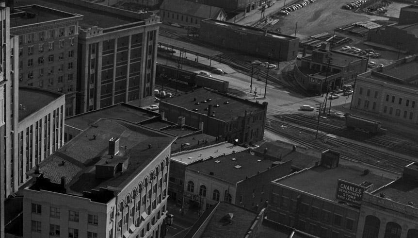
Aerial, looking southeast, 1950s. The rear of the 120 S. Corcoran building is visible across from the Durham Silk Hosiery Mill.
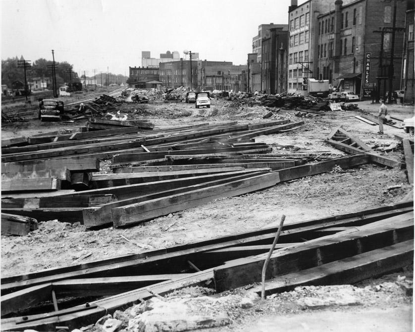
In the late 1950s, 120 S. Corcoran was demolished along with the Southern Railway depot to its west.
Fully Demolished SAL depot and 100 block of South Corcoran.
(Courtesy Duke Archives)
This area was transformed into surface parking (where the multiple rail spurs used to come off of the main tracks) and into what would become the Ramseur St. part of the Loop, although the Loop would not be completed for another 10 years or so.
Looking north from Corcoran and the railroad tracks.
(Courtesy Durham County Library)
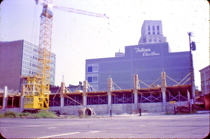
By the mid to late 1960s, this seemed like a prime spot for a fancy new parking deck.
Looking north from Corcoran and the railroad tracks.
(Courtesy Durham County Library)
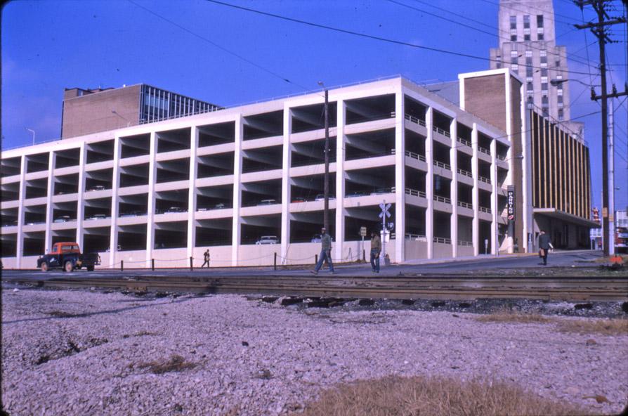
The completed product, looking northwest from the railroad tracks.
(Courtesy Durham County Library)
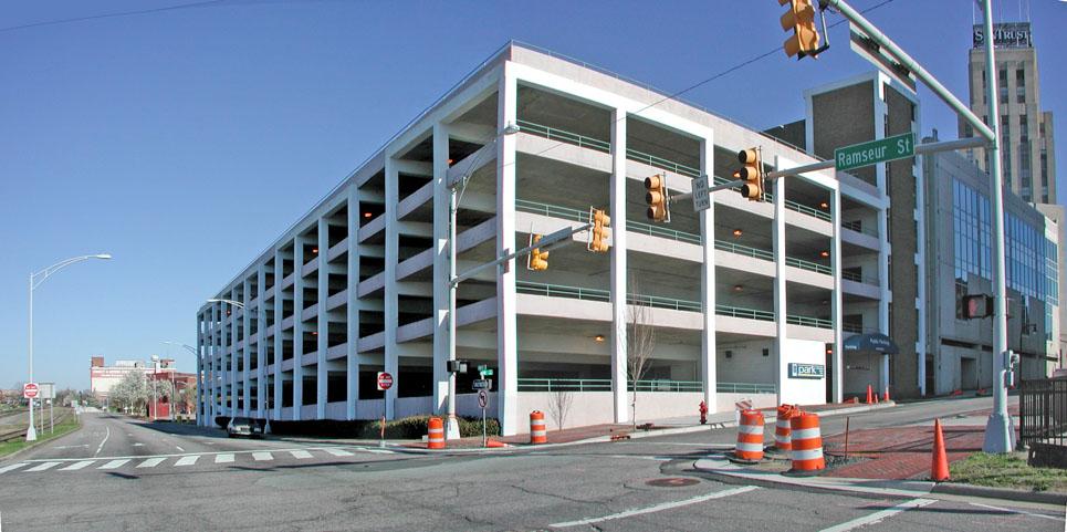
It hasn't changed much today.
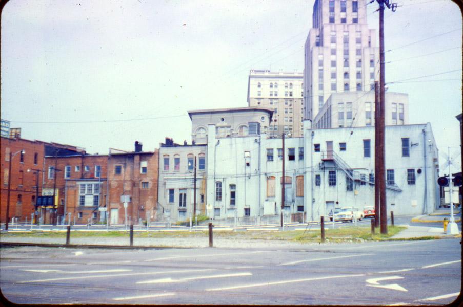
Looking northeast from Corcoran and Ramseur, 2007.
Since it seems that our redevelopment focus is concentrated on Corcoran St., this parking deck will need to be addressed if the powers-that-be are interested in moving people, rather than just cars, back and forth between American Tobacco and parts in-the-loop. The combination of Pettigrew, the tracks, the Loop, and this deck is a huge gulf of dead space that dissuades people from making The Crossing. Demolishing the eastern 1/4 of this deck and replacing that with a building that had active, usable street frontage would be progress.
Find this spot on a Google Map.
35.995218,-78.902326


Add new comment
Log in or register to post comments.