(Courtesy Durham County Library)
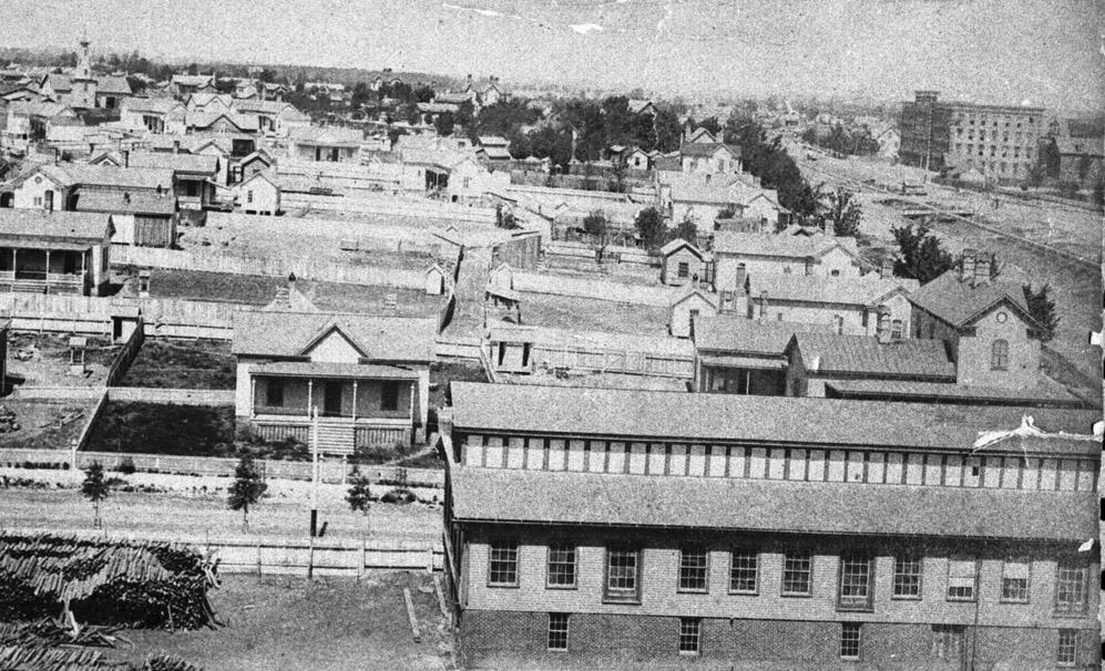
West Pettigrew Street, neé Railroad St., began as a residential street situated between the Blackwell Factory and the Duke Factory
Looking west from the top of the Blackwell Factory, mid-1880s. Carr St. and an early Blackwell's Durham Tobacco building are in the foreground - the houses to the right face Pettigrew and the railroad tracks. The first wing of the Duke Factory is visible in the right background.
(Courtesy Herald-Sun)
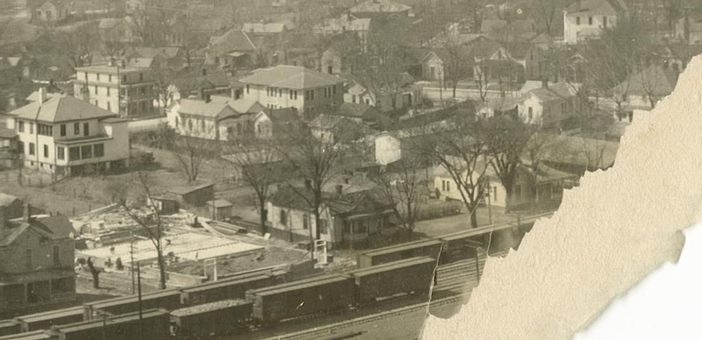
The western portion of the 300 block (which ran between Carr St. and Ashton Place) remained residential through most of the early to mid 20th century
Looking southwest from the First National Bank Building, 1920s - although a tear in the photograph obscures the western portion of the block, several small two story houses are visible.
(Courtesy Duke Rare Book and Manuscript Collection/Digital Durham.)
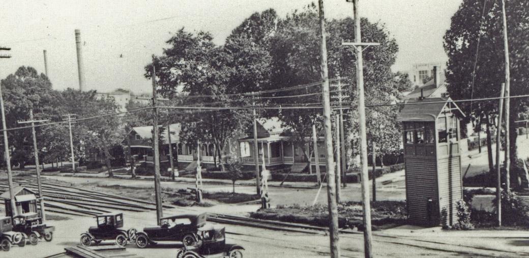
Below, as seen from the West Chapel Hill St. crossing, looking southeast. Ashton Place is the street entering Pettigrew from the south, straight ahead. (Notice that, prior to the overpass construction, Ashton Pl crossed Pettigrew to intersect with West Chapel Hill St.) A bit of the Morehead School is visible in the background as well.
(Courtesy Durham County Library)
By the mid 1960s, this strip had become entirely commercial - through replacement and conversion of residential structures.
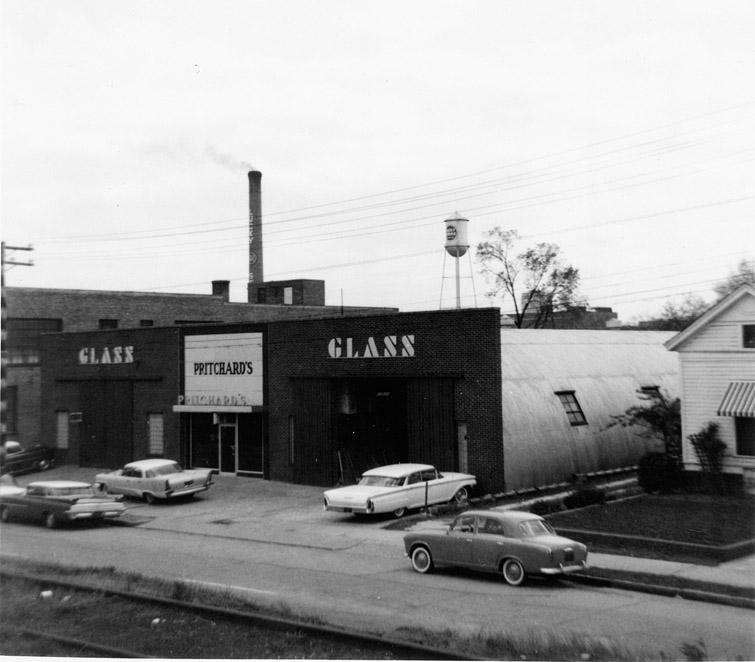
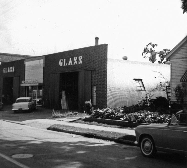
307-309 West Pettgrew was torn down in 1947 to make was for Carolina Glass, started by Norman Benson in 1929, which had become Pritchard Glass by the 1960s
(Courtesy Durham County Library)
(Courtesy Durham County Library)
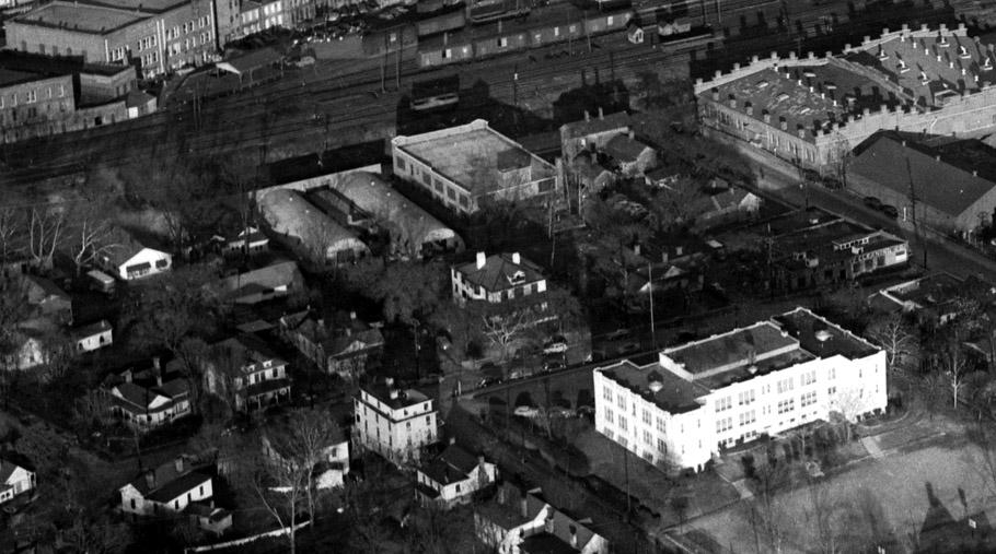
Although it had a brick facade, the 'building' actually consisted of two Quonset Huts extending south from the brick facade with some kind of bridging structure in the middle. Given the construction date, I wonder if these were some that the military sold off after WWII. These can be seen to better advantage in this earlier, 1948 aerial photograph.
(Courtesy Herald-Sun)
These structures were torn down by urban renewal in 1967.
Looking east, February 1967. The Tops Service Station and 317 W Pettigrew are still standing in this picture, but wouldn't be for long.
(Courtesy Herald-Sun)
Several other light industrial buildings replaced these structures, most auto and construction.
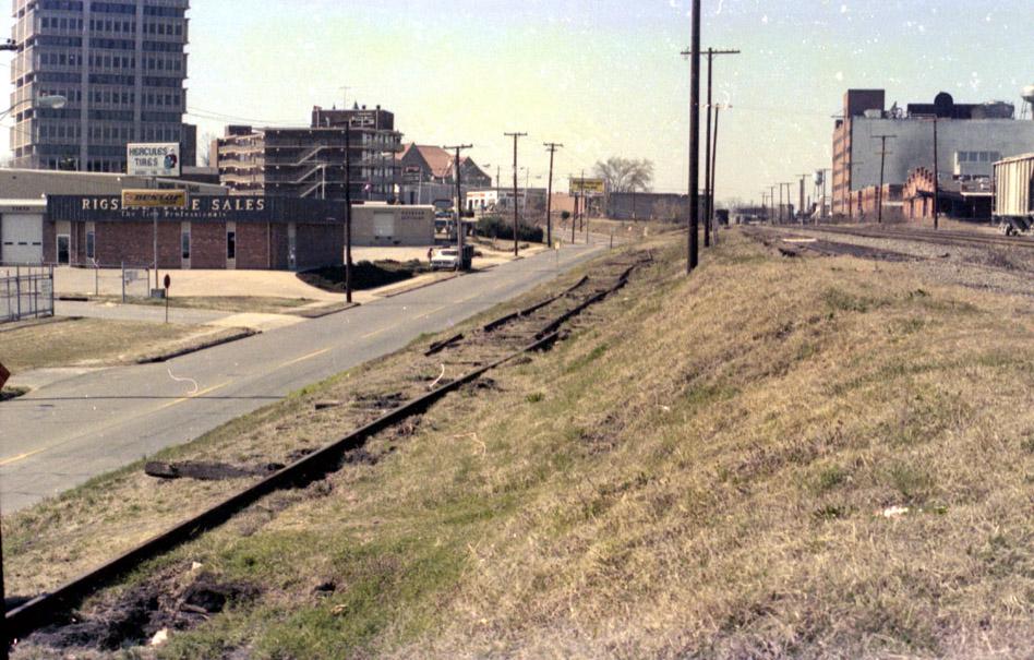
Looking west from the tracks, 1981.
(Courtesy Robby Delius)
In recent years, these had become Merchants Tire and Ferguson Plumbing Supply. These were purchased by the city several years ago in anticipation of the construction of the new transit station. Demolition of these structures began in September 2007.
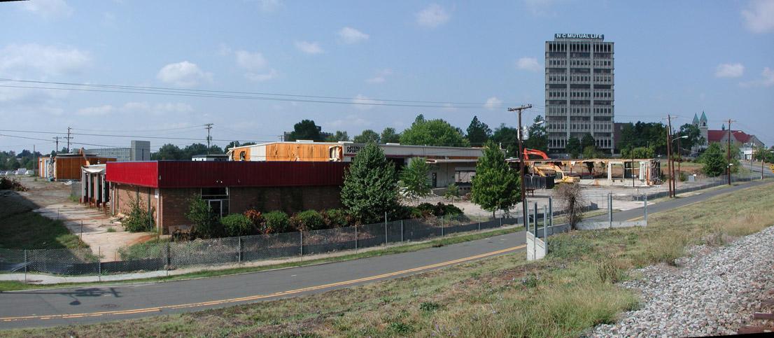
Looking southwest, 9.23.07.
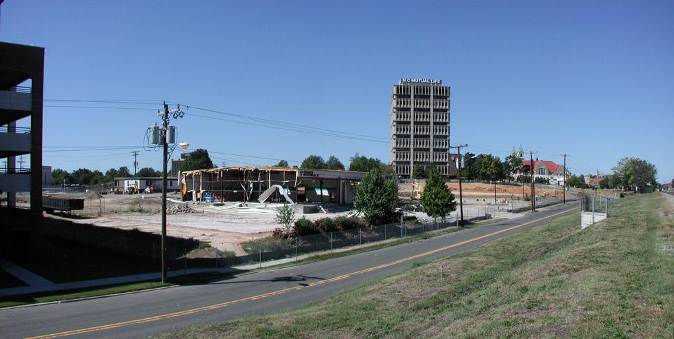
Looking southwest, 11.05.07
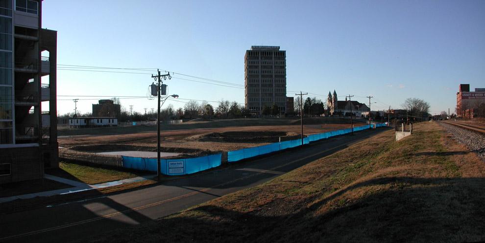
Looking southwest, 12.16.07
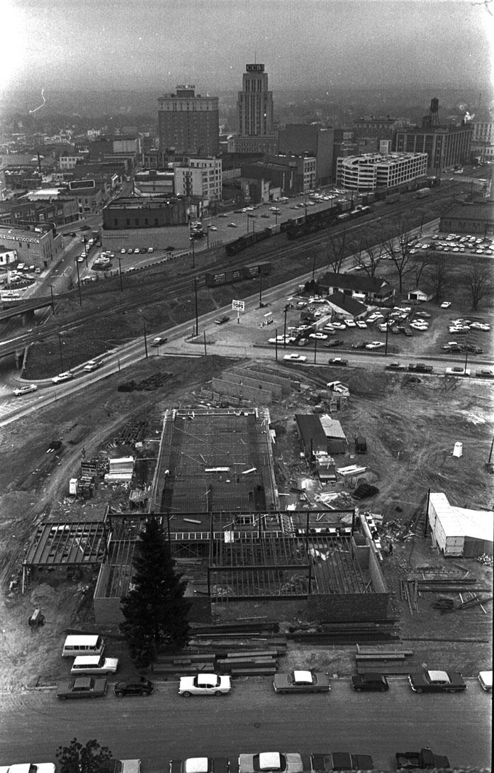
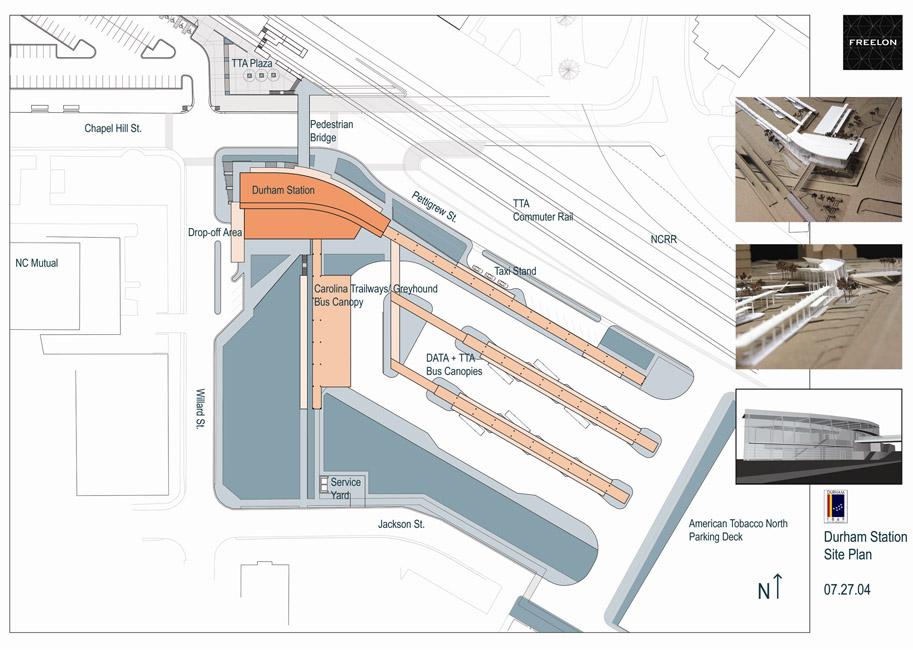
Per a rather old Freelon site plan (2004), this part of the site will be filled with long bus stalls. I don't think this has changed with the RFP, which seems to contemplate private sector development of the Willard/Jackson portion of the site.
(Freelon Group)
All of which means that West Pettigrew is unlikely to be very pleasant walking territory. We can hope this means, however, that Great Jones Street will become more pleasant walking territory, and that future acquisition of the Durham Belt Rail will mean development on the current bus station site adjacent to a walking trail - development that will help link Five Points with the West Village development and Brightleaf.
Add new comment
Log in or register to post comments.