Support OpenDurham.org
Preserve Durham's History with a Donation to Open Durham Today!
OpenDurham.org is dedicated to preserving and sharing the rich history of our community. Run by our parent nonprofit, Preservation Durham, the site requires routine maintenance and upgrades. We do not ask for support often (and you can check the box to "hide this message" in the future), but today, we're asking you to chip in with a donation toward annual maintenance of the site. Your support allows us to maintain this valuable resource, expand our archives, and keep the history of Durham accessible to everyone.
Every contribution, big or small, makes a difference and makes you a member of Preservation Durham. Help us keep Durham's history alive for future generations.


Comments
Submitted by Paul (not verified) on Tue, 6/30/2009 - 2:10pm
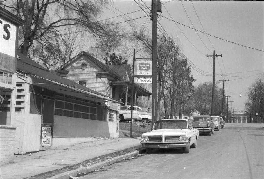
I can't guess the "where," but the "when" would be circa 1965, based on the 1962 Pontiac.
Paul Magee
Submitted by Anonymous (not verified) on Tue, 6/30/2009 - 2:18pm
is that the school of Math & science at the end of the street?
TSQ75
Submitted by Steve (not verified) on Tue, 6/30/2009 - 5:27pm
I have no idea what it is, but that's definitely not NCSSM at the end.
Submitted by Gary (not verified) on Tue, 6/30/2009 - 5:32pm
My original scan is higher resolution, and I can't tell what is at the end of the street in it either.
GK
Submitted by Deloris Grayson (not verified) on Tue, 6/30/2009 - 7:05pm
The picture you are looking at is
the Williams Produce mkt on South
St down the hill from the Pepsi
Cola Plant and beside Scott and
Roberts Cleaners,Good owners and
good merchandise (candy)
Submitted by Gary (not verified) on Tue, 6/30/2009 - 7:27pm
Nicely done Deloris! That must be about 302 South Street, at the corner of Proctor and South. I wondered if that was the Silk Hosiery Mill at the end of the street... Now that you've pointed the way, I can see the buildings in the Bird's Eye view here.
GK
Submitted by G Wolf (not verified) on Tue, 6/30/2009 - 7:48pm
Wait, so the building all the way in the background in this page is the same as the one that's partially cutoff at the top of the second photo on this page?
Submitted by Gary (not verified) on Tue, 6/30/2009 - 8:05pm
G Wolf
Yes - this one. Proctor and South would have been pretty high ground prior to the freeway. Think of how high the sidewalk around the parking garage behind the DPAC is; this would have been 1 block south of there. You can get a sense of how high this was by looking at the way Morehead cuts into the north end of the Forest Hills Heights public housing. That's about where this would have been.
GK
GK
Submitted by Deloris Grayson (not verified) on Fri, 8/8/2014 - 9:02pm
As this was our only neighborhood grocery store that sold meats, vegetable, fruits and yes CANDY (yum) it did sat near the end of South and Proctor
with the Dry Cleaner being at the end. this was about a good block from where the Forest Hill Apts is now,and you are correct the Hosery Mill is seen
at the top of the picture. Loving all the memories this brings back
Add new comment
Log in or register to post comments.