Support OpenDurham.org
Preserve Durham's History with a Donation to Open Durham Today!
OpenDurham.org is dedicated to preserving and sharing the rich history of our community. Run by our parent nonprofit, Preservation Durham, the site requires routine maintenance and upgrades. We do not ask for support often (and you can check the box to "hide this message" in the future), but today, we're asking you to chip in with a donation toward annual maintenance of the site. Your support allows us to maintain this valuable resource, expand our archives, and keep the history of Durham accessible to everyone.
Every contribution, big or small, makes a difference and makes you a member of Preservation Durham. Help us keep Durham's history alive for future generations.
Comments
Submitted by Andrew Edmonds (not verified) on Thu, 11/11/2010 - 3:28am
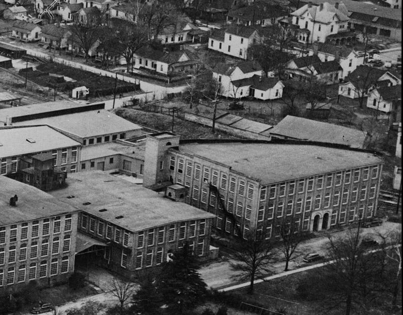
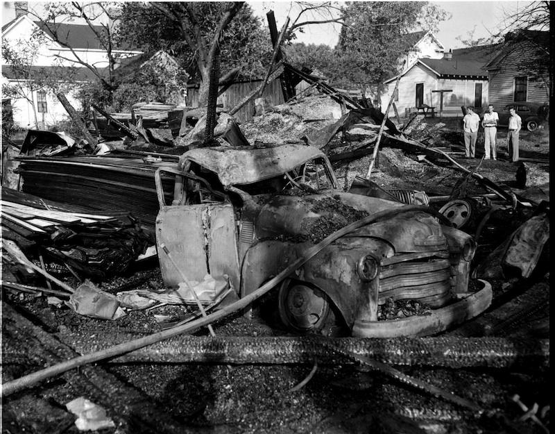
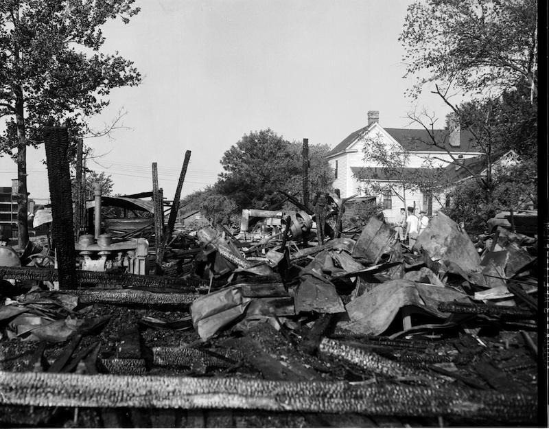
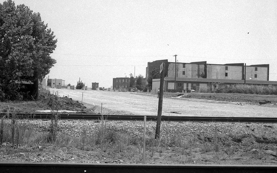
Wow, the eastern corner of Hood and E Main Streets had a whole string of buildings. Who knew?
Submitted by Anonymous (not verified) on Mon, 11/15/2010 - 6:00pm
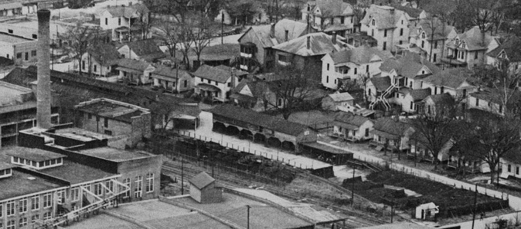
The railroad that runs beside the Golden Belt Mfg. Co, is the Norfolk & Western Rwy. (former Lynchburg & Durham RR), not the Durham Belt Line. The Durham Belt Line RR ran from a wye with the N&W North of the East Geer St. railroad bridgeup to the Liggett & Myers plant on Main Street. The Belt Line was built by Brodie Duke to connect the L&D with the L & M plant (at that time the W. Duke & Sons plant). After the bankrupcy purchase of the Durham Belt Line RR., N&W trains into Durham left the former L&D line and ended on the Belt Line RR at Main Street. The N&W engine terminal was near El Toro Park behind the City Garage. When the City of Durham wanted to expand the City Garage in the 1960s, the N&W built Duke Yard North of the wye.
One part of the Durham Belt Line planned,but never built, was a branch from the Washington Street crossing due West to Trinity College and Erwin Mills.
Submitted by Gary (not verified) on Mon, 11/15/2010 - 6:06pm
Thanks Anon - I always thought the Belt Line included the section between where the Norfolk and Western branches to the northeast near Geer St. and the NCRR tracks. I appreciate the correction -
GK
Submitted by Andrew Edmonds (not verified) on Sat, 12/4/2010 - 2:20am
This lot on the 1913 Sanborn is labeled with the business name "J.N. Umstead & Son Wood & Coal Yard".
Add new comment
Log in or register to post comments.