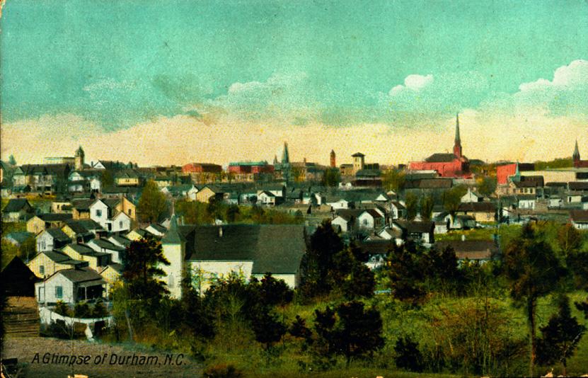
Looking north from the present-day location of Rolling Hills, ~1910. The St. Mark Church is visible in the foreground. Other prominent structures visible in the distance include (left to right) the Trust Building, the Hotel Carrolina, First Baptist Church, Fire Station #1, Union Station, the original Durham County Courthouse, Trinity Methodist, the Lyon Tobacco Co, Pine St. Presbyterian, the Venable Tobacco Company, and First Presbyterian. The street running diagonally from the left foreground to the right background is Pine St. (present day South Roxboro.)
(Courtesy John Schelp)
The St. Mark African Methodist Episcopal (AME) Zion church was founded in February 1890 by Reverend C.H. McIver and members Gaston Bynum, William and Flora Colley, Derbie and Jerry Richmond, Jordan Wilson, and Sarah Marsh in the Colley home, located on Willard Street. By the early 1900s, a frame church was built at Pine and Pickett Streets, the current location (although the street names have changed.)
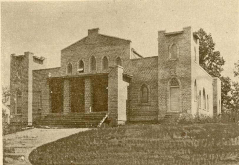
By the 1922, a brick sanctuary had been erected at the current location.
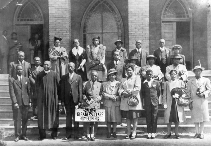
St. Mark's AME Zion, looking east, 1922.
(Courtesy Duke Rare Book and Manuscript Collection / Scanned by Digital Durham)
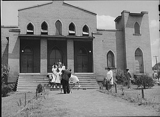
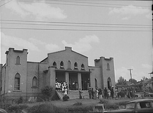
Looking east, 1940.
(Courtesy Library of Congress)
Looking southeast, 1940
(Courtesy Library of Congress)
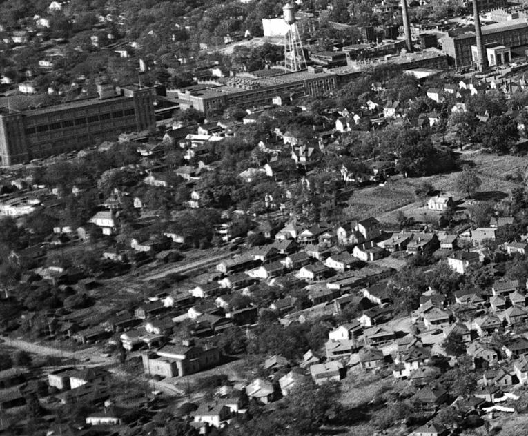
An aerial shot showing the rear of the 1920-1950s structure in the left foreground, with American Tobacco in the background.
(Courtesy The Herald-Sun Newspaper)
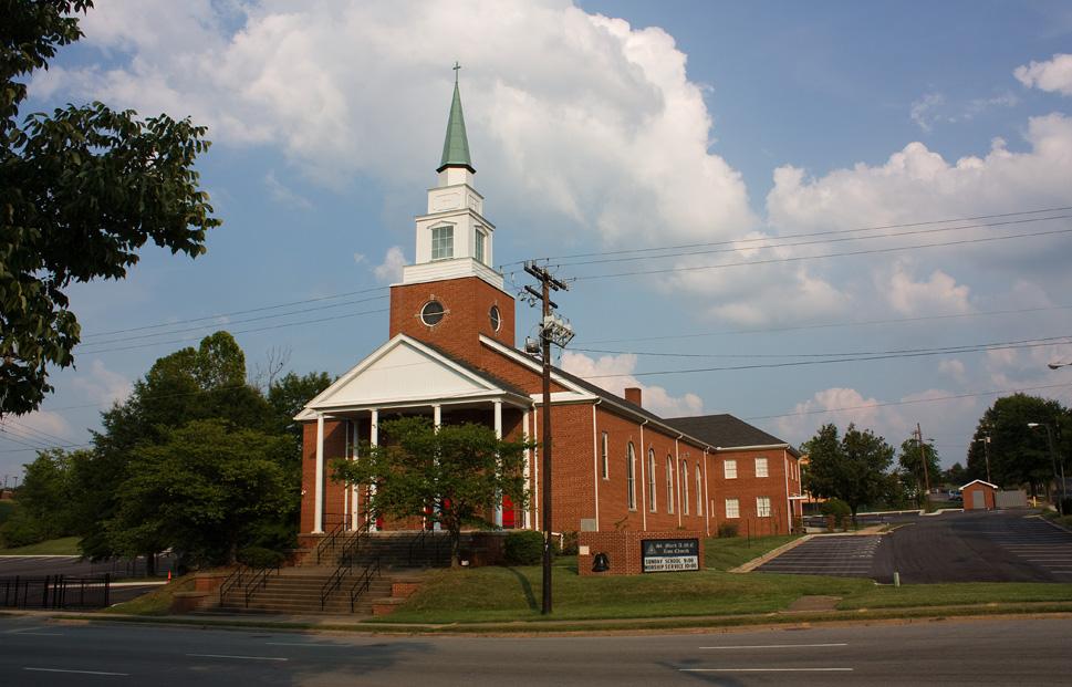
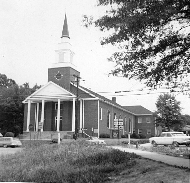
In 1954, this structure was replaced with a new neoclassical sanctuary. A nursery school, kindergarten, and first grade were established in the new facility.
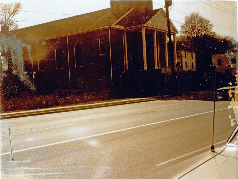
531 S. Roxboro St, 1966.
(Courtesy Durham County Library / North Carolina Collection)
A mid-1960s not-so-great shot, looking south on South Roxboro.
(Courtesy Durham County Library / North Carolina Collection)
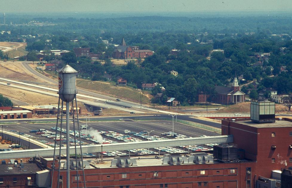
In 1967, the Durham Freeway ('East-West Expressway') was knifed through Durham immediately to the north of this church. By the mid-1970s, all of the surrounding structures of Hayti had been demolished.
Looking southeast at St. Mark's, 1970, in what I think of as a 'missing link' shot - freeway is complete, much of the north side of the freeway has taken on a post-urban renewal form, but many of the structures surrounding the church, including those demolished for the ill-fated Rolling Hills, remain.
(Courtesy The Herald-Sun Newspaper)
The church remains active today, a vibrant, if lonely, remnant of Hayti.
Looking northeast from Lakewood Ave. and South Roxboro St., 08.20.08
Find this spot on a Google Map.
35.988254,-78.90169

Add new comment
Log in or register to post comments.