Support OpenDurham.org
Preserve Durham's History with a Donation to Open Durham Today!
OpenDurham.org is dedicated to preserving and sharing the rich history of our community. Run by our parent nonprofit, Preservation Durham, the site requires routine maintenance and upgrades. We do not ask for support often (and you can check the box to "hide this message" in the future), but today, we're asking you to chip in with a donation toward annual maintenance of the site. Your support allows us to maintain this valuable resource, expand our archives, and keep the history of Durham accessible to everyone.
Every contribution, big or small, makes a difference and makes you a member of Preservation Durham. Help us keep Durham's history alive for future generations.


Comments
Submitted by Anonymous (not verified) on Wed, 6/20/2007 - 3:46am
I just want to say thank you for writing your blog. It makes me sad to see all the new parking lots created. Thanks for creating awareness.
Submitted by Phil (not verified) on Wed, 6/20/2007 - 5:24am
Cool pix. Thanks for posting.
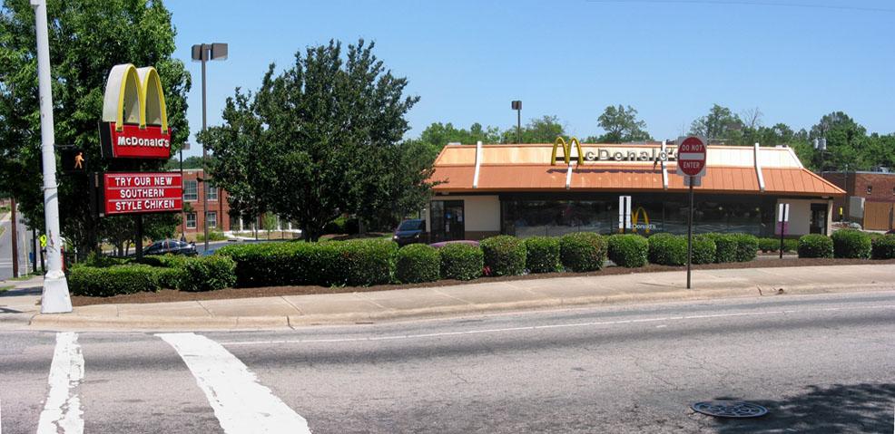
The area around McDonalds really does feel like it must have been something else in the past.
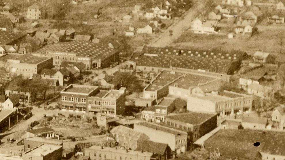
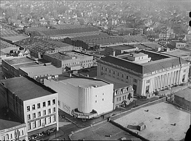
Looking at those monster warehouses in your pictures, I struggle to discern whether I ever saw them in real life (I got here in '83 but didn't start driving until '84, and didn't start exploring until maybe a bit later) or if I only recall seeing the pictures.
Someone once wrote that when we think we're remembering some past event, we're really only recalling our most recent memory of it.
Submitted by Carey (not verified) on Wed, 6/20/2007 - 1:34pm
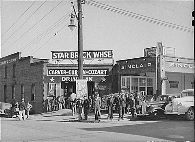
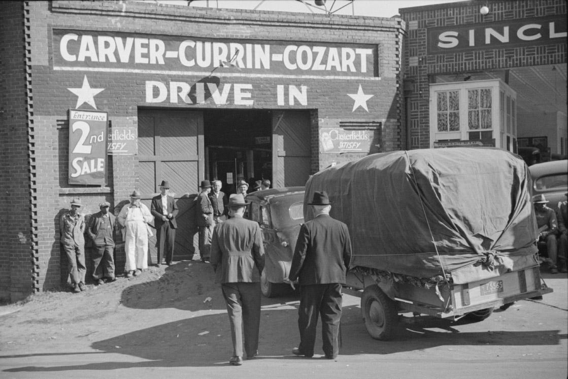
Interesting aerial photo. It looks like Morgan Street actually does "bend" in front of the Star Brick Warehouse. I had always assumed that was created when the loop was built, but I guess it was like that long before our beautiful asphalt moat took shape. It is my understanding that the undoing of the loop is next on the City's list for downtown streetscape improvements, which I'm sure will be quite a lively discussion. I think a lot of the research you have done can come in handy for that discussion, which will hopefully take on the form of a public charrette.
Submitted by Gary (not verified) on Wed, 6/20/2007 - 2:38pm
Anon
Much thanks for the nice comment about the site - I always feel a bit guilty for making people sad, but as you note, the intent is to provide people with context for our future plans/policies, so we can do things that we will (hopefully) be proud of.
Phil
Thanks - there were more warehouses than the Liberty into the late 1980s, for sure, but not this close to Morgan. You would have had to drive up Rigsbee, and it's the kind of thing that's probably hard to appreciate without an aerial shot. Interesting re: memory. I think about this as I walk around downtown - I have a 3D picture in my head of the city sometime in the early 20th century, which I visualize as I walk down the street, seeing a 'memory' of buildings that I never actually saw - and yet I've visualized it so much, it takes on the character of something I've experienced...
Carey
You're right - Morgan curved to restablish a right angle with Mangum, although it 'T'ed into Mangum - the portion between Mangum and Roxboro is the new part. (Although all of it was widened considerably.) I really hope that fixing the loop is a priority. I wish they'd started with that rather than the current project, although I'll concede that returning Main and Chapel Hill to two-way are important for doing anything with the loop. I'd be thrilled if the city/DDI looked at historical photos for inspiration. I think they tend to write them off as nostalgia rather than seeing a design template to work off of.
GK
Submitted by Michael (not verified) on Thu, 6/21/2007 - 5:47pm
As I recall, the city did really want to do the loop as part of the "nearly there now!" streetscape project. Because most of it doubles as US-70, though, that brought in NCDOT, who nixed the idea because traffic counts on the loop were too high to meet their criteria for reverting to two-way.
I'm thinking that some point in the next six months, after Main and Chapel Hill have re-opened, would be a good time to push for a reassessment of those counts. That would be enough time for people to learn how to use the new two-way streets, but before the natural increase in traffic pushes the counts back up.
However it happens, the eastern end of the loop desperately needs radical change, which won't be cheap.
Submitted by Patrick D. (not verified) on Tue, 3/25/2014 - 3:38pm
My grandfather owned an Antique Ford Parts company (Pat Day Company) there on Rigbee & Seminary (where the McDonalds now stands) from the mid-60's until 1980. Trying to locate photos of that corner in that time period. Any chance you or someone reading this has anything? Thanks! --Patrick Day.
Submitted by Marian on Tue, 6/24/2025 - 12:23pm
My father was stationed at Camp Butner at this time. In a letter (dated July 9, 1944) to his parents he wrote of the fire. Here's an excerpt:
"I was in Durham last night and saw the biggest fire I have ever seen. Perhaps you will read of it in the papers. I was in a movie and suddenly someone up in the 2nd Balcony yelled fire and a big commotion started. I immediately thought of the Circus in Hartford and wondered if this was another. I noticed that the balcony was cement though. Well everybody started out in a fairly orderly manner and we got down to the lobby. Well the theatre wasn’t ablaze according to the usher, would we kindly resume our seats? We had just about decided to do just that when someone opened a side fire exit and we saw the biggest mass of flames and smoke imaginable. The flames were higher than a six-story building nearby – A whole square block of wooden warehouses was burning about ½ block from the theatre. We went out and even from that distance it burned our faces. There were three fire trucks pouring two pitifully small streams of water into the mass of blaze… I never knew there were so many people in Durham. The town literally shuts down at 9 o’clock. One is actually very lucky to find a hamburger joint open after that hour. But the place was jammed with staring people – mostly negros. We watched for a while, then went up on the 10th floor of the Washington Duke Hotel and looked down on it. Less than three blocks away. What a fire – then all the electricity in downtown Durham went off. The flames were bright enough to light the town for blocks around but of course, no traffic lights working and from then until I left about midnight there were nothing but excited crowds and traffic jams and over-excited small-town cops in the dark streets. The Camp Butner bus station was in the restricted area so [my buddy] and I saw a bus and ran and followed it until it stopped. There we crawled on -- not in time to get a seat, however -- and came back to camp."
Add new comment
Log in or register to post comments.