Support OpenDurham.org
Preserve Durham's History with a Donation to Open Durham Today!
OpenDurham.org is dedicated to preserving and sharing the rich history of our community. Run by our parent nonprofit, Preservation Durham, the site requires routine maintenance and upgrades. We do not ask for support often (and you can check the box to "hide this message" in the future), but today, we're asking you to chip in with a donation toward annual maintenance of the site. Your support allows us to maintain this valuable resource, expand our archives, and keep the history of Durham accessible to everyone.
Every contribution, big or small, makes a difference and makes you a member of Preservation Durham. Help us keep Durham's history alive for future generations.
Comments
Submitted by Steve Graff (not verified) on Fri, 6/25/2010 - 9:23pm
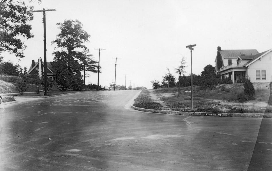
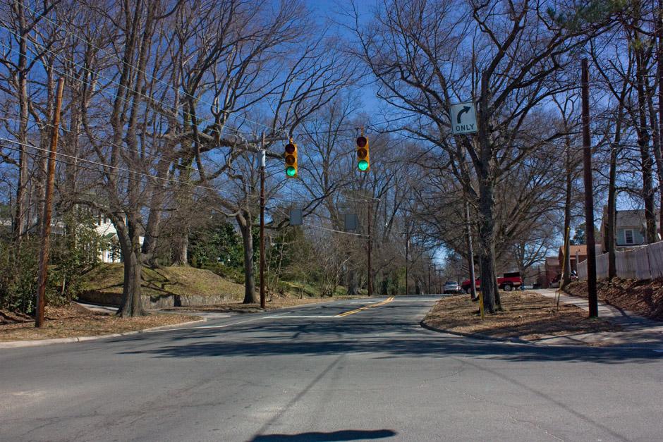
It's interesting to note how much "lower" the granite curbs are today as compared to the old picture. The rising tide of asphalt is overtaking our old curbs.
It would be nice if the next time the city re-surfaces many of our old streets that they scrape them down so that we can once again have effective curbs that channel water towards storm drains, and also act as an impediment to parking up on the curb. There are also places where I can see beautiful old bricks peeking out from under old broken asphalt.
Submitted by David Jeffreys (not verified) on Sat, 6/26/2010 - 1:33am
Also interesting that in 1938 this particular corner hearalded the present street corner signs, though it does still have the name painted on the curb. Whatever happened to those beautiful vertical obelisks at the street corners with the names on them? That was a nice touch and I think they are all gone. Does anyone have an obelisk remaining on their street corner?
Submitted by D N (not verified) on Sat, 6/26/2010 - 3:30am
David: Gary has written about those signposts before, so he can correct me if he's wrong, but I believe the last known one is at Gordon/Yancey near 147/Chapel Hill St.
Add new comment
Log in or register to post comments.