Crest Street

Hickstown derived its name from Hawkins Hicks, who lived on Mulberry Street (the western extension of West Main Street beyond Ninth St.) Hicks arrived at ownership of the property in 1863 after her common-law husband Jefferson Browning left all of his property to their three sons: James, Payton, and Dudley. Hicks sued, and was awarded ownership of the land (not sure how her sons felt about that.)

Although Hicks was the primary landowner, and white, the settlers of the community were primarily African-American. The impetus for initial settlement in this area is unclear, although given the topography, we can surmise that the land was cheap and available to African-Americans due to its relative undesirability - as occurred in Brookstown, the western portion of Hayti, the Bottoms, and Smoky Hollow. This community coalesced around the New Bethel Baptist Church, organized by Rev. John Scales, in 1879; the church had formed out of a Sunday School established in the area in 1877 in the home of Rebecca Lyon. The church was initially located just to the south of where the West Durham Lumber Company was later established, on land donated by Jerry Walker.

Hickstown was incorporated in 1887 - which seemed to be, primarily, a response to prohibition in the city of Durham, enacted that same year. As it goes with vice, displacement occurred from the city proper, but settled at its fringes - Smoky Hollow (an outgrowth of the former vice haven Prattsburg) to the east, and Hickstown to the west (a bit further to the west than another one-time Pratt libation location, Pinhook.) Part of Durham's rowdy reputation - the one that scared Meredith College to Raleigh, rested on its downtown taverns - Carrington's, on the corner of Peabody and Mangum St. and Mangum's Tavern, on the northeast corner of Mangum and Main Sts., were two that relocated to Hickstown after the Drying of Durham.

This engendered a good bit of consternation from the more well-to-do members of the West Durham community, who lived on the high ground between ~Anderson St., Erwin Road, and the railroad tracks (along Erwin and West Pettigrew) - an area known as Caswell Heights. Pharmacist Richard Blacknall, JW Brooks, and JW Swift protested the incorporation of Hickstown to the state legislature.

The community continued to grow because/in spite of this, depending on your perspective. The establishment of Erwin Mills on the north side of the railroad tracks, to the east-northeast of Hickstown, in 1892-3 provided a nearby source of employment, although given Erwin's reputation as an abstemious sort who would fire those arrested for public intoxication, I wonder how he felt about hiring residents of Hickstown. Several streets were named for the circuses that visited nearby (Barnum, Bailey, Ringling,) encamped west of the city limits and north of the railroad tracks (around the location of the shopping center on the south side of Hillsborough Road, west of Lasalle St.)

In 1921, a frame schoolhouse built on Crest St., evidently on the site of a previous, undersized schoolhouse of undetermined age. The school was built at least in part with Rosenwald funds, and called the Hickstown School. It replaced an earlier school on the same site that had become overcrowded. In the late 1920s , the New Bethel Baptist Church moved from its original location to land purchased from JK Mason on Crest Street just to the east of the school. The proximity and growth of the West Durham Lumber Company adjacent to the original site was one impetus for that move.

Per the 1980 Durham Historic Inventory:


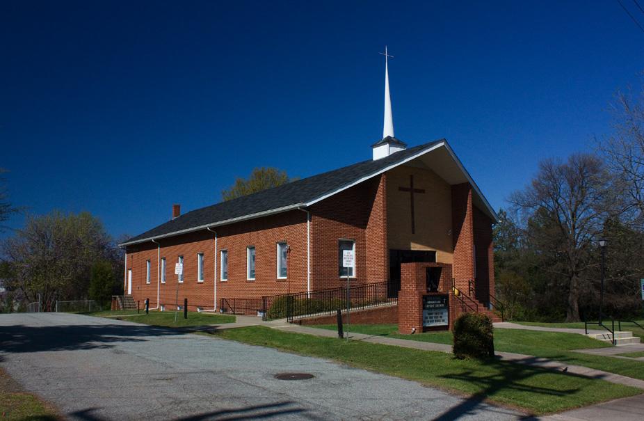
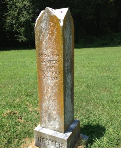
Characteristic of the history of most neigh- borhoods, Crest Street's traditional focus was its institutions - church, school, and, to a lesser extent, the neighborhood markets. In 1879, Rev. John Scales organized the New Bethel Baptist Church in response to the heavy attendance by area children at the Sunday School that had been founded a short time before by Rebecca Lyons. Shortly thereafter, the congregation built a one-story frame church on the edge of the property occupied by West Durham Lumber Company. As the lumber plant expanded in the 1920s, its proximity prompted the New Bethel congregation to erect a second church on Crest St. This frame building, marked by corner towers on the main facade, was replaced in 1964 with the brick church that stands on the Crest St. site today. On Crest St. a couple of blocks west of the church, an extensive church cemetery, now overgrown, is filled with markers that reflect the long history of New Bethel Baptist Church.

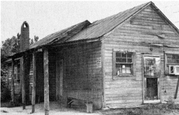
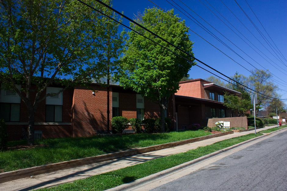
The neighborhood school and markets did not prosper as did the church. In 1921, a one- story frame building, named Hickstown Public School, was built one block west of the New Bethel Baptist Church, apparently replacing an earlier school building on the site that could no' longer accommodate its growing enrollment. In the 1960s, the-1921 frame building was replaced with the brick building named Crest Street School that occupies the site today. As a result of shift- ing school age populations throughout Durham and changes in school assignments prompted by public school integration, the newest neighbor- hood school ceased to be used by the Durham School System a few years after it was built. Subsequently, it was sold to Duke University which uses it today as a warehouse.s Neighbor- hood markets have fared a bit better than the school. Nunn's Store, at 2309 Crest St., one of a few small groceries that have operated in Crest Street over the years, continues to serve the neighborhood. This very simple one-story gable- roofed frame building also continues as a popular neighborhood gathering spot.


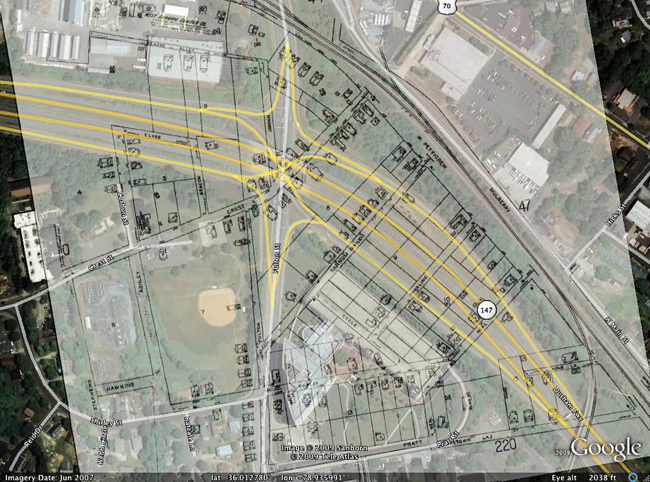
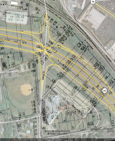
An overlay map of Hickstown in 1937 atop 2007 satellite imagery.


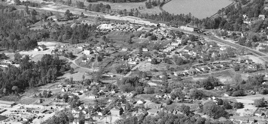
Bird's eye view of Hickstown, looking northeast, mid-1950s.
(Courtesy The Herald-Sun Newspaper)

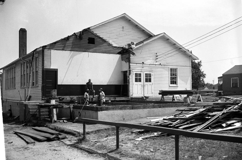
Hickstown School was demolished and replaced with a new Hickstown School in 1957.


Hickstown School being demolished, 06.22.56
(Courtesy The Herald-Sun Newspaper)


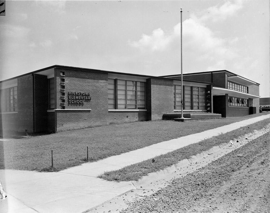
The replacement Hickstown School - Hickstown Elementary, late 1950s.
(Courtesy The Herald-Sun Newspaper)

From 1959, the pathway of the Durham Freeway was set by the NCDOT and an exuberant Durham business community. From RTP, this highway would run northwest - mostly following the northwest-southeast transportation ridgeline that had defined Durham, via the Hillborough-Raleigh Road and the North Carolina railroad. The right-of-way would swing southward as it approached downtown to avoid large industrial sites such as the former Durham Cotton Manufacturing Company, American Tobacco, and Liggett and Myers. Once downtown, the freeway would swing northward again to follow the line of the railroad right-of-way to the Highway 70 bypass/15-501 bypass on the west side of Durham.

The Hickstown School was shuttered by the mid-1960s - I don't know if this was in anticipation of the Freeway or not, but I have to suspect so. The New Bethel Baptist Church, though, replaced its frame structure on Crest Street with a brick structure in 1964.

The freeway was constructed as far as West Chapel Hill Street by 1969, where it was oriented north-south before it would make its turn to the northwest by the time it reached Swift Avenue. This completed the initial phase of the project, and for several years, the southeast-bound freeway was accessed from West Chapel Hill St.

The pause in construction occurred in a different climate than when the freeway began. Only the booster-y types still were spreading the sunshine about what a great place Durham was becoming through urban renewal and highway-izing. The national climate had changed as well; the passage of landmark environmental legislation in the late 1960s-1970 created some counterbalance to the dreams of the pave-everything crowd. Notably, NEPA, the National Environmental Policy Act of 1970, would require that an Environmental Impact Statement be completed for great earth-moving projects such as the Durham Freeway.

NCDOT and the Federal Highway Administration (FHWA) took the position, predictably, that an EIS was not required for the remainder of the Durham Freeway, as it had been on the books since long before the passage of NEPA. Hickstown residents, primarily affiliated with the New Bethel Baptist Church worked in conjunction with ECOS, a group of Duke University students opposed to the extension of the freeway, to obtain a court order in 1973 that required FHWA and NCDOT to prepare an EIS for the remainder of the Durham Freeway. It appears that it was during this time that the neighborhood became more identified by "Crest Street" - the location of the New Bethel Baptist Church - than Hickstown.

The freeway construction through Hickstown/Crest St. became a galvanizing moment that would become the genesis of several still extant organizations. My understanding is that the People's Alliance grew out of the Crest St. fight, and that Steve Schewel founded The Independent during and subsequent to his involvement in the fight for the neighborhood while at Duke. (Someone please correct me if I'm wrong about these repeated anecdotes.)

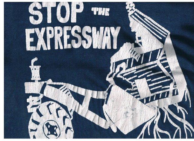
The work of these community groups with the neighborhood helped forge a coalition that could stand up to the foregone conclusions of NCDOT and the business community. The People's Alliance printed "Stop the Expressway" T-Shirts which helped to fund the opposition.


Image courtesy John Schelp / designed by Brown (Griffith) Little.

The initial plan for the neighborhood called for provision of housing relocation funds to the residents; i.e., residents are given funds with which to move somewhere else. This plan was actively opposed by the neighborhood. In 1977, the neighborhood received legal aid from the North-Central Legal Assistance Program. These attorneys filed a Title VI administrative complaint with the United States DOT attesting that the planning of the route of NC147 was racially discriminatory. The USDOT Office of Civil Rights concurred in 1980.

The neighborhood subsequently was able to retain a traffic engineer to present counter-arguments to those proffered by NCDOT, and in 1978, a group of Duke students conducted a sociological survey which documented the highly cohesive nature of the community, a survey which was validated with follow-up studies in 1980.


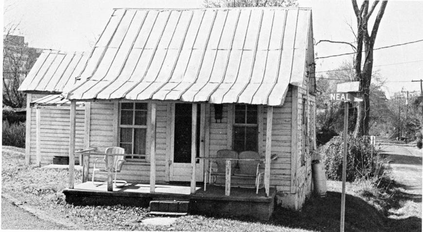
Corner of Neal and Shirley Streets, 1979.

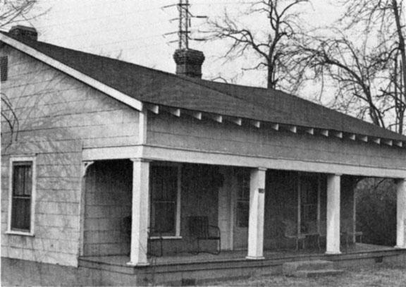
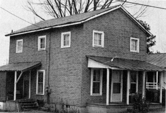
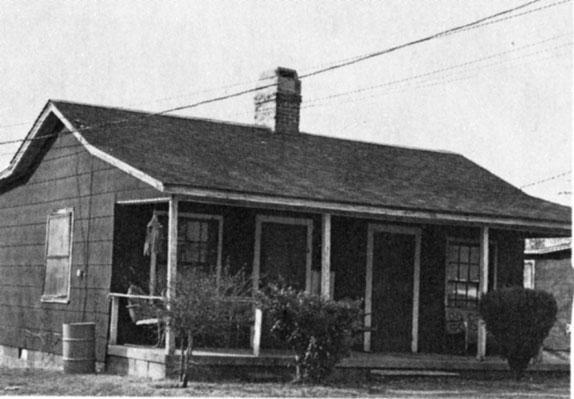
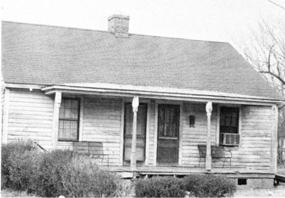
A representative sample of houses in 1979:


106 Neal St.

2401 West Pettigrew
 

306 Fulton St.

201 Beacon St.

Nunn's Store - Crest St.

2302 Crest St.


At this point, NCDOT began to acknowledge that there might be alternative viewpoints to their own that held a modicum of validity. In concert with Washington DC representatives from FHWA, a collaborative process between stakeholders was outlined to plan subsequent steps. Per a case study of the process:

"Objectives and structure were established, including a technical operating committee (the "Task Force") composed of representatives from the Crest Street Community Council and the principal public agencies and private organizations involved in the project, including FHWA; and a Steering Committee composed of Task Force members, top government officials, and private interest groups. Although the process was interrupted for 11 months to resolve a zoning dispute in the Crest Street neighborhood, the basic structure help up and resulted in completion of a comprehensive mitigation and enhancement plan in 1982."

This plan involved the relocation of the entire neighborhood, except for the New Bethel Church, and the former Hickstown School, which would become the WI Patterson Community Center. The entire New Bethel cemetery, located to the west of the church, was disinterred and reinterred in New Bethel Memorial Gardens, 2619 West Pettigrew Street; Glenview Cemetery at intersection of NC 55 and Riddle Road; and Beechwood Cemetery at intersection of Fayetteville Street and Cornwallis Road. The case study notes that this was necessary in part because the City of Durham rezoned part of the target land during the process to allow a health club (the later Metrosport) to be constructed, reducing that available for relocation.

Prior to relocation, 22% of dwelling units were owner-occupied. Sixty-Five houses were moved from their existing locations to open land to the southwest, and multiple new single family and apartment units were constructed. At project completion, 56% were owner-occupied.

Per the case study:

"The Federal 'housing-of-last-resort' provision of the Uniform Relocation and Real Property Acquisition Policies Act of 1970 provided the flexibility FHWA needed to commit Federal funds to construct replacement dwellings for the new community configuration. However, because the State of North Carolina had not previously enacted legislation commensurate with the Federal Act (including housing of last resort), an act of the North Carolina Legislature was required to make State matching funds available. The community successfully argued that replacement housing should be provided as a means of preserving the family relationships and social fabric of the Crest Street neighborhood. This reasoning permitted the neighborhood to be treated as a whole and enabled some Crest Street residents outside the highway footprint to be included as part of the mitigation. In addition, based on 23 U.S.C. 109(h) of the 1970 Federal-aid Highway Act, Title VI of the Civil Rights Act of 1964, and NEPA, FHWA is required to consider fully not only the direct impacts but also secondary and cumulative impacts of proposed Federal-aid highway projects. This further buttressed the idea that the entire Crest Street neighborhood, not just that portion of it within the project footprint, should be included in the mitigation and enhancement plan."

Here is how the Durham Historic Inventory described the pre-relocated neighborhood in 1980:


Most of the houses in the sparsely settled Crest Street neighborhood are basic types which reflect their early occupancy by farmers and laborers: The oldest surving houses, apparently dating from around the turn of this century, are all one story and very simple in design. A rela- tively substantial early example at 2224 Pratt St. isset back in its large lot; it has a triple-A roof and decorative shingles in the front gable. The three- room shotgun house at 201 Corbun St. and the very tiny houses at 202 and 203 Neal St. are more typical of Crest Street's earliest development.

The majority of Crest Street housing traditionally has been rental, often owned by absentee landlords. The Neal St. houses, however, were built as rental property by long-time neighbor- hood resident Tom Bynum. Although most of Crest Street's working population were employed in Durham's tobacco factories, a few earned a liv- ing as contractors, locally and throughout Dur- ham. Bynum is said to have built several houses in Crest Street; whether all were his invest- ments or some were on contract is not known. Another resident, a Mr. Lyon, worked as a con- tractor throughout Durham.

From the 1910s to the 1930s, stylishness was introduced to Crest Street's housing in the form of bungalows. Owner-occupied houses tended to exhibit careful, if restrained, detailing. Several, such as the Pierce House at 310 Bass St., show the full complement of the basic bungalow features of triangle brackets in deeply overhang- ing eaves and box pylons on brick plinths sup- porting an engaged full facade porch. Others are simpler in overall form, yet are ornamented with such fanciful features as decoratively sawn shingles, as seen in the house at 2309 Shirley St. Some houses, built as rental prop- erty, also were erected in rows of identical design as exhibited in the 300 block of Fulton St. Many of these structures are duplexes, the one- story gable-front form being the most popular; most are not at all embellished. An exception is th duplex at 118 Jordan St. which has decorative leaded windows on its main facade which reflect the practice popular in Durham of using salvaged materials in new construction.

Today, Crest Street is a neighborhood in transition. Certain aspects, such as its rural character, a housing stock comprised primarily of rental units, and the modest income of its residents, remain constant. The interest of resi- dents in their community is evident in the care they give their buildings and yards. There are many young and elderly people here, but there is little crime. Crest Street's labor force no longer works mainly for the tobacco industry, but for nearby Burlington Industries, the Veterans Ad- ministration Hospital, and Duke Medical Cen- ter. The Veterans Administration Hospital, tow- ering above the southwestern edge of Crest Street, forms a stark contrast to the neighbor- hood's village-like atmosphere. Duke University and its Medical Center, Crest Street's biggest employer, is expanding, and in fact owns a great deal of the land in the neighborhood. The great- est threat perceived by Crest Street residents is destruction of the character of their community and the displacement of its residents that could result from private development of absentee landowners and from the completion of the East-West Expressway. When completed, the Expressway will cross the northern edge of the neighborhood, necessitating the removal of several buildings. 


"Several" was clearly an understatement in the ever-restrained DHAI. The reinvented Crest Street neighborhood feels a bit like a place apart today, at least to my perception. Given its easy-to-overlook entrance off of Fulton St. or Douglas St., many folks in Durham likely don't even know that the neighborhood exists.

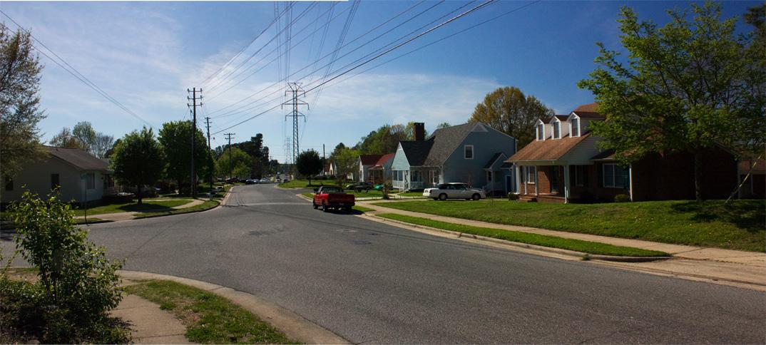
I struggle a bit with how to feel about what has transpired with Hickstown/Crest St. Certainly, it's the best outcome that could have happened with the Freeway a foregone conclusion. Should it be bothersome that the neighborhood feels more like an aging 1980s era subdivision, complete with tons of vinyl and cul-de-sacs, rather than a community that dates to 1887? Or is this just my aesthetic and regret, when in reality, most of the existing housing stock in 1980 was in poor condition and the roads were dirt. Could more of the houses been moved and renovated sensitively, rather than vinyl-ized? But is the latter exactly, I would suspect, what the residents wanted?


New Bethel Baptist Church, at the former corner of Ashley St. and Crest St., 04.12.09


The former Hickstown School, now the Community Center, 04.12.09


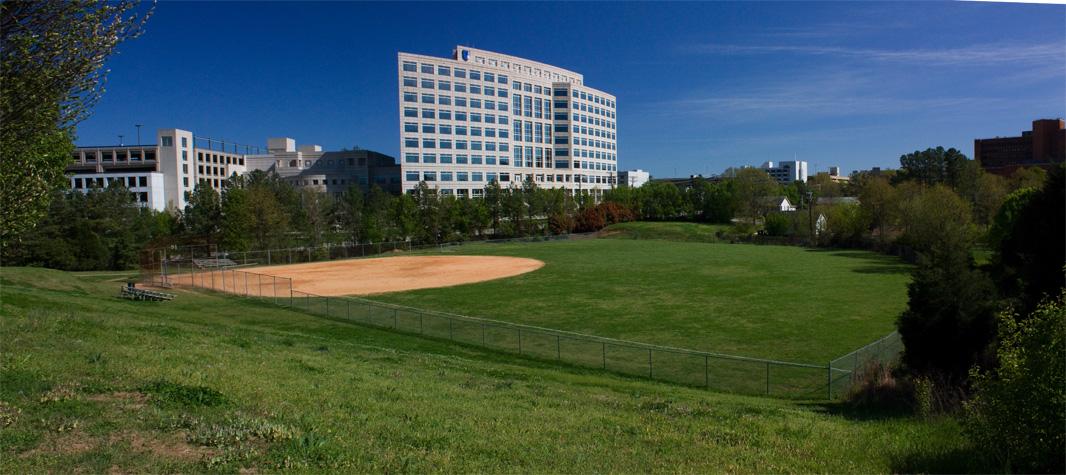
Part of Crest St. Park, looking southeast from near New Bethel Baptist. This vista - the baseball diamond ringed by large buildings oddly gives me the sense of a more urban setting than I usually feel in Durham.


The mid-80s vintage neighborhood, looking west on Crest St., 04.12.09

It nags me, but I have to simply return to how incredibly difficult it is to move NCDOT away from a stupid plan. The immense work and legal action invoked by the community and allies just to get NCDOT to do the basic, right thing is astounding. Despite the number of times this example has been written up, I don't think the culture of NCDOT has changed markedly since then. The burden is still on the community to prove why NCDOT's plans are wrong-headed. The community's victory in this case is depressingly impressive - because it simply should not have been this hard.