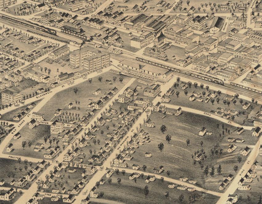
McMannen Street was one of the very early developments of larger homes in Durham. Much like Morris Street to the north of downtown, it seems that it was never an identifiable neighborhood, per se, but a distinct development from the later Morehead Hills to its west and Hayti to its east. While the street aligned with Mangum St. to the north, it did not cross the railroad tracks. (which is why S. Roxboro used to be Pine St. and Blackwell retains its separate name from Corcoran.)
McMannen Street was one of a series of real estate ventures by John McMannen. Before there was Greenfire, Scientific Properties, etc., there was John McMannen. McMannen appears to have been quite the character in early Durham history - a singularly determined entrepreneur. A lay preacher in the Methodist Church, McMannen first struck it rich by commissioning engravings of the "pilgrimages through life of the sinner and the Christian" and selling them. McMannen used the money earned (the engravings did quite well) to purchase the patent for a 'Smut and Screening' machine that separated diseased grain from healthy grain. He sold this through newspaper ads in 1854, and began manufacturing them at the Leathers Mill in South Lowell (in northern Durham County, west of Bahama.)
McMannen was among the very first, aside perhaps from Durham himself, to see the potential of Durham as town/city after the establishment of the railroad. He bought land from Bartlett Durham south of the the railroad tracks, and ran a newspaper ad entitled "Proposal for Building a Town." He proposed selling half-acre lots to the well-to-do. However, he also prohibited 'ardent spirits' in the development, which sunk his venture.
He lost much of his money, his land in South Lowell, and the land (on which he had made only a down-payment) from Durham. However, DC Parrish, his close friend, came to his aid, and helped secure new property south of the railroad tracks. This property would become McMannen Street, and was a success. The McMannens built their own house (called 'The Heights') at the highest point of land, next to the tracks, in 1860. No pictures of this house survive. It is an interesting pattern to note that many of the early inhabitants of Durham came from northern Durham county - Red Mountain (Rougemont), South Lowell, Orange Factory - which is where most of the significant mercantile / manufacturing activity was before the railroad.
By the 1890s, McMannen, South, and Red Cross Streets were fully developed with early housing:
(Courtesy Duke Archives)
McMannen became quite involved in local government - and seemed to wax and wane between success and failure for the remainder of his life.
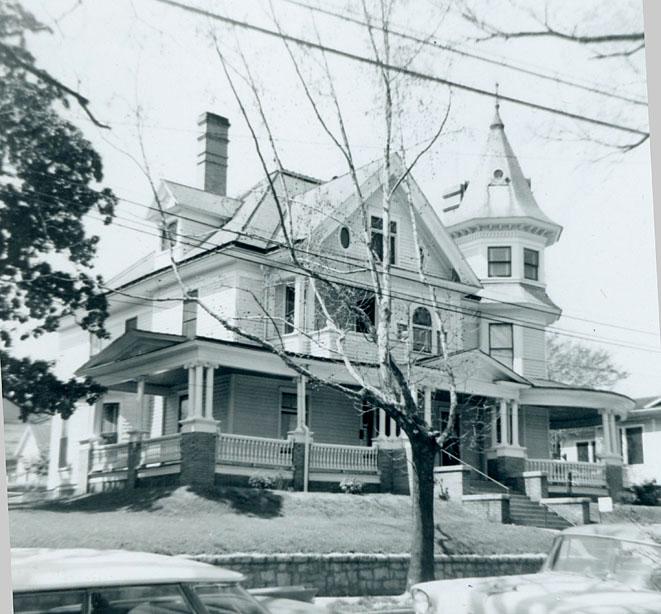
Like housing in the East End and West End, many of the simpler structures were replaced with larger, more ornate structures
412 McMannen (South Mangum) St.
(Courtesy Durham County Library)
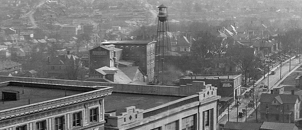
Looking south from ~Main St., you can see the tower of the above structure just beyond the Austin-Heaton Company water tower. The more visible street, to the right (west) of that structure is South St., which once ran north to Pettigrew (between McMannen and Blackwell) but very early on was terminated at Vivian after the construction of the railroad depot between Vivian and Pettigrew.
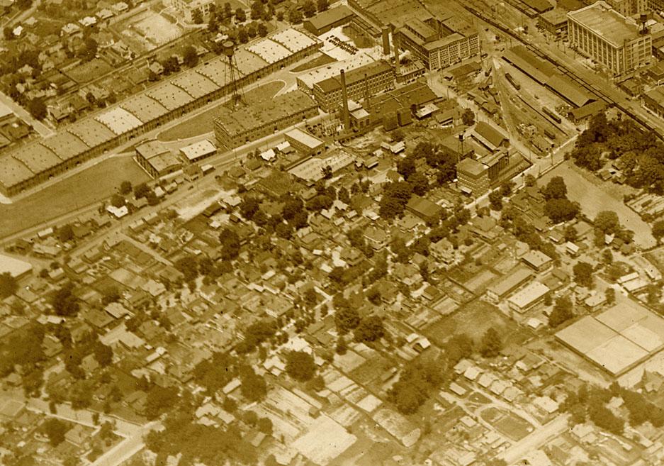
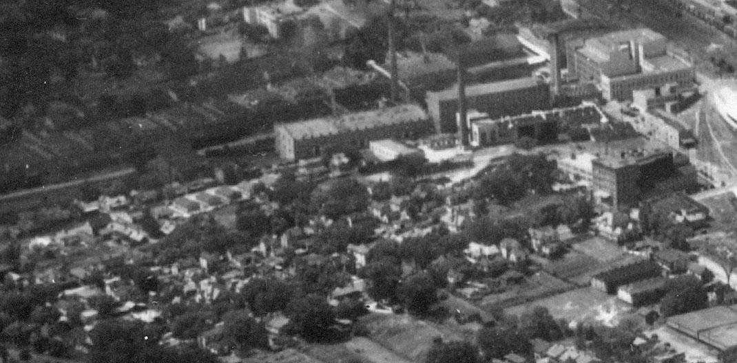
A view of the area ~1930. The American Tobacco Co. is to the west - Red Cross, South, McMannen, and Pine are the visible north-south streets to the east of the factory.
(Courtesy Duke Archives)
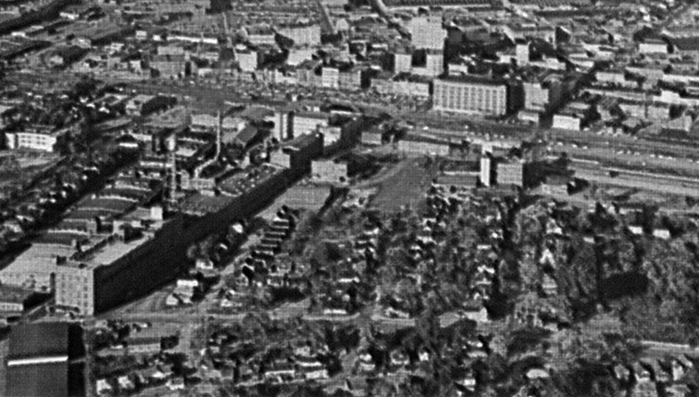
A closer view, looking east, 1940. McMannen St. is the first residential street in the foreground.
(Courtesy Durham County Library)
The picture below is from the late 1950s/early 1960s. The quality isn't good, but the perspective, looking directly up the N-S streets, is unique. Proctor St. is the E-W street in the foreground.
Every residential structure in the above pictures was torn down either through urban renewal or construction of the Durham Freeway. People often mention the Durham Freeway to me in relation to Hayti; there is no doubt that the Durham Freeway caused major damage to Hayti and other neighborhoods (an left a permanent barrier.) But of the two 'forces', urban renewal was far more destructive, and destroyed far more housing.
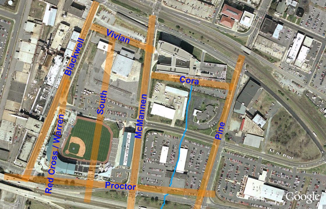
I'll be profiling the individual blocks of McMannen St. over the next few weekdays, below, I've made a basic map to show the original street names/configuration. My squiggly blue line is the original stream that ran between McMannen and Pine, to give you a sense of the natural topography (older +/- more affluent housing was typically along the higher ground - McMannen and Fayetteville were the two major north-south 'ridges' that extended south of downtown.)
~2005.
Comments
Submitted by Andrew (not verified) on Thu, 6/14/2007 - 5:00pm
Gary, do you know on which side of McMannen he built his home? How far back from the tracks do you think it was?
--ASE.
Add new comment
Log in or register to post comments.