Cleveland-Holloway

The Holloway Street District stands as a vestige of Durham's most fashionable late nineteenth-century neighborhood, originally known as the Dillard Street neighborhood. Focused initially along E. Main, Liberty, Dillard and Queen streets at the east end of the downtown area, the neighborhood has been recalled consistently through the decades as the greatest concentration of Durham's finest and most architecturally distinct homes of their day. It was Durham's most striking early residential manifestation of the tobacco boom that began after the Civil War and steadily escalated. By the early 1870s, the tobacconists and the other businessmen and professionals benefitting from the rapid expansion of the city's industrial base were exhibiting their recently acquired wealth by constructing new houses, often substantial and elaborately decorated, at the edge of the business district, con- venient to their places of employment. Dillard Street, also known as "Mansion Row," was the heart of the neighborhood, distinguished in the 1870s by such opulent dwellings as the Second Empire house Capt. E. J. Parrish built for himself and Julian S. Carr's Waverly Honor. Through the 1880s and 1890s, stylish houses, frequently replacing humbler or outmoded dwellings, were added to the earliest part of the neighborhood, which was beginning to expand along Holloway Street, also developed by pioneering Durham families.

"Gray's New Map of Durham" reveals that by 1881 houses occupied most of the lots on Dillard Street and the 300 and 400 blocks of E. Main and Liberty streets, as well as those on Roxboro and Queen streets (then named Second and Third streets, respectively) south of Liberty Street. At that time, the stretch of Holloway Street included in the Holloway Street District began at the east corporate line, at the north end of Dillard Street. Originally named the New Wake County Road, in the 1890s it was known as O'Briant Road and "the brickyard road" in reference to Calvin O'Briant who operated a brickyard on his vast tract of land east of the Norfolk and Western Railroad tracks. Some time in the 1890s, Holloway Street in the heart of the downtown area was extended east to connect with O'Briant Road and the entire street was officially named Holloway Street.

Gray's map shows that William Mangum owned a large tract north of Liberty Street beginning at the east end of the original block of Holloway Street and extending east along the north side of O'Briant Road for a short distance. The May family's farmland north and east of Mangum's land reached from the east side of Cleveland Street to the north stide of O"briant Road, almost to the railroad tracks. In 1886, the May family divided this huge tract into four lots, two of which encompassed most of the Holloway Street District north of Holloway Street. Except for lots along Dillard Street, all of the land in the Holloway Street District south of Holloway Street was owned by James A. Ferrell and his sister, Lucy.

As the tobacco industry prospered and Durham's population grew and diversified, the demand for housing increased. In response, the owners of undeveloped property at the edges of the established residential neighborhoods began subdividing their land into building lots. Naturally, the more elevated and level terrain traversed by the long-established roadways, including Holloway Street, was the most appealing to individuals seeking lots on which to built their own houses or stylish houses for speculative resale.

In the Holloway Street District, quite a few lots were bought and sold and several developed during the 1880s. The Bird's-Eye View shows only two houses on the north side of Holloway Street. One is a small one-story house later replaced by the Holloway House at 517. A 1903 plat reveals that the other house, the Suitt-Whitley House at 525 Holloway, was built at the south edge of Lot No. 3 of the May land allotted to Martha May in 1886. The Bird's-Eye View also shows the south side of the street, where James A. Ferrell and his sister had begun selling lots in the 1880s. A. K. Umstead purchased a parcel at the west end of the district from them in 1885. In 1888, the Ferrells sold the adjoining tract, today 514 and 516 Holloway, to Frank Puryear. During the remaining years of the century, they sold a few other parcels in the district and retained the rest for their own and their family's use. A. K. Umstead's house (at 504 Holloway, destroyed) and the house built by Frank Puryear, now known as the Noell House at 514, are included in the 1891 rendering. The two-story, one-room-deep house east of the Noell House mast be the old Ferrell homeplace referenced in several 1890s deeds for adjoining15roperty, which probably was built by Simon Ferrell upon buying the property in 1869. Around the corner, Dillard Street is shown lined with houses, almost all of them recorded ten years earlier on Gray's Map.

The individuals building houses for themselves in the district during the 1880s and 1890s were among the industrialists, merchants, and professionals whose successes produced Durham's booming real estate market. Frank Puryear remains an elusive figure, but A. K. Umstead was a well-known, prosperous tobacconist; his thriving warehouse business was located nearby at the corner of Holloway and Roxboro Streets.

The residential real estate market remained strong at the north and northeast edges of downtown Durham throughout the late 1890s to around 1910, the period in which the majority of the houses in the district were constructed. In fact, several of tlrlose, vklo built :or purchased houses for themselves here were active real estate investors. A farmer by vocation, James A. Ferrell extended his role in the development of the Holloway Street District beyond the subdivision and sale of his land for the con- struction of houses. Ferrell reportedly built the Ferrell-Pollard House at 606 Holloway in the 1890s for an adopted son named Jimmy Hopkins, to whom the Ferrellssold the property in 1894. 12 Also, in the 1890s, James A. Ferrell built the Ferrell-Moore House at 602 Holloway for himself and his wife and daughter. After his daughter, Lottie, married Marvin B. Moore in 1903, Ferrell moved the old family homeplace to 610 Holloway (where he is believed to have sold it) in order to buil13the Moore- Umstead House for them at 520 Holloway, the original homeplace site. The vernacular Italianate house that was moved is believed to have been the oldest structure in the district; deteriorated but intact, it was destroyed by an arsonist in February 1984 as this nomination was being prepared.

Other pioneering Durham families rivalled the Ferrells in their development activities in the district. William Mangum had Creighton Hall at 513 Holloway built for his daughter and son-in-law Lizzie and James N. Umstead, in the late 1890s and deeded it to them in 1902. The house lot was at the southeast edge of Mangum's huge tract; most of the tract remained undeveloped until after Mangum's 15 death in 1906 when it was platted into 81 lots and apportioned among his six heirs. Over the next few years, Lizzie Umstead sold her thirteen lots just north of the district individually for private development. Later her son, James N. Umstead, Jr., pursued real estate investment as a career. Adjoining the Creighton Hall property, Robert M. Jones, partner in the Markham-Jones Feed and Grocery, bought a parcel of building lots on the north side of Holloway that had been part of the Martha May tract. In addition to building his own house on the parcel, at 521 Holloway, in the early 1900s he built the neighboring houses at 517, 523, and 527, and probably also built 519 and 525.

Altogether, the early occupants of the district represented a wide variety of occupations and interests, of which real estate was just one. The four Pollard brothers who ran Pollard Brothers Hardware, Waverly Ice Cream Company, and Pollard & Pollard Stables lived in the 500 and 600 blocks; grocer James H. Burns lived at 702; M. Donald Bright, partner in the Pritchard and Bright downtown clothing store, resided at 527; and Edward C. Perry, owner of Langley & Perry, Pianos and Organs, made 609
his home. On Dillard Street, C. C. Thomas, founder of the Thomas and Howard Company, wholesale grocery business, replaced an early house with an imposing Colonial Revival style house in 1909. Among the financiers residing on Holloway were John R. Holloway, secretary and treasurer of the North Carolina Joint Stock Land Bank, at 517; Alonzo P. Carlton, president of the Durham Insurance Services Company, at 519; and Fidelity Bank cashier, L. D. Kirkland, who built the house at 516 Holloway.

A few early occupants of the district were industry executives and professionals and one was an academician. One of Durham's most illustrious citizens, Edward C. Hackney, a mayor, county attorney, and newspaper editor, bought the White-Hackney- Markham House on Dillard Street shortly after it was built at the turn of the century; later, his daughter and her husband, Charles O Markham, professor of mathematics and treasurer of Duke University, lived here. Henry Wilkerson and Paul E. Crews, two executives with the Golden Belt Manufacturing Company, built their houses next door to each other on Holloway shortly after their employer opened its new textile factory a few blocks away in 1902.  Paul Noell, general manager of the American Tobaccco Company leaf department, lived at 514 Holloway for more than fifty years. The house next door was owned and occupied by attorney R. Percy Reade from 1909 until his death in 1960. It is interesting to note that Reade and Noell, as well as Marvin B. Moore, who married James A. Ferrell's daughter, all moved to Durham from productive tobacco farms at Mt. Tirzah in neighboring Person County. Furthermore, they or their spouses (Noell and Reade were brothers-in-law) were descendants of Col. Stephen Moore, Revolutionary War soldier and owner of West Point, New York, which he sold to the federal government in 1790 after his move to Person County.

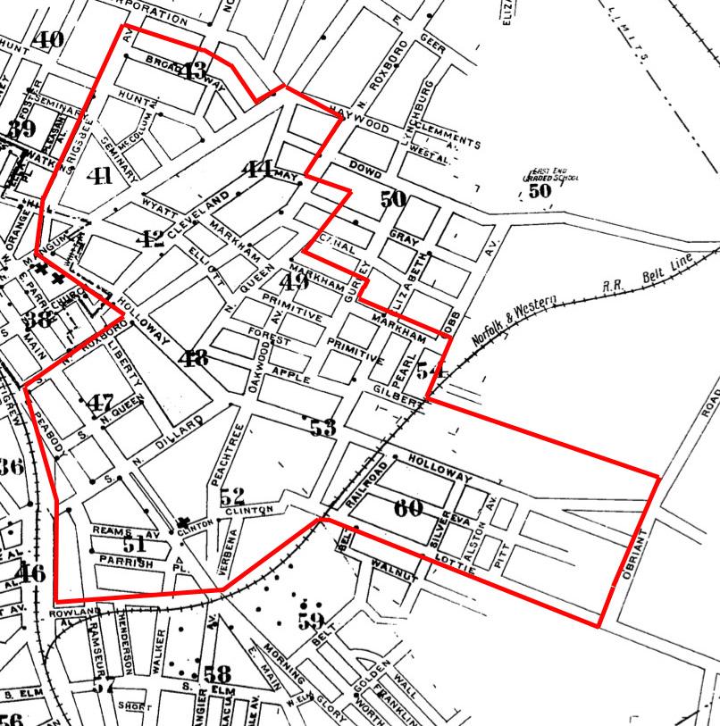
CH_1913.jpg

(Above, rough extent of the neighborhood by 1913 - much of the peripheral areas were still sparsely developed, and the area around Peachtree Alley and Clinton, although contiguous, was an African-American enclave of small houses. Note the distinct separation between this area of development and the well-circumscribed Golden Belt mill village at the bottom. Lottie Street would later become Liberty Street.)

By around 1920, the district was fully developed. Prosperous Durhamites desiring to construct their own houses had to look for building lots elsewhere, usually in the new streetcar and automobile suburbs. By the early 1910s, the streetcar suburb of Morehead Hill, characterized by new architect-designed houses, had become Durham's most prestigious neighborhood, in turn supplanted in the 1920s by Forest Hills and Hope Valley. Nevertheless, the Holloway Street District retained much of its cachet for many years. Although some of the early residents chose to move to the more modern and stylish suburbs removed from the increasingly congested downtown area, many--such as the Noells, Reades, Wilkersons and Joneses--remained lifetime residents.

After World War II, the district began to show signs of decline. Some of the large houses were divided into apartments by resident owners who found it difficult to maintain them as single-family dwellings; others were converted to investment property as part of estate settlements. The expanding downtown began to erode the older edges of the neighborhood, and, in the 1960s, Urban Renewal wiped out almost all of the original part of the neighborhood dating from the 1870s. As nearby houses fell under the wrecking ball, the Markhams successfully fought con- demnation of their property at 204 and 206 Dillard Street. Although the portion of Holloway Street included in the district was spared, many of the houses con- tinued to deteriorate, particularly the abandoned buildings targeted by vandals. Some of the most attractive houses, however, have remained continually owner-
occupied and well maintained. Recent investments, prompted in part by the survival of much of the district's fabric and an increasing interest in Durham's older buildings in general, may signal the stabilization and eventual resurgance of the district and the remainder of their neighborhoods.

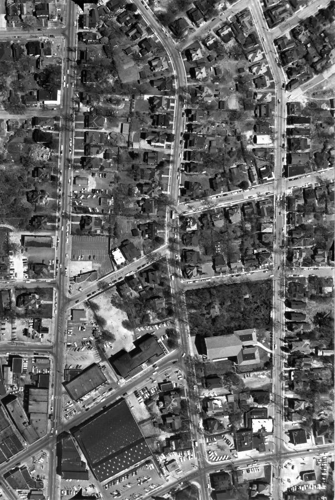
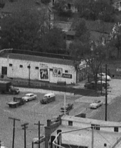
CH-aerial1_1959.jpg

1959 aerial of Cleveland St. and North Roxboro St.

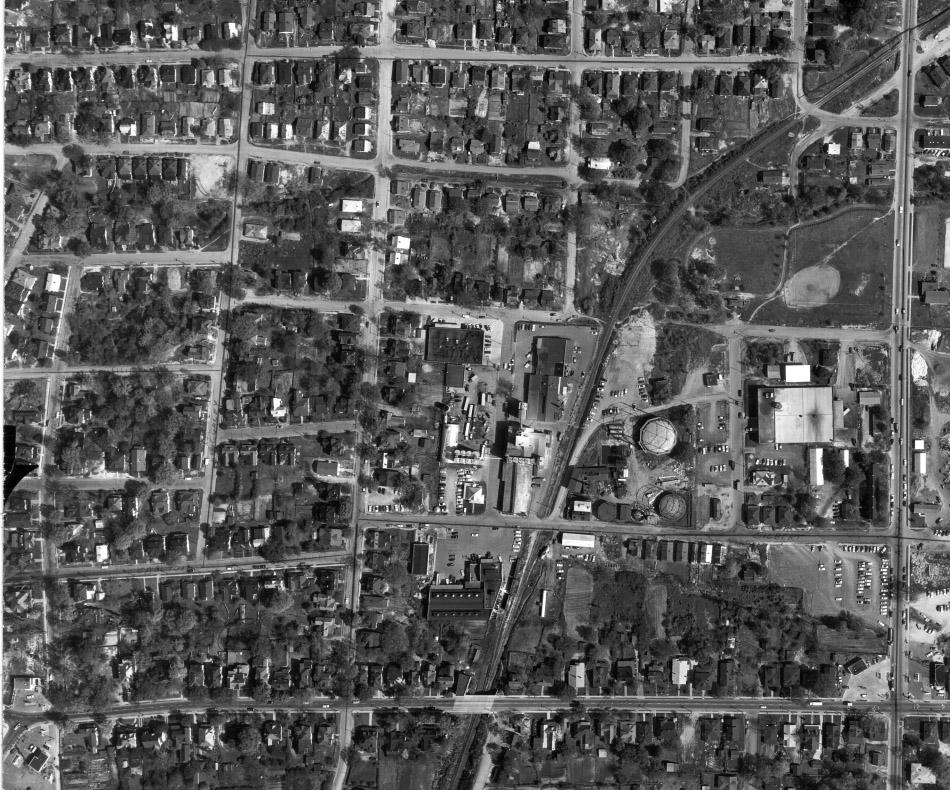
ClevelandHolloway_aerial2_1959.jpg

Holloway Street, Oakwood Ave. and east, 1959

The Holloway Street District evolved as an extension of the fashionable residential neighborhood that began in the 1860s at the east edge of downtown Durham. It extends from the area that formerly was the core of that premier neighborhood, decimated first by the en- croaching central business district and finally by clearance for Urban Renewal projects and thoroughfare plans. Consequently, the approaches to the district from downtown are broad streets lined by empty grass- or underbrush-covered blocks and blocks that have been cleared and redeveloped with modern buildings.

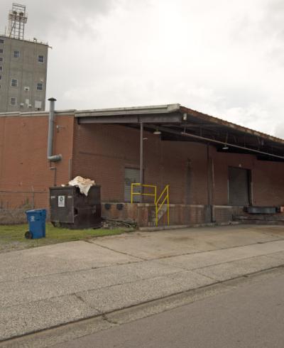
In contrast to those transitional blocks, the Holloway Street District is filled with houses shaded by mature hardwoods that form a canopy over the streets and sidewalks. All of the buildings have front yards, except for (Former) O'Briant's Store which is situated
flush with the sidewalk and the edge of the Holloway Street bridge over the railroad tracks. The setbacks are fairly uniform and most of the yards are narrow so that the houses are closely spaced. The occasional house set further back fiXro the street usually is situated on a larger tract than its neighbors and thus also has wider side yards. Originally, iron fences delineated many of the yards; none of the fences survive, but many of the very low concrete or brick retaining walls separating front yards fro~ sidewalks and driveways remain. Front walks run in straight lines from the sidewalk to front porches and most of the houses have narrow driveways leading to detached garages in the rear yards.

Holloway Street runs through its district in a straight line across level terrain. Twenty-two of the twenty-six buildings in the Holloway Street District are in the 500 and 600 blocks of Holloway ~treet. The two easternmost structures in this district are in the 700 block just past the bridge over· the Norfolk and Western Railway tracks; beyond these two houses, the quality and condition of the architecture deteriorates as Holloway Street descends a rather steep hill. Although separated from the Holloway Street houses by five empty lots, the two houses on Dillard Street are among the district's most architecturally and historically distinctive buildings and are linked to the rest of the district by their visual attributes. As part of Durham's thoroughfare plan, Holloway Street is wide and carries much traffic.

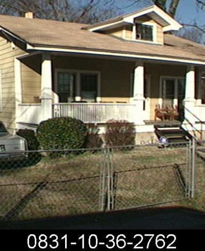
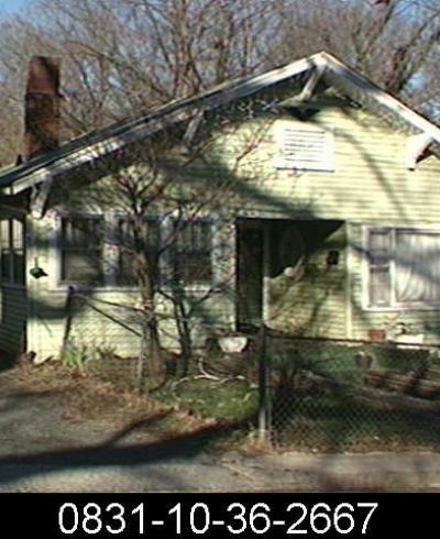
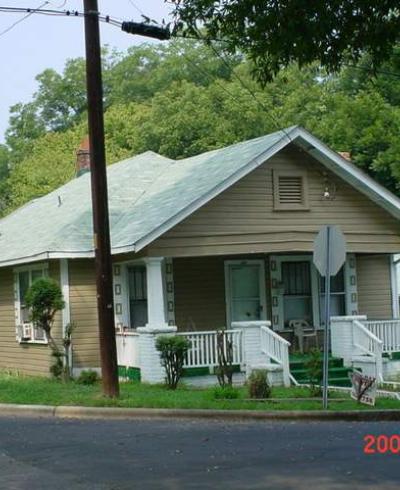
Except for the brick commercial building, all of the primary structures in the district are one- to two-and-one-half-story frame houses dating from the 1880s to the 1920s. Altogether the houses produce a fabric of various forms and rooflines whose texture is enriched by a broad range of applied decoration and shea~hings. The predominant archi- tectural style of the district is the vernacular Queen Anne, interspersed with the early Neoclassical and Colonial Revival styles. The commercial building and a couple of four- square houses date from the late 1910s.